
While the heaviest rain is gone there is still plenty of opportunity to pick up rain between now and Tuesday. Dry conditions will develop again mid-week.
Winds which saw peaks up to 70mph will weaken somewhat. Southwest winds will shift more westerly but winds of 15-30mph are likely into Sunday morning before dropping under 15mph.
The key to the forecast is the upper low is still in the process of moving over California. As it does so it will continue to drive the development of more showers. The good news is that the rain rates will be dramatically lower than the activity that caused the widespread flooding issues last night and this morning.

After that low moves through the jet stream will deliver another trough Monday into Tuesday for more showery rainfall. Again the rainfall rates are not critical however total accumulated rainfall could mean some ponding and minor flooding could develop with each period of showers.
Total additional rainfall between Saturday afternoon and late Monday will range from less than .50″ to as much as 2″ with some 2.5-4″ of rain at high elevations in SLO and SB county.

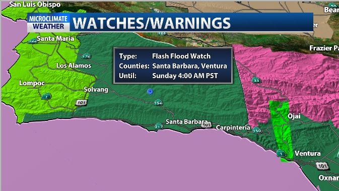
Due to saturation and additional rain the flash flood watch is still in place into early Sunday morning.
The high wind warnings will drop this afternoon in areas where the warning has not already dropped however some locally strong winds will be possible into early Sunday.
The high surf advisory and coastal flood advisory remain in place into Sunday morning for 12-19ft surf but it looks to diminish to 6-8ft. by Monday.
Temps look to stay below average into next week.
We have another separate story on rainfall totals, road closures and impacts from the system on KSBY.com
