


UPDATE (2:30 p.m.) - The final portion of the Tsunami Advisory that was affecting the Santa Barbara County South Coast has been canceled. No remaining advisories are in place for the central and southern California coastlines.
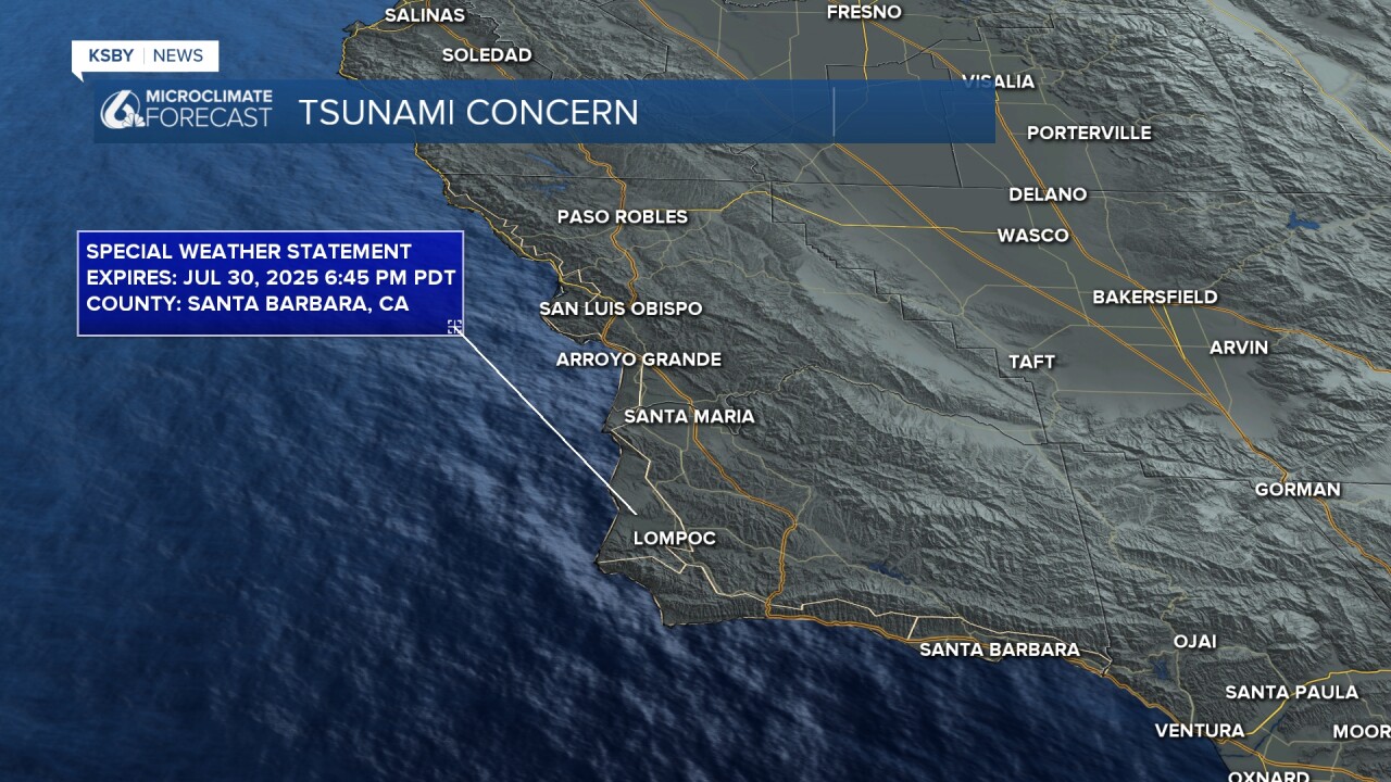
There is a lingering special weather statement in place for all beaches. This is to alert beachgoers of erratic currents across the region.
___
UPDATE (1:42 p.m.) - The Tsunami Advisory for the area of the Central Coast between Point Conception in the south and Ragged Point in the north has been canceled. This includes all of San Luis Obispo County and northern Santa Barbara County.
An Evacuation Warning issued for some neighborhoods next to the bay in Los Osos has also been canceled, according to the San Luis Obispo County Office of Emergency Services.
A Tsunami Advisory remains in place for the South Coast from Rincon Point to Point Conception.
The only other area along the California coast that remains under an advisory is from the Humboldt/Del Norte county line to the Oregon border.
___
UPDATE (9:48 a.m.) - While a Tsunami Advisory remains in effect for San Luis Obispo and Santa Barbara counties, local harbor officials say no damage was seen as a result of tsunami waves overnight.
A 2.7-foot max tsunami height was observed at Port San Luis at 2:14 a.m., according to the National Tsunami Warning Center, but Harbor Patrol tells KSBY News there was no damage to report.
Morro Bay Harbor Patrol says they saw some tidal surges around 2 a.m. but no damage. Officials there had evacuated people on boats and in waterfront businesses prior to the expected tsunami as a precaution.
In Santa Barbara, a 1.3-foot max tsunami height was reported at 3:02 a.m.
___
UPDATE (7:32 a.m.) - Advisories have been lifted for parts of the California coast this morning from Ventura County south, according to the National Weather Service. San Luis Obispo and Santa Barbara counties remain under a Tsunami Advisory.
___
UPDATE (2:04 a.m.) - The National Weather Service is warning those in nearby areas of a "rapid and damaging surge" expected at Port San Luis. Watches and advisories also remain active at this point, and people should stay away from coastal areas. Waves may return several times in the next 24 hours at even higher water levels.
___
UPDATE (12:08 a.m.) - SLO County Fire has issued an Evacuation Warning for the following zones in Los Osos:
- SLC-178
- SLC0179
- SLC-180
- Homes north of Butte Drive at Nevada Court
SLO County Fire has issued an Evacuation Warning for the following areas of Los Osos due to Tsunami Advisory: SLC-178, SLC-179, SLC-180 and homes north of Butte Dr at Nevada Ct. For the interactive map and more info, visit https://t.co/2Ja6DazVOH pic.twitter.com/s5Sqc7HbVi
— SLO County OES (@slocountyoes) July 30, 2025
___
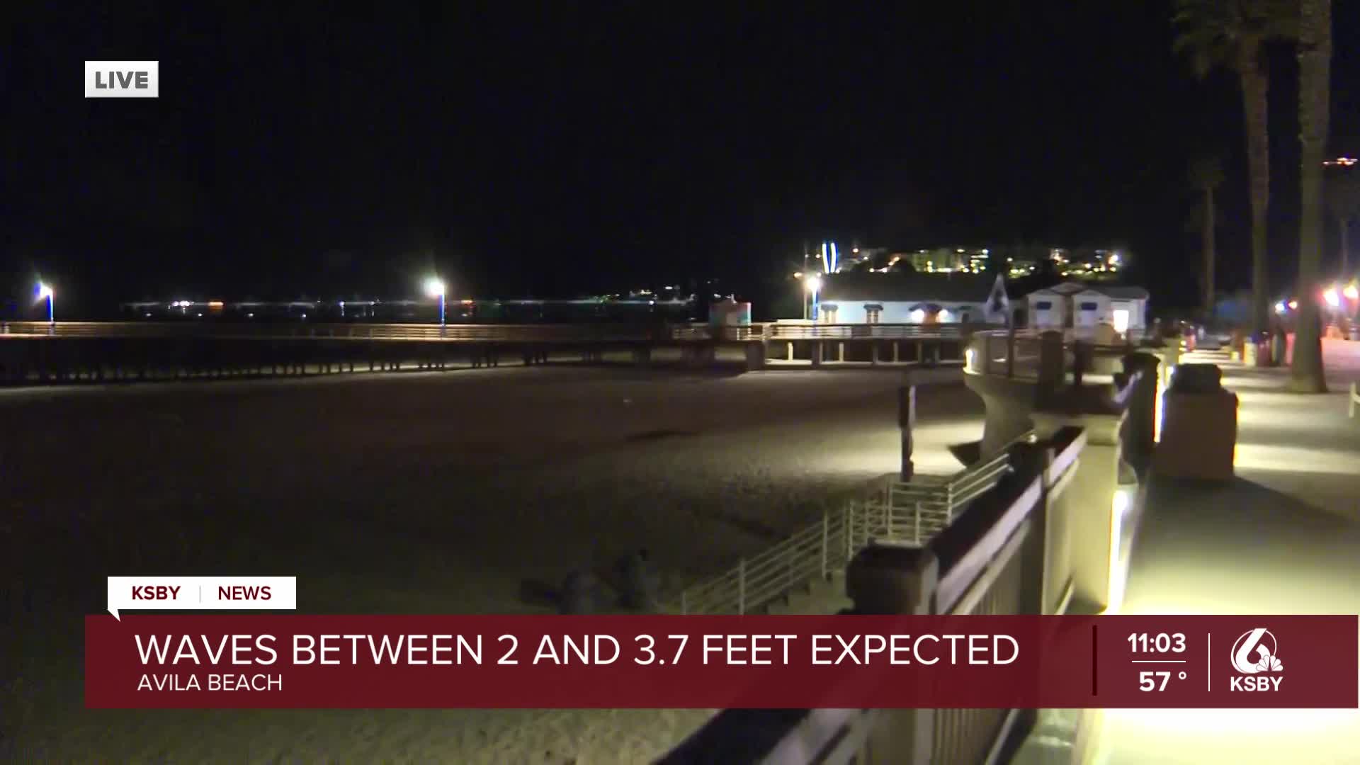
UPDATE (10:38 p.m.) - The latest bulletin from the National Tsunami Warning Center is forecasting maximum tsunami heights between 2.0 to 3.7 feet in Port San Luis and less than a foot in Santa Barbara.
The forecast max tsunami height is defined as the highest expected water level above the tide.
According to the National Weather Service, Port San Luis is the main point of concern along the Santa Luis Obispo and Santa Barbara county coastlines.
#Tsunami Advisory in effect for coastal regions. Impacts: Surging of sea water in and out of harbors, with water levels fluctuating, dangerous currents and waves are possible. Port San Luis is main point of concern in the area. pic.twitter.com/blXEXMdrVa
— NWS Los Angeles (@NWSLosAngeles) July 30, 2025
Mark Kocina of Avila Beach Whale Watching says they received a warning from the Harbor Patrol office about potential damage from a tsunami.
“Kyle, one of the Harbor Patrolmen, is calling all the people who have skiffs on the pier here and warning us there could be some really strong currents in the middle of the night from the tsunami, so we're getting out of the water and taking it home so it's safe, and then we'll bring it back in the morning and get back to work,” Kocina said.
Potential tsunami waves could reach Port San Luis by 12:35 a.m.
UCSB seismologist Zach Eilon spoke with KSBY News about the tsunami potential along the Central Coast:
___
UPDATE (8:03 p.m.) - The U.S. Geological Survey has upgraded the earthquake that occurred near Petropavlovsk Kamchatka, Russia to a magnitude 8.8 quake.
The National Weather Service says it is carefully monitoring ports and harbors north of Point Conception, where waves from a potential tsunami would likely be larger, including Port San Luis and Morro Bay. Damage within harbors is possible.
___
UPDATE (6:49 p.m.) - The Tsunami Watch issued for California has been changed to a Tsunami Advisory.
The National Tsunami Warning Center predicts a possible tsunami could reach heights between 1.7 to 3.2 feet at Port San Luis (starting at 12:35 a.m.) and 0.9-1.7 feet in Santa Barbara (starting at 12:50 a.m.).
The following post explains the differences between watches, advisories and warnings:
A Tsunami Watch is out for our coastal areas. As more information comes in, we will either see this become a Warning, an Advisory, or an Information Statement. Stay tuned for updates. https://t.co/a5BRD08RxO pic.twitter.com/8UKWk2Ee7v
— NWS Los Angeles (@NWSLosAngeles) July 30, 2025
The National Tsunami Warning Center advises people in Warning and Advisory areas to do the following:
- Move out of the water, off the beach, and away from harbors, marinas, breakwaters, bays and inlets.
- Be alert to and follow instructions from your local emergency officials.
- Boat operators: Where time and conditions permit, move your boat out to sea to a depth of at least 180 feet. If at sea, avoid entering shallow water, harbors, marinas, bays, and inlets to avoid floating and submerged debris and strong currents.
- Do not go to the shore to observe the tsunami.
- Do not return to the coast until local emergency officials indicate it is safe to do so.
A Tsunami Advisory means a tsunami with strong waves and currents is possible, and currents at beaches and in harbors, marinas, bays and inlets may be especially dangerous.
___
(5:38 p.m.) - A Tsunami Watch has been issued for the West Coast, including California, following an 8.7 magnitude earthquake in Russia.
According to NOAA's U.S. Tsunami Warning System, the Tsunami Watch includes southeast Alaska, British Columbia, Washington, Oregon, and California.
The earthquake struck at 4:25 p.m. Pacific, about 80 miles southeast of Petropavlovsk Kamchatka.
According to the Tsunami Warning Center, a potential tsunami could reach Port San Luis at 12:35 a.m. and Santa Barbara at 12:50 a.m.
"Tsunami Watches are an advance notice to areas that could be impacted by a tsunami at a later time," according to the National Weather Service.
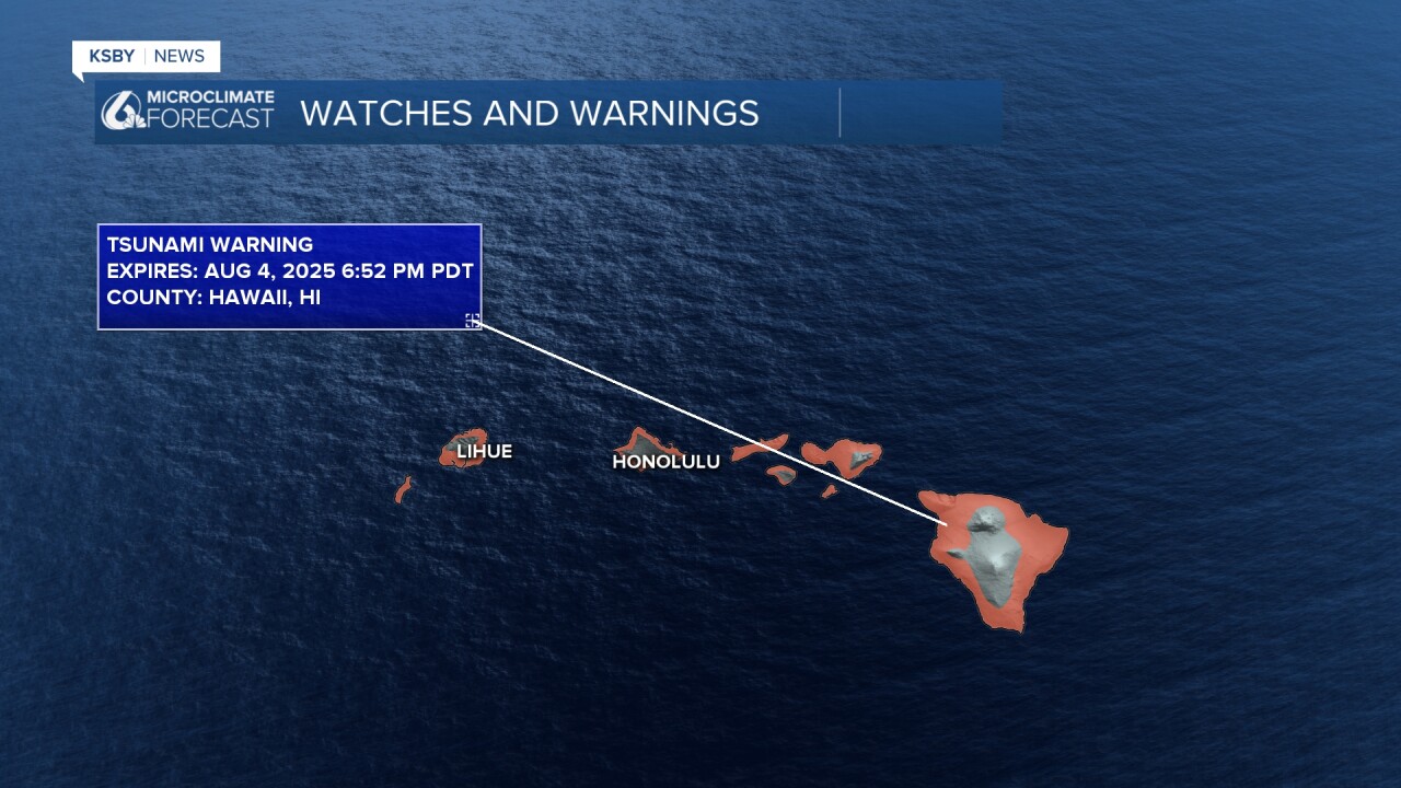
Alaska's Aleutian Islands are under a Tsunami Warning, as well as the Hawaiian Islands.
According to the Tsunami Warning Center, the quake had generated a tsunami that could cause damage along the coastlines of all of the Hawaiian Islands, with the first waves expected around 7 p.m. local time.