Good Morning Central Coast!
We are nearing our next rain event, so let's jump right in. A large low pressure will bring (marginal) atmospheric river conditions to Northern California. By the time it pushes south to us it will have weakened significantly, but will still bring heavy rain, wind, and snow to the region.

By Tuesday afternoon rain will begin to fall across the region. It will move south quickly bringing with it strong winds.

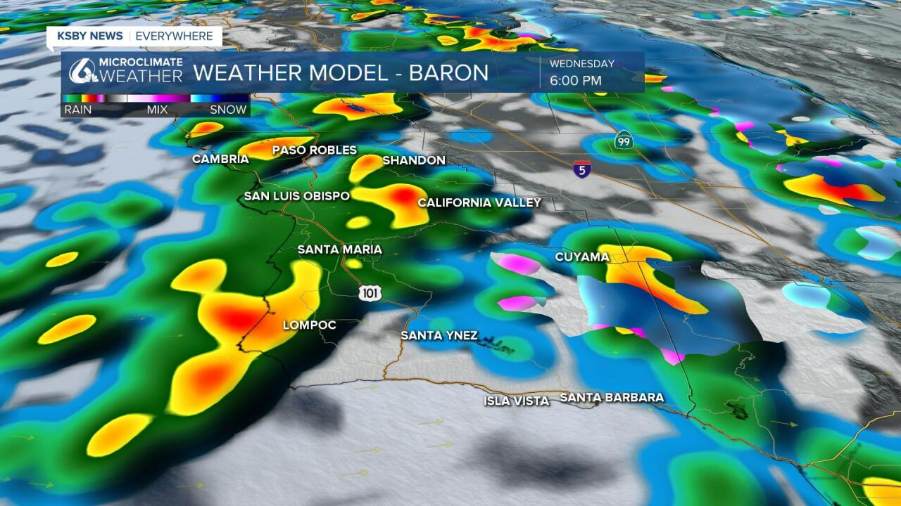
We’ll see that activity continue into the early hours of Wednesday morning then a bit of a break before the cold-unstable upper low drifts over us. When the cold unstable air aloft comes over the Central Coast not only are showers likely but also some potential for thunderstorms.

This storm will not deliver as much rain as prior systems this month but it does have some potential to have an impact. Due to the very wet rain year, reservoirs are either full or close to full, a number of roads have had damage and some other critical infrastructure bears close monitoring. Check out some of the reservoir levels here.
As a result, the Weather Prediction Center has identified the Central Coast as having a “slight” risk of excessive rain potential. Excessive rain in this case is just enough to cause problems, meaning the bar is pretty low. We should see rain accumulation thru Thursday morning up to 1.5”, but most places getting less than the top amount. I would say that almost everywhere will see between 0.75 and 1" of rain.

Alongside the storm here are several advisories/watches/warnings in place.
First there is a wind advisory in place for the higher elevations across the region through 5AM Wednesday morning. Gusts may reach 45mph as the front passes through. Even if you aren't within the advisory area winds may still be problematic.

The storm also has a cold air component that will impact the interior valleys with snow chances. There is a winter weather advisory in place for the highest elevations of Santa Barbara county through 10 am Thursday morning.

This is mainly a threat for the highest elevations of Santa Barbara county where up to 5 inches of snow is possible.

Highs Today will be in the 50s to mid-60s with the warmest temps being on the Santa Barbara County Southcoast because the cold front arrives there last. Wednesday and Thursday look to see highs in the 50s with the cold storm on top of us. After the storm departs temps for many return to the 60s with some mid-60s or better for the Southcoast for the weekend.

Have a great day, and grab that raincoat Central Coast!


