


Good Morning Central Coast!
We are off to a cold start with continued air moving in from the interior valleys pushing frost chances down to the coasts.
There is also a bit of cloud cover continuing through the region this morning bringing fog into the interior valleys and some spots in the coastal valleys, take it slow to start the morning.

Lows in the early morning hours will fall below 32 in the interiors and into the frost categories in most coastal valleys there is a frost chance in the early morning hours.
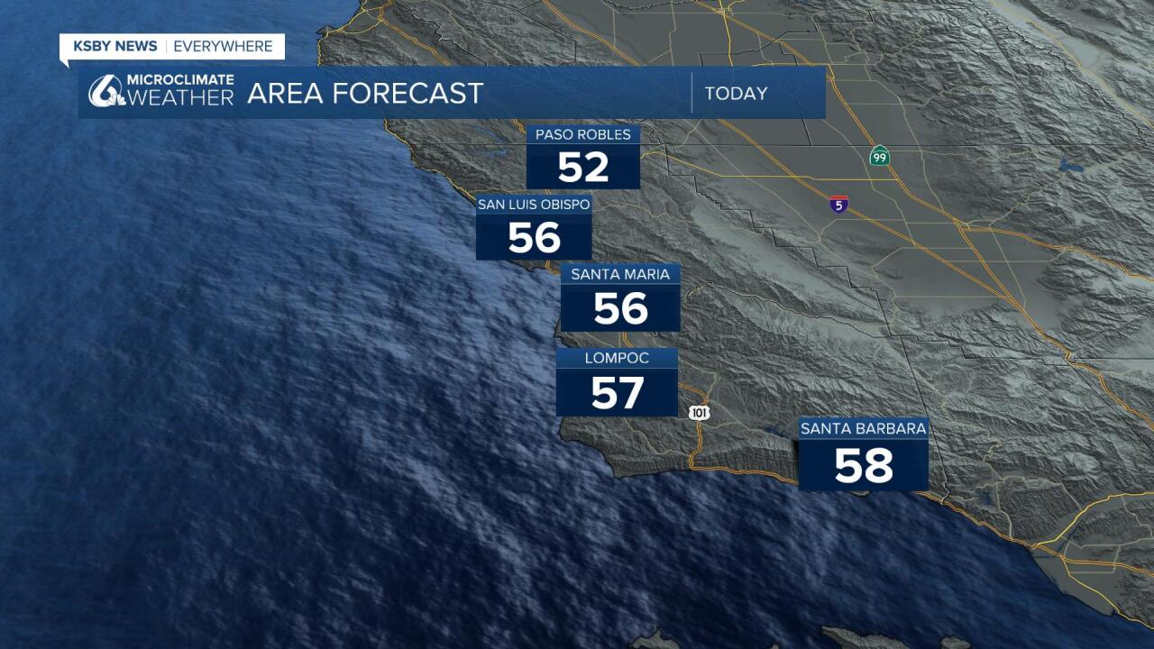
Temperatures will stay on the chilly side with highs in the mid to low 50s across all but the interior valleys where temps will stay in the 40s.
Through the next few days sunshine will help to warm temperatures slightly each day but it will stay on the chilly side. Highs will climb to the low 60s with a little more cloud cover Thursday but on the whole will stay below normal for this time of year thanks to a cold air mass that was ushered into the region by our last storm.
That rain storm soaked much of the region with rain reports ranging from less than an inch to more than 8" in some high mountain locations. The good news is that this was a significant system and it did boost the lake levels significantly. Take a look, this graphic shows the current percentage of capacity, the week-to-week percentage change, AND the elevation change:

The median was 1-2.5" with some places higher, there were also notable places like the Santa Maria Valley that hugged the lower end of the scale. In general, the system arrived on time and delivered the heavy rain we expected along with the high winds. The combination proved to be powerful, knocking out power to many.
So what is next? The system has kicked out of CA but will plague the rest of the country with a major winter snowstorm, and a severe weather outbreak in the southern U.S.
The storm will scrape its way across the U.S. into the coming weekend.
The Climate Prediction Center has flipped about the extended outlook going with a drier than average 6-10 day outlook (and cooler than average), the 8-14 day flips temps back to above average on the Central Coast but still keeps the precipitation outlook drier than average.
Have a great day Central Coast!
