


———UPDATE 10:30 AM ———
Here is a look at the forecast as of 10:30 Wednesday Morning.
———-Original Story ———
Good Morning Central Coast! A large "atmospheric river" system is headed our way and will make for a dangerous day across the west coast with significant flooding and wind risks here for the Central Coast.
Here is a rundown of the storm, I will continue to update this story through the morning hours as more information on the storm becomes available.
Starting off the morning the warm front associated with our strong system is pushing through. This will result in light to moderate rainfall through the morning hours. Other than complicating the morning commute this will be mild and do little more than be an appetizer for the main event that will push through later tonight into Thursday Morning.

Accumulations from the warm front will stay under half an inch for most, slightly higher totals are expected for northern San Luis Obispo County.
After the early showers there will likely be an imperfect lull. I call it that because I think there will be less activity but I can't say some showers are not possible or even likely. This lull takes place from the later morning into the mid-afternoon. After that heavier rain becomes likely.
Right now models are showing the cold front to slam into the Central Coast around 7pm and heavier rain (and even thunderstorms) are in the forecast into the early overnight. After the heavy rain, the system will back off but showers are likely to continue into and thru Thursday but much less intense than the frontal passage.
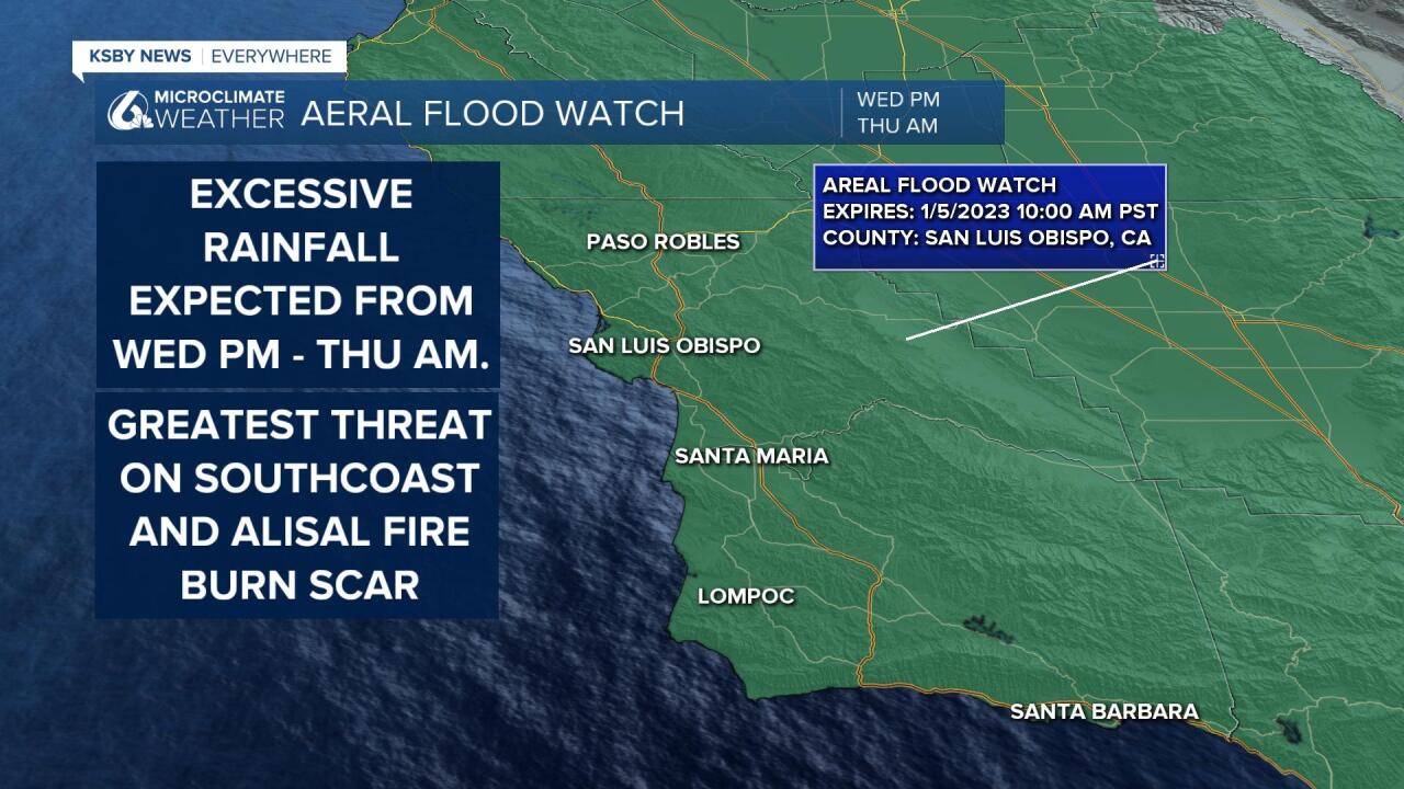
During the frontal passage, some very high rain rates are possible. 1"/Hr. rates are possible. Flooding is a concern and a flood watch has been issued for Wednesday. Essentially urban and small stream flooding is possible but also there is some concern about the Alisal Fire burn scar area.
In total 1-4" of rain are possible with more in higher elevations.

This IS an Atmospheric River event. On a scale of 5, this event will be a 2 locally and a 3 in the Bay Area. An atmospheric river is a stream of moisture supply in the air over our heads. The term "river" is not at all inaccurate, at times these atmospheric rivers contain as much moisture as a large river at its mouth. Knowing where this supply is pointed is important in determining where flooding may be possible or likely.
Thunderstorms are also possible since cold air associated with the storm does look to destabilize the air to the point where it is possible. The Storm Prediction Center has Northern and parts of Central California in their convective outlook. Where thunderstorms take place rainfall rates can be high and localized high winds and hail are also possible.
Winds will be high. SE-S winds 30-45mph with gusts to 60mph are likely across the area Wednesday.
With all the winds, a lot of energy is going into the water. Already swell/surf is 8-10ft and an advisory is in place, a high surf warning is in place for waves that will build to 16-22ft.
The heaviest rains will end during the overnight Wednesday into Thursday, however more lingering showers are likely for much of Thursday.
After the system wanes Thursday, Friday and Saturday look to be a break before more rain comes Sunday. That system will not be as wet as the Wednesday into Thursday storm.
Take caution today Central Coast! With quickly changing conditions now is a good time to have multiple ways to receive alerts, download the KSBY Microclimate Weather App to get alerts for your location.
Chief Meteorologist Dave Hovde will have the latest on the storm this evening and overnight.
