

Happy Friday Central Coast! As we gear up for the weekend we will embark on a days-long cooling trend. An upper level low pressure system is passing through the Pacific Northwest, that is helping to push more onshore winds into the region cooling us down. Winds will stay consistent WNW bringing in the cooler marine influence as well.
Temperatures Friday afternoon will be very widespread with upper 80s still possible in the interior valleys, on the beaches most locations are unlikely to reach far into the 60s.
Temperatures today will be on the mild side inland with highs in the 80s bit beach temperatures will once again struggle to reach the 60s. pic.twitter.com/pzLjg4mchu
— Vivian Rennie (@VivianRennieWx) May 6, 2022
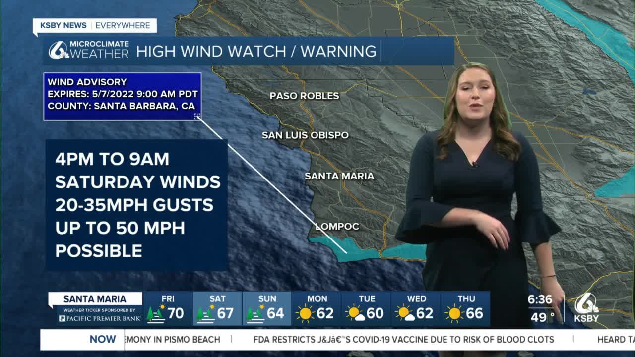
Friday afternoon winds will kick in, especially along the southcoast of Santa Barbara county where gusts up to 50 mph are possible overnight.
Slow cooling day to day will continue through Sunday before another low will push much cooler temperatures into the region. As the center of the cold air pushes though Monday and Tuesday there will be more humid air but any rain chances are unlikely.
Day after day will continue to cool down this week until we eventually reach well below normal temperatures early next week. pic.twitter.com/DBNRXXu5hn
— Vivian Rennie (@VivianRennieWx) May 6, 2022
Have a great weekend Central Coast!
