Good Morning Central Coast!
As expected rain returned Tuesday and this is just the first in a series of systems into and past the New Year. As of Wednesday morning, many locations have already picked up more than 1.5". Check out rain totals here.
Rain from this system will continue into the evening and activity should be done by Wednesday morning.
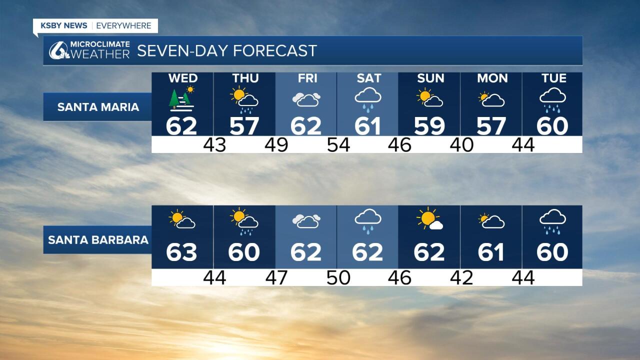
Temperatures today will be on the cool side, especially compared to the 80s over the holiday weekend. Most spots will reach into the low 60s today.

There will be a short break in the rain on Wednesday thanks to a high pressure system sitting just off our coast. More showers return Thursday. The Thursday storm will be a bit less well developed than previous storms that have swept across our region. A few hundredth of an inch of rain is expected but it is going to help prime our region for more storms.
There will be a bit more cloud cover for Friday before a more robust rain chance moves in on New Year's Eve (Saturday). This system brings the chance of 1-2" more inches of rain as well as gusts and the potential for some minor flooding. It will be a bit of a quick splash and dash system but impacts will be similar to our Tuesday system. Plan for this in your NYE festivities.
But perhaps the most interesting thing to look at in the extended forecast is the potential from the 3rd-6th. The GFS model has been advertising a strong system with a decent atmospheric river connection. It is a long way away still but with models showing something significant this far out it is something to think about.


Even past our forecast the climate prediction center is still favoring an active pattern into mid January.

Have a great day Central Coast!


