


Happy Friday Central Coast!
We made it to the end of the week and as we start off the day grab that extra layer. It is going to be cold outside across the region. The first concern ahead of us is the early morning lows to kick off your Friday. Yesterday's freeze watch has been replaced by a freeze warning in the interior of SLO county with frost advisories in effect for the Cuyama Valley and the Santa Ynez Valley. The freeze warning implies overnight lows as cool as the mid to upper 20s are possible and also that temps could stay below 32 for an extended period of time potentially damaging or killing sensitive plants.
Pipes also need to be monitored and hypothermia is a risk for people who are exposed too long to the cold temps. There is also a frost advisory in portions of the region. This monitors slightly less intense cold temps. There is still a risk of plant damage but the lows are not as likely to be as cold nor last as long at sub-freezing conditions.
Winds from the north are keeping the region clear of fog but also bringing in some high level clouds into the mid morning hours. This will not impact the morning much, if at all.
The temperature recovery today is actually pretty good: after lows near freezing for some high generally get into the mid-60s (away from beaches). It will still be chilly but mild comparatively to this morning.

Saturday likely will feature sunshine and some slightly warmer temeratures but it isn't going to last. A cold front will plunge through the region Sunday cooling temps significantly and bringing our next chance for rain.
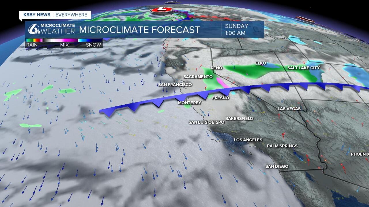
Monday conditions get more active with a large system rolling in, rain may start as early as late Sunday night, although that is bound to change as the system comes into more focus over the next few days. Monday into Tuesday will bring the bulk of the rainfall although Wednesday looks wet on a number of computer models.
The models are also all agreeing on the potential for significant rain from the system. 0.50-2+" of rain is possible for the Central Coast. Here is a look at one models output. My focus is on the potential rain from this storm but not the location specific totals. This far out they are bound to change.

This will also be an impactful system elsewhere, please check the KSBY Microclimate Weather App for forecasts outside the area.
After the system kicks out Wednesday we look quiet into the following weekend.
Note: Yes, rain is likely on election day, please think ahead if you vote in person or plan on dropping a ballot. Extra time may be necessary.
As for your weekly drought monitor update, the Central Coast saw a little splash-and-dash rain system mid week, most of the area didn't even get to a tenth of an inch while on the high side some mountain locations were between .25-.45".
That's not much for an area locked in a long-term drought.
The U.S. Drought Monitor update was released yesterday and there was no week-to-week change. 100% of the state is still in drought with the Central Coast experiencing the 3 worst categories: severe (at the coast), extreme (in the coastal valleys) and exceptional (in the interior).

Have a great day and a fantastic weekend Central Coast!
