


Good Morning Central Coast! We made it to Friday and there are moderate temperatures ahead before a large system arrives late in the weekend and will start next week on a soggy note.
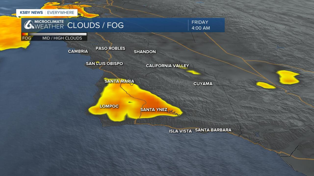
Before we dive into the storm let's chat about what the near term forecast holds. To kick off the day most of the Central Coast has clear skies, along the southcoast of Santa Barbara County this is aided by some strong southerly winds pushing offshore. There is a dense area of fog lingering in the valleys extending from Lompoc into the Santa Ynez valley. This will continue into the mid morning hours before clearing out quickly.
The short-term forecast continues to look cool with some night and morning marine cloud cover, even into some interior valleys. This not particularly exciting pattern remains in place into the weekend before the storm system arrives.
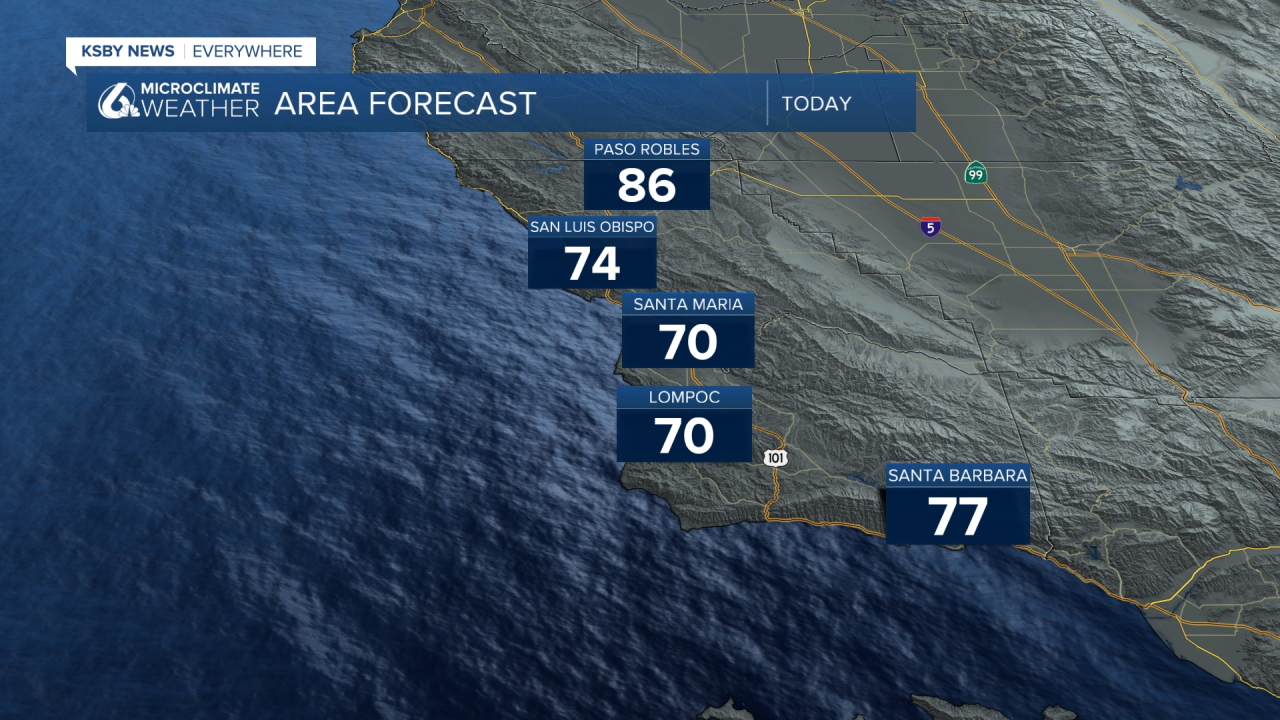
Beaches will continue to see more cool highs in the 60s with coastal valleys in the 70s and 70s and low 80s inland. Overnight lows also cool on the cooler side.
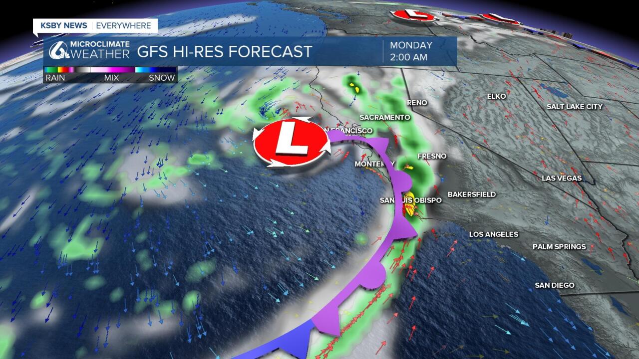
It is next Monday drawing a lot of attention in the Central Coast weathercast. Models have been lining up for a good soaking rain event in NorCal with the Central Coast still in line for some reasonable rain.
It needs to be said however that rain looks to fall off from north to south and we are in the gradient where south of the Central Coast not much is likely. Over the next few days even small shifts of the storm track may drastically change our conditions.
This means we are again in a wide range of light to .75" with some 1" potential showing up on some modeling. This far out you should expect some timing and intensity adjustments.
we may have to crank up the rain potential for Monday. I've been going with light to .75 with some totals to 1". The latest GFS model likes up to 2" and it joins some runs of other models with high potential. That being said some models are showing very light rain with the heavy band falling further North. It is still really early to cast this in stone. Timing and intensity can certainly change and I would expect some tweaking over the next few days. That said, I think we need to at least tell people about the modeling showing high potential.
The rain will taper off by Tuesday morning and we will begin a slight warm up. This will be delayed into the middle of next week by the rain chances. By the end of next week most highs will be a few degrees above normal for this time of year. Thankfully we have no temps that will even come close to the recent heat wave.
Have a great day and fantastic weekend Central Coast!
