


Good Morning Central Coast!
To kick off our work week (and holiday for some) there is a bit of cloud cover continuing to cross the region as we prepare for rain to begin later today. This will not greatly impact the morning commute but will complicate road conditions later in the day.

Rain will begin in the morning hours and remain light and patchy through much of the day. This will also keep temperatures on the cool side with highs only reaching into the low 50s.

By the evening the cold front that this storm is anchored to will move onshore and bring heavier and more consistent rain. Even this area of heavier rain will not be as intense as Saturdays storm but moving slowly still allowing significant rain to fall. I Expect mainly 0.25"-0.5" but some high-elevation slopes will pick up more. Throughout Tuesday we can all enjoy another brief break from the rain.
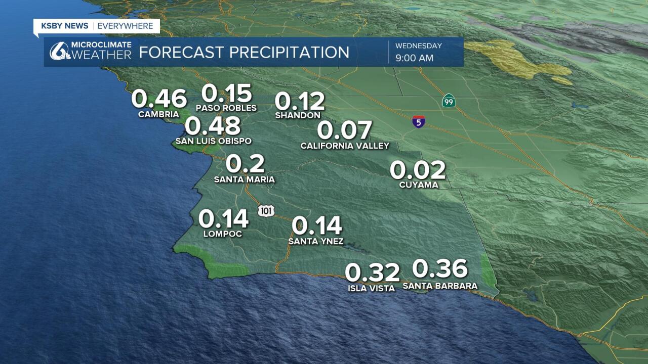
A second much stronger storm will push into the region from the pacific and bring more significant rain and strong winds Wednesday into Thursday. This system will begin to produce rain overnight Tuesday into Wednesday as a warm front brings the first portion f the storm to town.

Once the warm front passes there will be scattered showers until the cold front reaches us Wednesday evening. At that point heavier rain but the bulk of the heavy rain will show up on Thursday. Alongside the heavy rains strong winds are expected as the cold front passes through. They are still a ways out but potentially damaging winds are expected.

Will likely see at least strong advisory level winds developing Wednesday across SLO and Santa Barbara Counties and certainly strong winds across adjacent the coastal waters. Thanks to the winds from the storm waves will increase significantly. Expect for high surf and strong rip currents.

As for rain totals during he Wednesday/Thursday storm, amounts with this storm may surpass the Saturday night storm and bring several inches of rain. It looks like the interior valleys will see the least, around an inch expected coastal valleys have the potential of 3+ inches. The majority of the rain will fall on the south coast where the winds will help kick up additional accumulations.

Once that passes we have another break in the rain, Friday looks dry. Further out on the horizon models are showing the possibility of more rain into the next week. Details are still fuzzy on that one though, since it is still so far out but we will keep an eye on it and update as it approaches.
Have a great day Central Coast!
