


Good Morning Central Coast!
We have made it through a massive system that drilled us with powerful weather Thursday all the way to Saturday.
Here is a brief look at some of the rain totals from this system. A full interactive map can be found at this link.
| Location | Rain total Thursday through Sunday morning |
| Gibraltar Dam | 9.41" |
| Lake Cachuma | 5.11" |
| Santa Barbara (at downtown flood control office) | 2.95" |
| Isla Vista | 2.45" |
| Lompoc | 5.02" |
| Buellton | 3.66" |
| Santa Maria | 2.42" |
| Cuyama | 2.39" |
| Arroyo Grande | 2.89" |
| Cal Poly | 2.94" |
| San Luis Obispo (Airport) | 3.45" |
| Santa Margarita | 4.22" |
| Los Osos | 2.30" |
| Paso Robles (downtown) | 2.24" |
| Cambria | 1.66" |
| Shandon | 2.53" |
| Lopez Dam | 3.21" |
There is only a brief break before more rain is likely later Sunday into Monday. This system (Denoted #1 on the image below) will be quick-moving and weak Sunday night into early Monday morning. Totals from this one will be on the low side, we are talking tenths of an inch with more in the upper elevations. More rain is likely Tuesday (storm #2 on the image below) and there is even a chance Wednesday as well. Thru Wednesday the Central Coast could see .50-1.75” of rain with those higher amounts in the Santa Ynez Mountains.

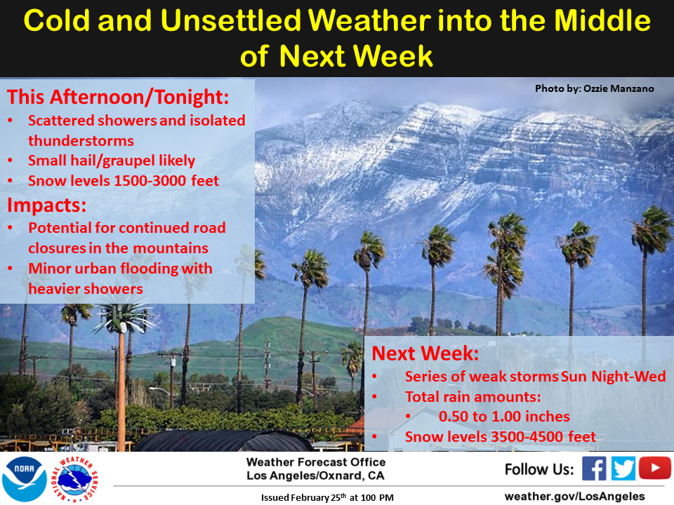
As a result, the high temperatures will continue to stay cool, generally in the 50s. Later this week, we’ll get a break in the rain systems and there should be some temperature recovery into the low 60s. I think that the NWS LA office put this forecast perfectly in this graphic.
There is a winter weather advisory in place for the Santa Barbara County mountains thru Wednesday for snow levels starting at around 3000ft. Above 3000ft some accumulation is likely. Elsewhere the northern hill of SLO County and the hills and mountains of the SLO County interior could see some additional snow but no accumulations outside of the highest peaks are likely.

The extended forecast shows a very weak system arriving around next weekend, very light rain is possible with other systems around the 8th thru the 10th with cold air and lower snow levels again.
Have a great day Central Coast!
