Good Morning Central Coast!
It is going to be a much more comfortable morning as lows are slightly warmer than previous mornings. This has brought most of the Coastal Valleys and beaches away from the frost that has been the story most previous mornings this week. Lows will be about 10 degrees warmer than the last few mornings this week. I will take that as a win but the reason we are warmer is rooted in the overall pattern.
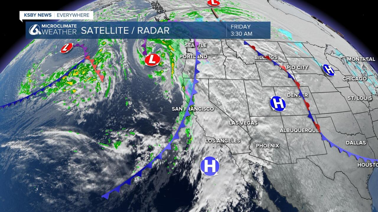
There is a cold front draped across the West Coast that is bringing some moderate to heavy rain to the bay area this morning and will bring snow to the Sierras by this afternoon.

The remnant of high pressure sitting off the coast of Baja will stop that storm in its tracks and will keep any of the rain from this system north of us. Clouds will continue to pass through the area today as the impulse of energy brought by the cold front surges through but that is about it.
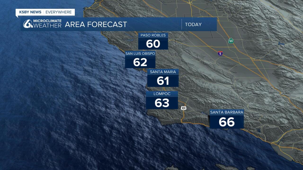
Highs today will reach into the low 60s, not too bad with some sunshine in the afternoon.

Despite our rain chance that we saw this morning being minimal (at best) our next measurable rain chances are close at hand. Late Saturday night into Sunday morning a new cold front pushes into the region.
Rain beginning late evening will push south into the overnight hours. The bulk of the rain will fall overnight but there is the chance for some lingering scattered showers through the morning Saturday. Now that there is a chance for some rain during the daytime hours there is the rain icon on the 7 day.
I think up to .50" is possible on the high side but most models indicate .1 to .3" of rain. Not exactly a whopper of a storm but something that you should take into account for your weekend plans.
Temps take a hit due to this. Saturday temps could hit the mid-60s or better before the cold front hits. Sunday 50s and low 60s for highs. After that, the sun is back out and we warm back into the mid to upper 60s.
Have a great day!


