


Good morning, Central Coast! Happy Wednesday!
To kick off the morning commute there isn't too much going on, just as expected we are in a little break between the initial pulse of the storm (yesterday's showers) and the main event.
As the morning progresses the low pressure system that is sitting just offshore will continue to make the turn onshore. This will slowly reintroduce rain, first to the western beaches, then to the interiors.
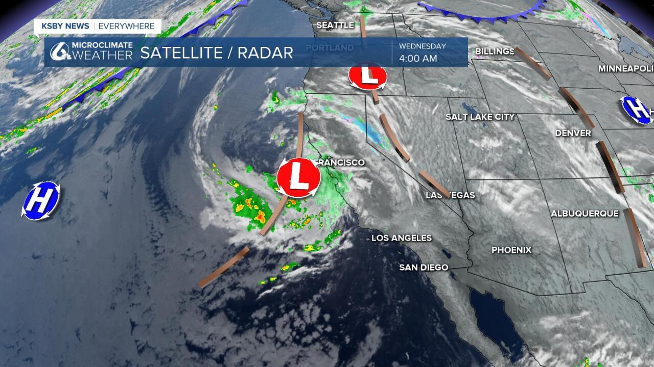
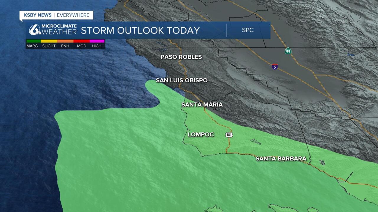
The rain will be widespread in the coastal valleys and beaches by noon, across the whole region by the afternoon. This will mostly be light rain for a bit of a dreary day but will contain some thunderstorms. That convective (thunderstorm) potential is going to be the greatest concern.
Thunderstorms introduce the possibility of brief heavy downpours and winds, hail, waterspouts, and even small tornadoes. That chance is small but sufficient enough along our south coast under the marginal risk for strong storms by the Storm Prediction Center (SPC) both today and Thursday.

This potential exists into early Thursday morning when the surface low starts to slide out of the area. A few widely scattered showers could pop up into the evening but the activity will significantly wane.
Our forecast for rain accumulation remains unchanged, up to 1” of rain total. That puts today's accumulations for most communities between a 0.3" and 0.75" of rain.
There will likely be the greatest potential for added rainfall on the the Southcoast and for any S-SW facing slope. The interior still looks to see the lowest rain totals.

Here is a look at the rain totals so far on an up to date map.
Snow levels for the system are above 4500ft. This could put snow on the Tejon Pass in the region and the highest elevations of the Santa Barbara and Ventura County Mountains.

After this system departs there will still be a trough over The West, so temps will recover but slowly.
Highs today will stay on the chilly side with the cold front that is bringing us this rain expected to keep temps moderate to cool.
The deeper extended forecast looks dry locally but regionally the PacNW Should see a series of fast-moving fronts and occasional showers, this will be enough to stop high pressure from setting up so the 8-14 day expectation on temps is below average.
Have a great day Central Coast!
