

Good morning Central Coast!
To kick off our Thursday morning skies are perfectly clear across the region. This is thanks to the high pressure that is skyrocketing our temps each afternoon.
Without any marine layer concerns commute conditions are wonderful!
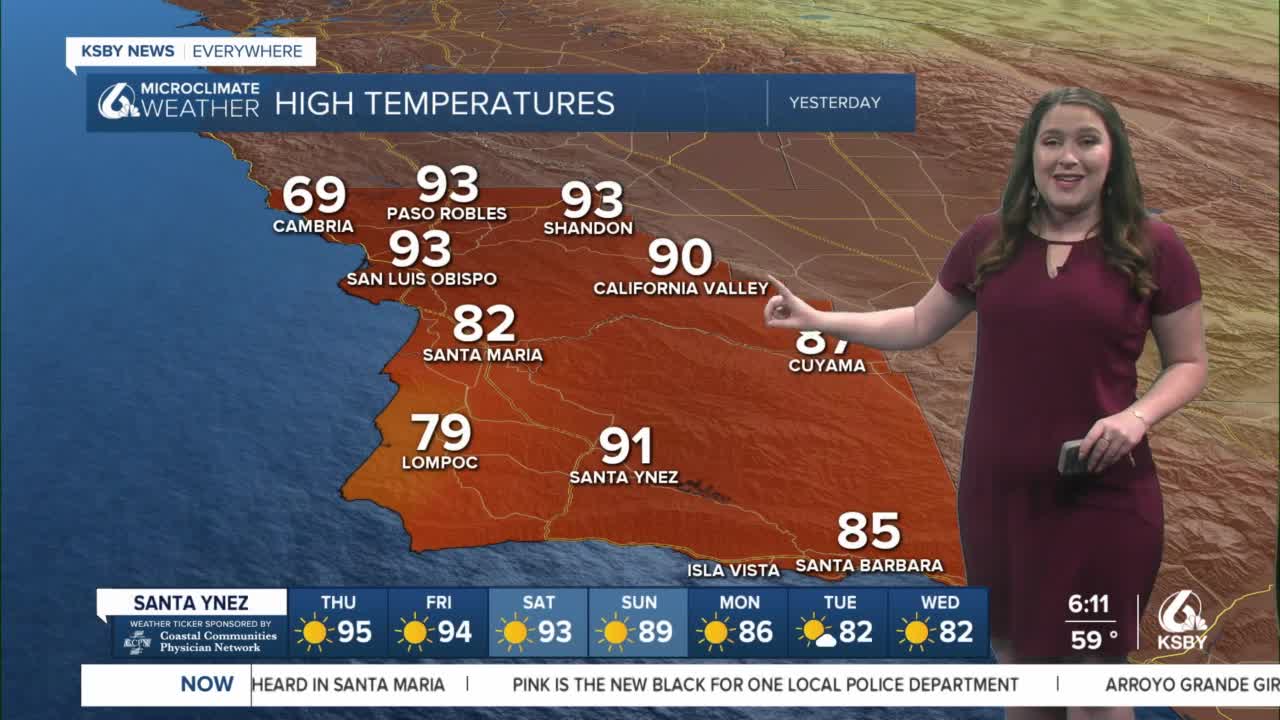
The rollercoaster of temps we have seen recently continues today as we "crest" with some extreme heat across the region. A large ridge of high pressure has set up to our West and as it slowly pushed towards us temps climbed as well.
We are no stranger to high pressure patterns here on the Central Coast. Offshore gusty winds, compressional heating, abundant sunshine and minimal marine layer make the perfect recipe for temps to soar.
The last few days brought temps up significantly and today we will reach the upper 90s in the interior valleys, some coastal valleys will reach into the 90s as well. Beaches will be a bit cooler but still well above normal for this time of year.
Temps will stay downright hot for the next couple of days as the ridge stays put. This will continue to bring upper 90s to the Central Coast but will bump temps significantly across the whole west coast.
Looking further down the forecast the weekend will be off to a hot start with some interiors flirting with triple digits. Thankfully Sunday a system will plunge south towards the PacNW and will break down the ridge. Temps will cool slightly Sunday before falling more significantly by early next week.
By the middle of next week temps will once again be closer to normal for this time of year.
Have a wonderful Thursday Central Coast!
