

UPDATE 12:00PM
The rain has begun in northern San Luis Obispo county and will continue to move south across the region through the rest of Thursday. Here is an update from Meteorologist Vivian Rennie at noon.
——Former Story——
Good Morning Central Coast!
There is a pretty significant rain storm on the way to us so let's jump right in!
All the dense fog that formed overnight has been pushed out of our area as gusts and cloud cover associated with the storm nears us. This means good conditions for the early morning commute (at least visibility wise) before rain moves in to the most northern portions of the Central Coast by mid morning into the afternoon.

Already over the course of the morning, we have witnessed an increase in clouds and more noticeably, gusts. Winds will push in from the south through much of the morning but when the cold front arrives later on in the afternoon winds will shift to the north and bring in more gusts up to about 40mph. Sustained winds will be less impactful, although still a pit pesky, up to 25-30mph.
While a drop or two of rain is possible anytime now, rain is more likely along a frontal boundary which will get here a little later in the morning into early afternoon. Northern San Luis Obispo county will start seeing the boundary by 11AM, Santa Maria by 1PM and the Santa Barbara county southcoast by early evening. The front looks to drag its way across the area from northwest to southeast over the entire daytime hours Thursday.
Rain from this portion of the system (just today) will bring the potential of up to an inch near the coast with a bit less inland. There is significantly more rain expected later on in the forecast so if these totals are a disappointment to you there is a lot more on the way.

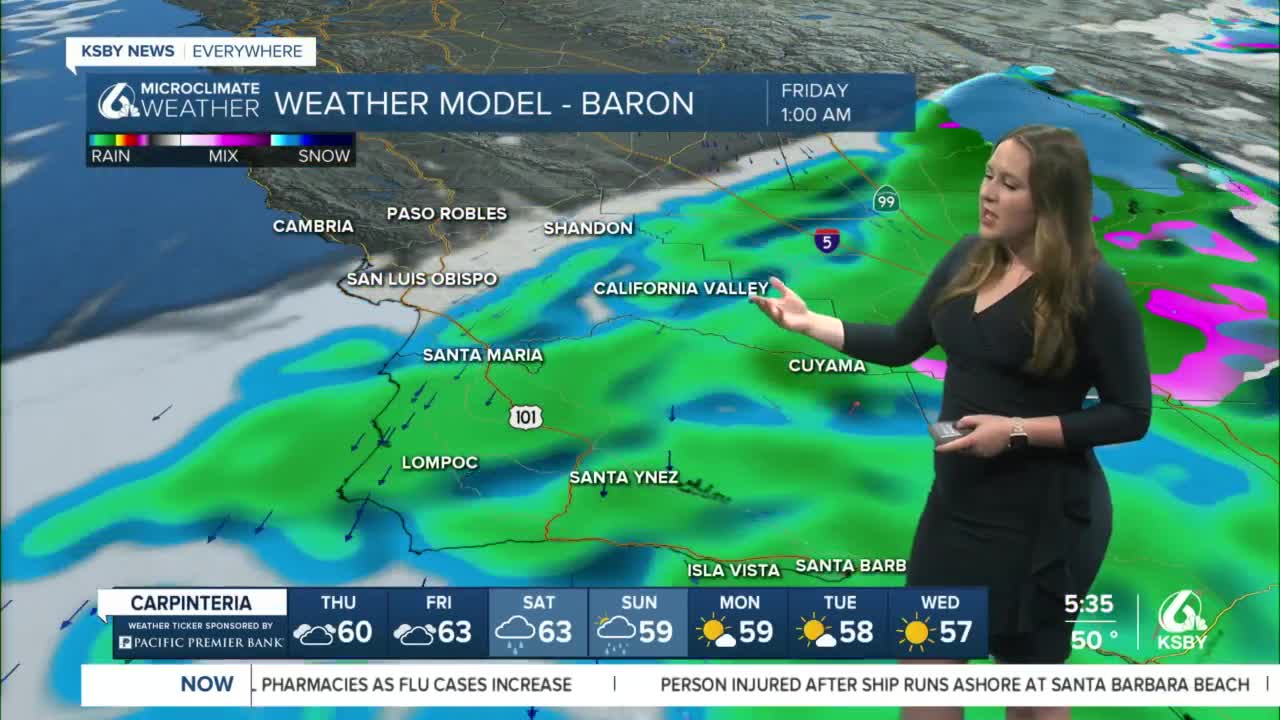
By Friday morning the front will have passed through and we move onto the second section of this storm. Scattered showers and on and off drizzle is expected to carry on across Santa Barbara County through until Friday night when the rain will pick up significantly once again. Rain looks to resume by Friday late evening and last through Saturday into Sunday. This second system will be a bit trickier given the overall meteorological set up but also the many events taking place across the region Friday Night, and through the weekend. My advice for those events, pack an umbrella... odds are you will need it at least once.
This second rain event is associated with another low dropping in from the PacNW and arriving at the same time another low comes up from the PacSW. The systems essentially merge. The impact of this is not only the earlier arrival but also the potential for another significant rain event. Models disagree on what the "hot spot" for this second phase of rain will be but most suggest another .5-2" could be possible for the area.
Cumulative rainfall could be impressive. The 18z is very bullish .5-4"! Even if it were only a fraction of that, it is very significant. This assumes the hot spot for accumulation Saturday into Sunday is on the west-facing Central Coast, that hot spot could be further south. However, anytime you see this kind of potential you have to consider what it would be like IF that happened. Flooding could be an issue.
Thus far there are no advisories. I do think wind advisories are possible today as the cold front pushes in.
Temperatures through today, and the majority of the extended forecast stay below normal for this time of year. Most locations will be in the 50s but some 60s are possible for afternoon highs.

Have a great day Central Coast and be sure to stay weather aware!
