


Good Morning Central Coast! To kick off our Thursday morning a large area of mid to high level cloud cover is surging onshore across the west coast. This is thanks to a system pushing in across the Pacific.

This will linger offshore today and will unfortunately not make it close enough to bring any rain. Other than adding that cloud cover the only impact will be slightly limiting the cooling factors this morning. That being said it will still be a chilly one today. Highs will be in the 50s and low 60s in the afternoon hours today.
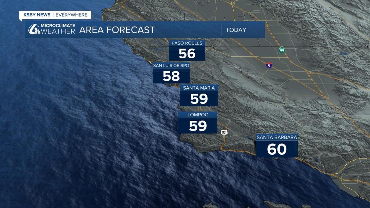
While these highs are cooler than normal for this time of year they aren't that far off, especially in the interior valleys. It is December after all.
Turning to the long range forecast, there isn't a whole lot going on. Some additional cloud cover will move in Saturday, that will do little more than knocking a few degrees from daytime highs. A resilient ridge of high pressure will settle in just offshore from the Central Coast. This will help us warm up slightly as we enter next week.
No rain is in our 7-day forecast. In fact, the current long range computer models are suggesting that rain isn't likely all the way through through its 16-day run. Unfortunately that means it is likely that we are done with rain for the year.
Have a great day Central Coast!
