


Good Morning Central Coast!
The warm temperatures that have made it feel less like fall and more like the middle of summer will be exiting the region making way for a more seasonal forecast as we head into the last few days of the week.
This shift is due to a large ridge of high pressure over the western US that gave way to a cold front overnight.
The front itself washed out over the pacific but cooler temps will still develop with the onshore flow, a deeper marine layer, and less high pressure. That deeper marine layer is prompting a few areas of dense morning fog that we need to contend with this morning. I expect the areas impacted by the fog will be much more widespread as we head towards sunrise.

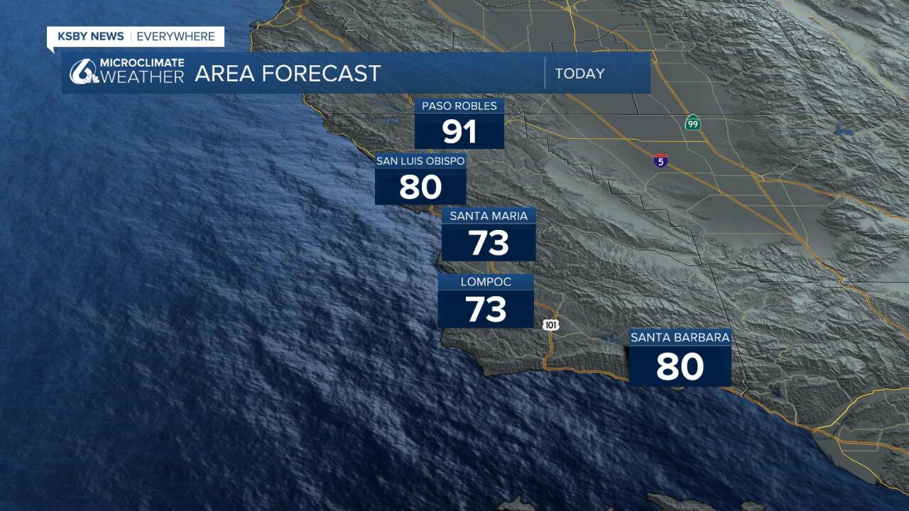
Temperatures today will be a little cooler than on Wednesday where many locations were in the upper 90s. Today inland temperatures will still reach into the 90s, although for today it is the low 90s, much more comfortable than the upper 90s from the last few days, Coastal valleys will be in the 70s and low 80s and most beaches will be in the lower 70s and 60s.
But Friday thru the weekend will see inland temps eventually fade off into the mid-80s (which is near average) with coastal valleys dropping into the 70s and beaches into the 60s. Not much change over the weekend. Early next week temps will come up a few degrees over the weekend highs but a plateau near average is likely.
In national weather news, KSBY will be monitoring and bringing full coverage of the impacts felt by Hurricane Ian as the storm moves into the atlantic.
Have a great day Central Coast!
