


Good Morning Central Coast!
It has been a wild weekend with significant rain, hail, strong winds and widespread damage thanks to a strong storm system passing through the region. Let's dive right in to what we can expect for today and the remainder of this system.
After a bit of a break last night heavy rain picked back up last night and this morning is pushing through the Central Coast through the morning. Clearing will take over into the mid morning hours and sunshine is expected in the wake of these storms. Morning rain totals will be in the hundreds or tenths of an inch, very minimal when compared to this weekend. Check out rain totals at this link.
Just because the rain is subsiding does not mean we are out of the woods yet. There are several advisories/warnings in place today.

There is the chance for winter weather (light snow accumulations) early this morning in the highest elevations of Santa Barbara County, cold temps are possible elsewhere.
Along our coasts the winds associated with our storm has increased wave heights significantly. Waves cresting 10-14ft and dangeous rip current.

As for wind, in SLO/SB county all wind advisories have dropped but breezy to gusty west winds will still prevail across much of the region for the rest of the day with local gusts over 40 mph
possible in some areas.
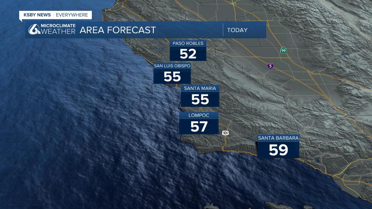
Skies should clear out Monday night through Wednesday but during this time there will be the possibility of some frost and freezing conditions. Overnight lows will be dip below freezing mid week and day-time highs will not be rebounding well, with temps still set in the mid to low 50's.
Looking to next weekend, there is still the chance for more rain. Models right now show at least some moisture possible but how much will be determined as we get closer.
Have a great day Central Coast!
