Good morning Central Coast!
As we kick off the morning it is chilly with some temps in the low 30s. Grab that extra layer as you head out the door.

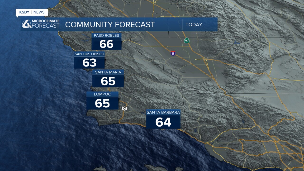
Thankfully we will warm up quickly and temps will be comfortable today. Most temps will be in the low 60s with beaches back in the 50s today.

Now that we have all the nuts and bolts of our forecast out of the way, let's dive into the big story. A massive atmospheric river is pummeling northern California this morning and will continue to bring life-threatening conditions throughout the week. We will not see impacts from this storm until late Friday and even then it will have weakened significantly.
Diving briefly into this storm... it is going to be strong and very significant, despite that the actual dynamics of the storm are very much what we are used to. It is a textbook atmospheric river with a "fire-hose of rain" pointed to Northern California. These spots can expect up to 20 inches of rain over the next few days. Flooding is expected as well as significant mountain snow and strong winds.
The storm will stay put for a few days before losing strength enough to drift south. That is when we will see some impacts.
Ahead of the storm reaching us the waves will kick up once again. This has prompted a High Surf Advisory for all western beaches going into effect at 3 p.m. Wednesday and lasting until Thursday morning. I would be shocked if this alert is not extended as localized sets of waves 10 to 13 ft are expected into the weekend.

Late this week our weather will take a noticeable turn toward cooler, cloudier, and wetter conditions as the storm causing concern to our north now begins to break down and the remnants will sag to the south.
Our rain chances begin late Friday night with the first showers possible in Northern SLO County and spreading south overnight. That is just the first impulse where rain is expected. A better chance pushes through Sunday morning when some pockets of heavy rain are expected alongside gusty winds.

Small off-and-on showers are expected through the early portion of the week.
Now that is a lot of rain chances back to back. None will bring particularly heavy rain but when added together we could see up to an inch and a half of rain through the forecast.

This is primarily a warm system, so snow levels will remain high through the weekend. However, colder air filtering in late Sunday and into Monday could lower snow levels, potentially dusting higher peaks above 6,000 feet. Only West Big Pine is tall enough for local snow.
Rain chances may persist into early next week as the system slowly exits the region. Temperatures will remain cool, but conditions should start to stabilize by midweek.


Have a wonderful day and be sure to stay weather-aware as the week goes on!


