


Good morning, Central Coast!
As we kick of the new workweek, sunshine is the story and we have a big warm-up in store. This is thanks to the transition between a persistent low pressure and a large ridge of high pressure.

There is a lingering high surf advisory for all western beaches in place through 9 a.m. Monday morning. Sets up to 10 ft are still possible today but the threat is dissipating.

Highs will be slightly below normal for this time of the year today. Upper 70s for the interiors. 60s by the beach and in coastal valleys.

Once the ridge fully settles in temps will climb quickly. Beaches will get to the 70s coastal valleys will make it into the 80s and for the first time this season, interior valleys will reach the 90s!
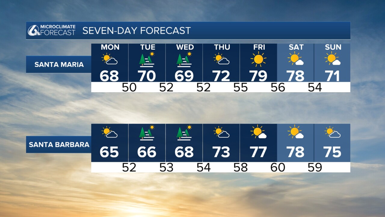

It is a long way out, but a slight cooldown is possible to close the weekend.
Have a wonderful day, Central Coast!
