


Good morning, Central Coast!
Big changes are headed our way, this will bring hot weather to start the weekend and a big cool down next week. This roller coaster of a forecast will be impactful for all communities.
Before I get to all of that, fog is the story this morning. Visibility is limited for most communities this morning. Take caution on the road and leave extra stopping distance this morning.

The overall pattern is shifting to high pressure today. That will bring sunshine, offshore winds, and limited marine influence. Long story short, it is going to get very warm very quickly.

That high pressure will bring temps to above normal values on Thursday. Some 90s are possible for interiors, upper 70s for coastal valleys, and 60s along the beaches.

Friday and Saturday will be the hottest with highs near triple digits for Paso Robles, 80s for coastal valleys including San Luis Obispo and Santa Maria. Beaches will climb to the low 70s.
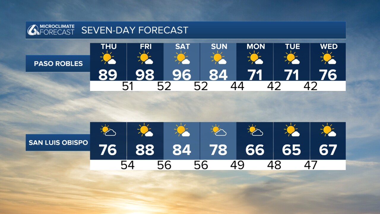

Next week temps will cool down quickly, even a rain chance is possible late next week.
Have a great day Central Coast!
