Good morning Central Coast!
Monday was a beauty across our Central Coast communities with comfortable highs and abundant sunshine, only the eastern beaches faced persistent cloud cover but even that cleared out a bit later in the day. Here is a look at the daytime highs for Monday.

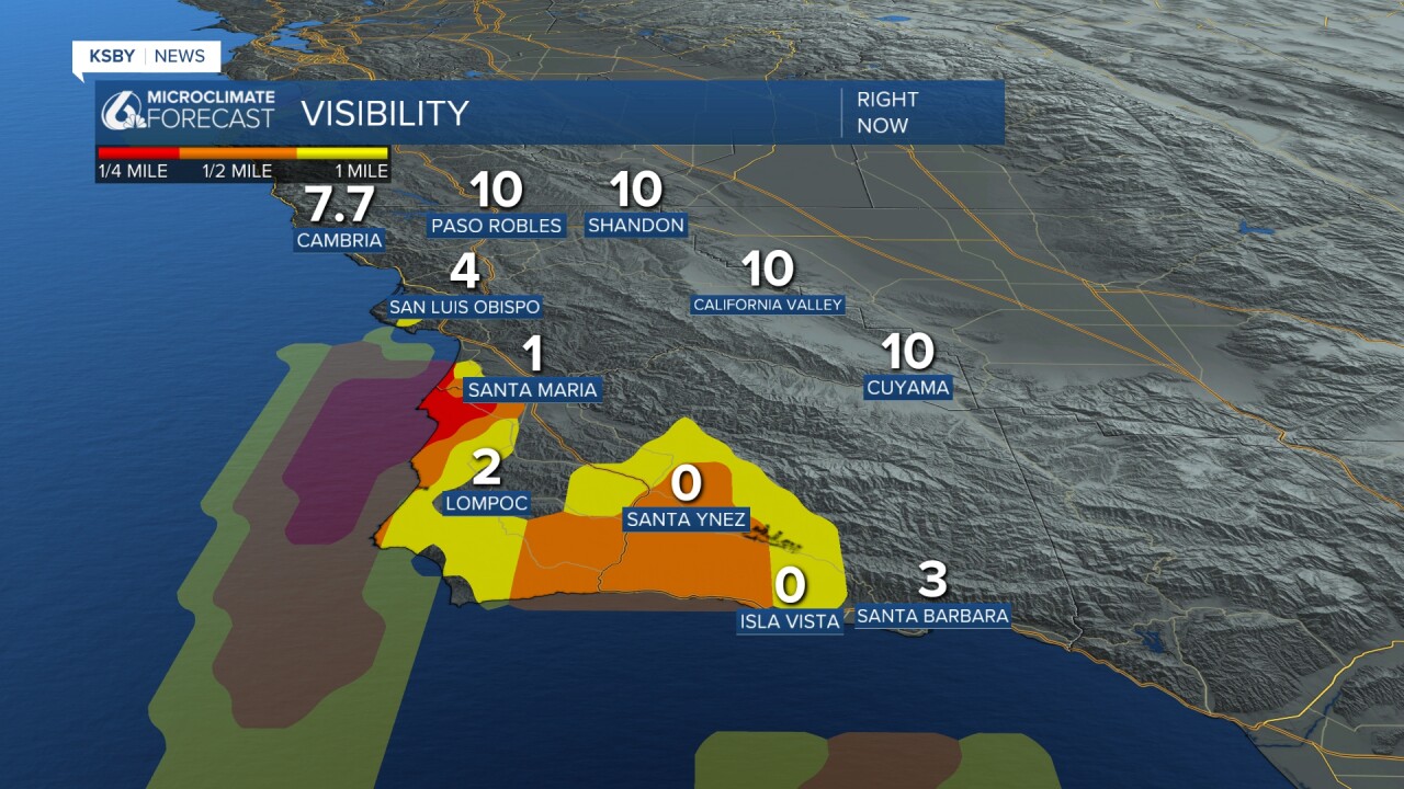
Turning to our forecast, once again the day is off to a foggy start with limited visibility across many of our coastal valleys.

The marine layer air is a relatively shallow layer though, it isn't deep enough to spill over into the interior valleys. That will make a huge difference in temperatures later today.
Where marine fog made for a cloudy morning temps will be mild, just above normal for this time of year. Interiors, where the marine layer did not reach will be hot today. Some may even reach triple digits.

Even though no alerts have been issued for this heat remember to stay hydrated, limit exertion in the heat and never leave pets or kids in a vehicle.
The temperature roller coaster will continue with an anticipated cooling trend Wednesday and Thursday due to an approaching upper low, which will deepen the marine layer. Warmer conditions will return Friday through the weekend, accompanied by locally gusty northerly winds.


Have a great day Central Coast!


