


Good morning, Central Coast!
To kick off the morning, cloud cover and fog is the story for many beaches and coastal valleys. Feeling very "May Grey" to kick off our Friday.
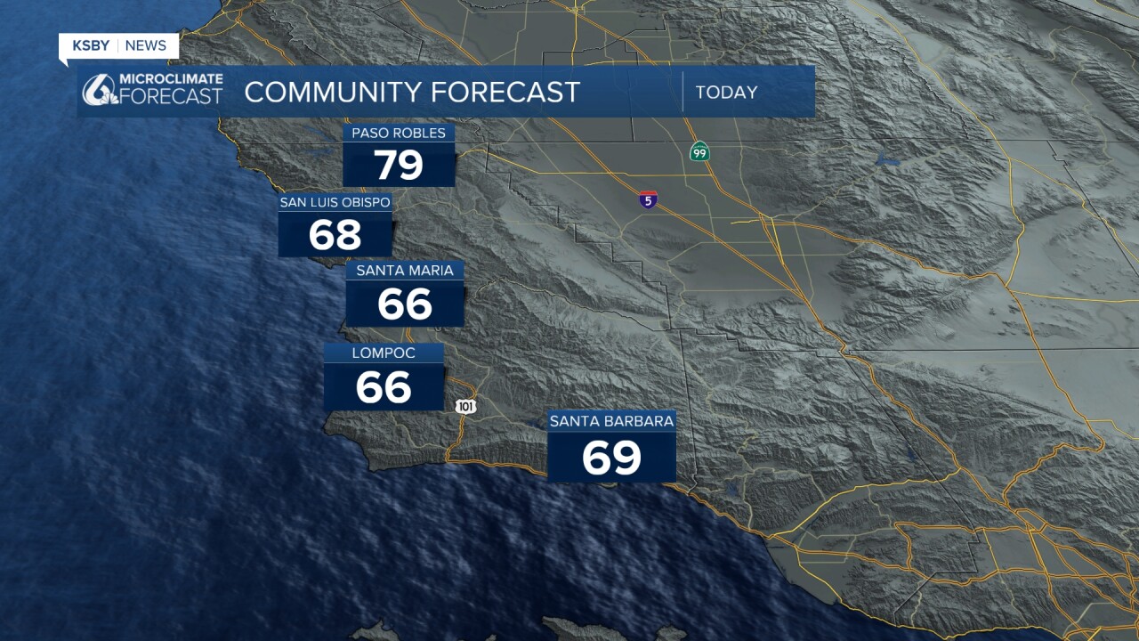
The good news is that this afternoon, sunshine will move in, and warm temps are expected. Interiors may even make a run for the 80s. Coastal valleys will be in the upper 60s while some beaches will stay in the 50s.
That warm up is from a weak high pressure that will be ushered out quickly by a cold front headed our way. That being said the warm up this afternoon brings us another shot for thunderstorms for the interior valleys.
Yesterday's rain was very localized but impactful nonetheless. Here is a look at the rainfall accumulation map.

Into the weekend a cold front is headed our way and will bring a whole lot more cloud cover, strong winds, and even some rain headed our way. The front will arrive early Saturday morning and bring some light rain to the region but that will be minimal and end by noon.

The greater concern following the front is the winds. It is going to be gusty with winds up to 40 mph.

Temps will also be low following the front with clouds and another round of light rain expected Sunday morning.
Looking ahead to the start of next week, there's a possibility of a brief warming trend as a secondary weather impulse moves through the area on Monday. However, this warm-up is expected to be modest, and temperatures will likely remain near or slightly below seasonal averages into the middle of next week.


Have a great day, Central Coast!
