


Good morning Central Coast! I hope everyone was able to enjoy the beautiful weather this weekend!
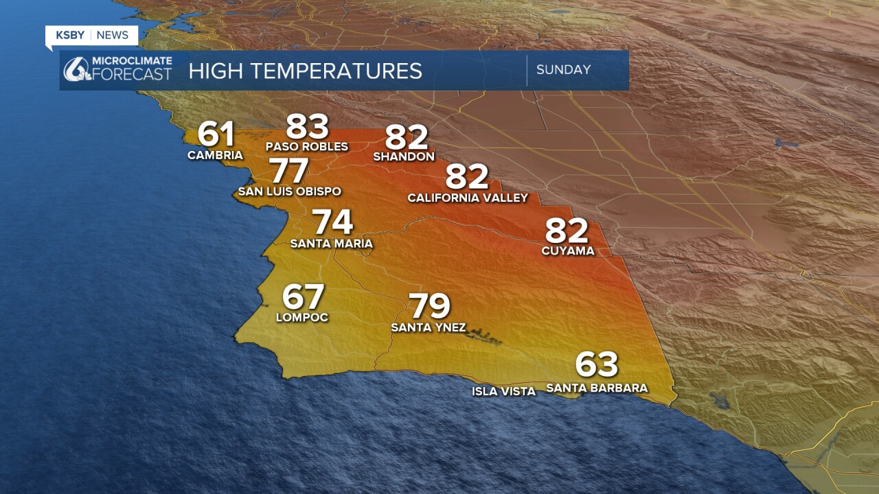
Sunday interiors reached into the 80s while coasts were in the 60s and 70s. That paired with calm winds and abundant sunshine made for a great time especially for outdoor events.
As we move into the workweek a cooldown is afoot. Onshore winds will bring in a deepening marine layer and low cloud cover. This will keep temps on the cooler side with highs falling about 10 degrees from Sunday.
Once again winds may gust towards 30 mph this afternoon. Just something to be aware of.

Tuesday and into Wednesday will once again be on the cooler side with more cloud cover. There is also the chance for several hours of light drizzle and mist through Wednesday. This is mostly when clouds are lowest and temps falling (overnight).
Thursday the winds will shift and a warming trend is in store. By next weekend abundant sunshine and highs in the 70s will return.
Have a wonderful day Central Coast!
