


Good Morning Central Coast!
For the start of your Thursday there are some areas of dense fog still sticking around but thankfully it is much less widespread than the last few days. That being said drivers on Hwy 166 through the Cuyama valley will be faced with limited visibility.

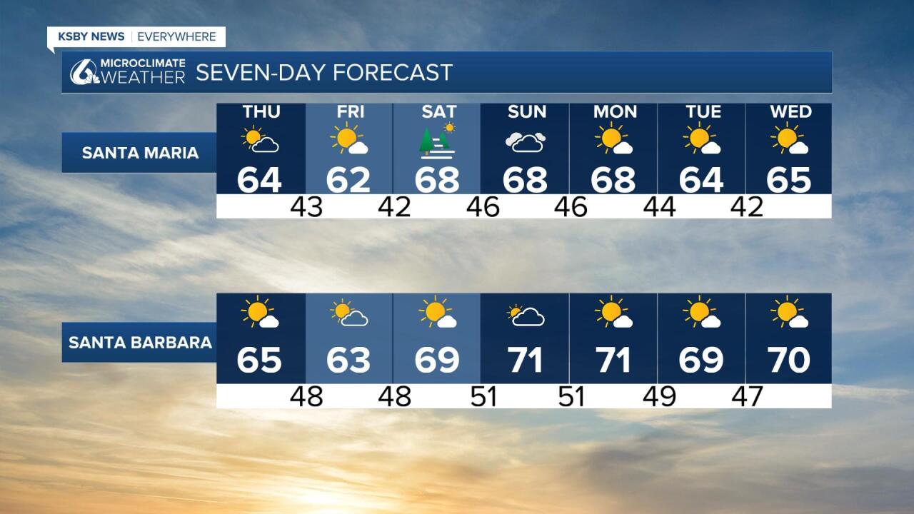
Temperatures this morning are slightly lower than the rest of the mornings this week, 40s will be widespread. Not necessarily coat weather but you may want an extra layer.
Highs today will stay a little cooler still, most locations will be in the 60s with the western beaches in the 50s.
Today will be another breezy day across the region, by early afternoon most of the coasts will see gusts up to 30mph possible, the SW portion of Santa Barbara county, including the Gaviota coastline will see gusts up to 45mph. That is just at the low end of advisory level, so one has been issued and will stay in effect through 3AM. have gusts up to Wednesday the NW Winds were 15-25mph with gusts to 35 mph for most of the area.

All these winds is due to the shifting trough passing through the region, as it pushes east some high pressure will start to build in and bring slightly warmer temperatures and more sunshine!

For the weekend the interiors will reach into the 70s, elsewhere upper 60s will be on tap.
Another trough moves into the PacNW next week to cool temps a little again and reintroduce breezy to windy NW winds.

There are a number of systems moving into The West but mostly the PacNW which means temps should remain normal to below average. No significant rain potential is in the local forecast but the PacNW will see a good string of potential systems.
Have a fantastic day Central Coast!
