


A wildfire mapping workshop was held at Atascadero City Hall on Wednesday to help residents better understand local wildfire risk.
City staff shared information about the state mapping process and took questions from the community about the new draft maps for Atascadero, which include expanded fire severity zones and updated wildland-urban interface maps.
"We want the residents to know that we're trying to build a wildfire-resilient community by adopting these zones," said David Van Son, the battalion chief of community risk reduction. "... Those standards also would require certain defensible space around those new structures to prevent what happened in the Palisades or Eaton fires.
Wildland-urban interface maps also establish building-code requirements, such as building materials used in the construction of new buildings in designated fire-risk zones.
Van Son said the updated maps are based on modeling that incorporates "modern climate data and advanced fire modeling, according to the city's website. It includes various factors, such as topography, vegetation, past fire history, wind, and what’s known as "ember casting," where flying embers are carried by wind, igniting new fires distant from the main fire.
Local fire officials will revise their wildland-urban interface maps to coincide with Cal Fire's. Van Son adds that state law mandates the updated maps must be adopted.
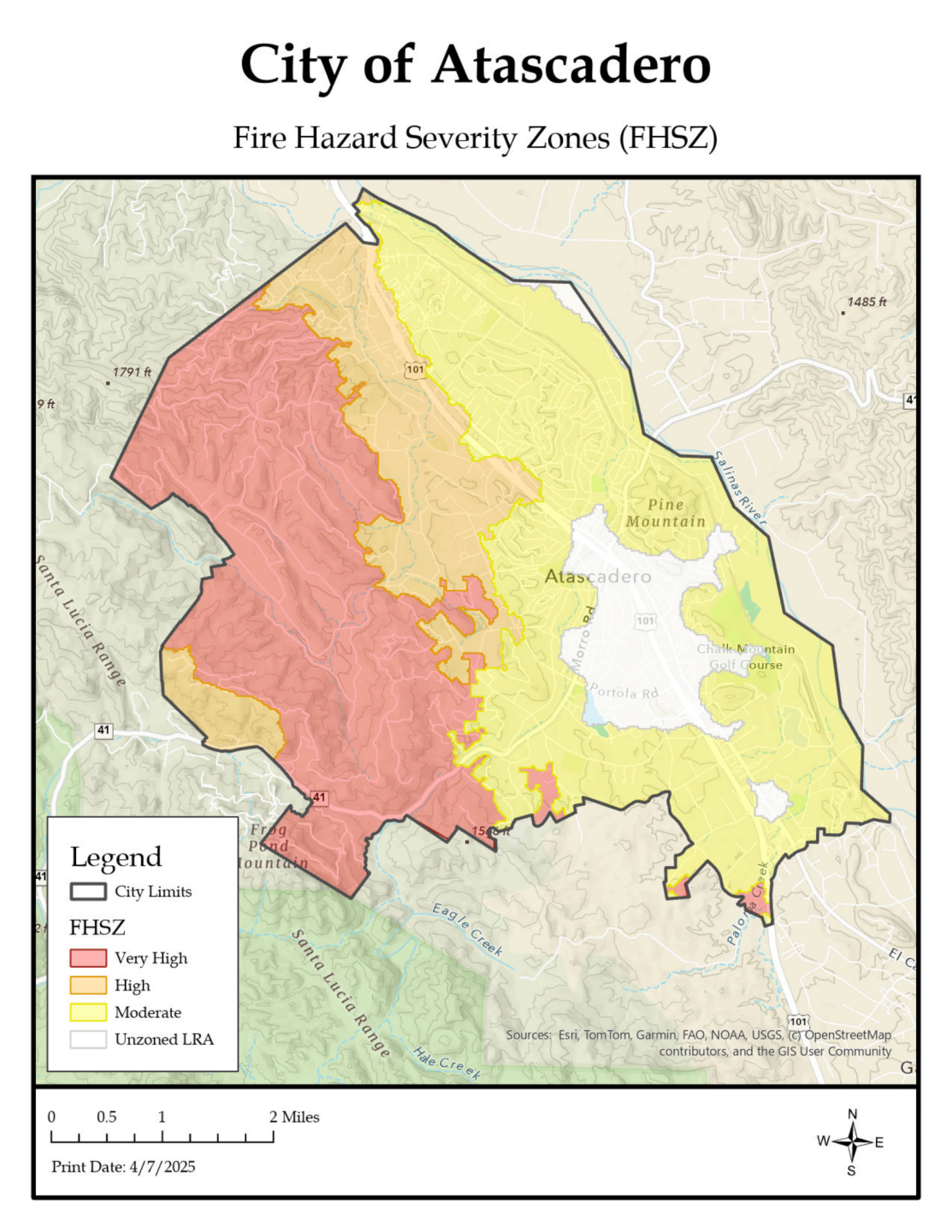
Officials say the revised maps will help property owners understand wildfire hazards and aid them in taking steps to better protect their homes and property.
"I am always concerned about wildfire, especially after we saw the Highway 94 fire come so close to our house, said Nancy Spitzer, an Atascadero resident. "So, I'm always interested in finding out more information. I do keep all my grass cut and have the defense of the space because that is so important."
Residents can submit comments on the city's webpage dedicated to fire hazard severity zones.
The city council will vote to adopt the maps.
