

Santa Barbara County has launched a new emergency mapping tool to help residents determine their risk levels and evacuation zones during emergencies.
The interactive map allows residents to enter their address and receive critical information about potential evacuation orders and safety protocols tailored to their specific location.
"You can put in five addresses. Put in your home address, your work, an elderly parent's address or your child's school, if you want to know what might be impacting the places you live, visit and work," said Kelly Hubbard, Santa Barbara County Office of Emergency Management Director.
The mapping tool was launched in early August, coinciding with the massive Madre and Gifford fires that threatened the area this summer.
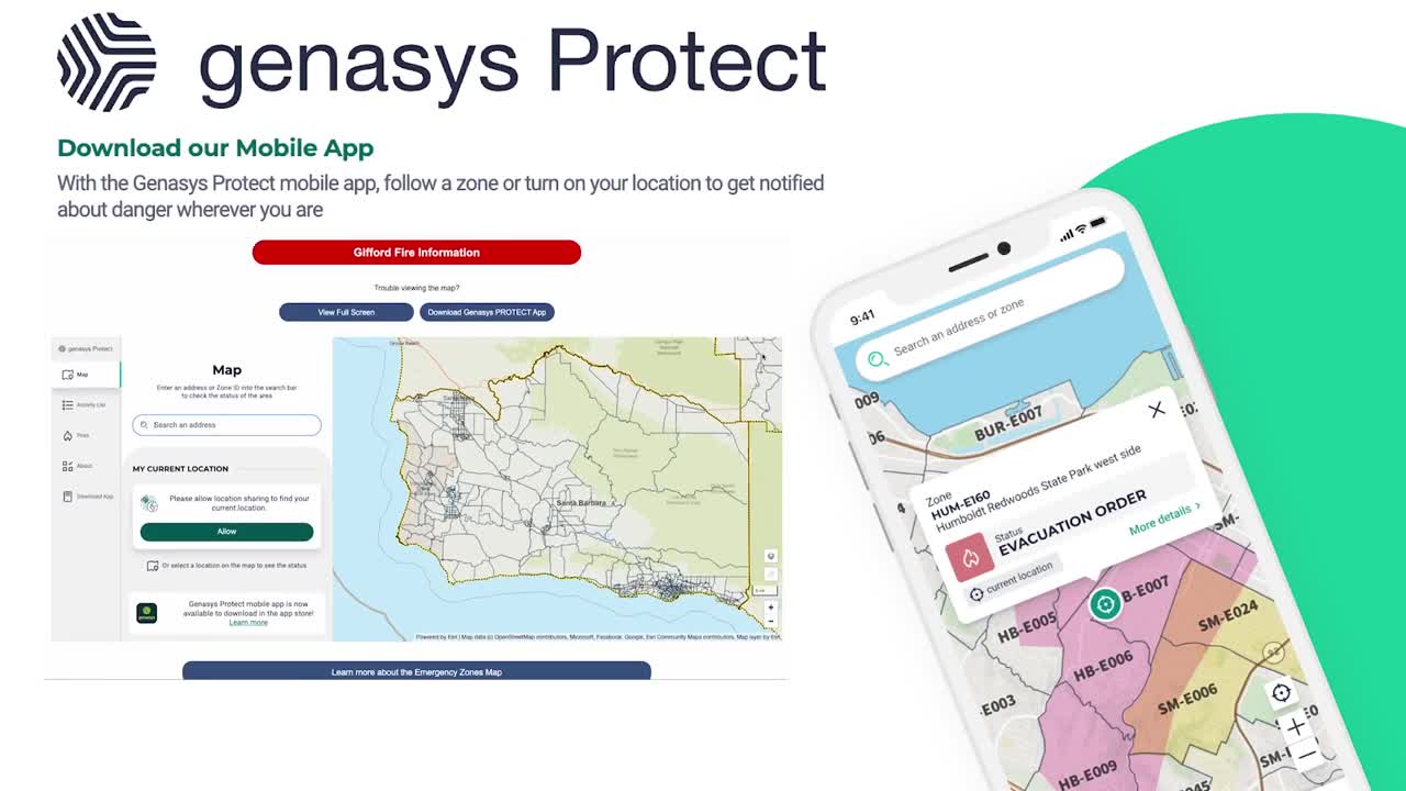
Residents can access the map through a mobile app or online at readysbc.org/emergency.
If you download the app, you'll get multiple notification options, sending alerts via text, email, and phone calls when a user's address zone is activated during an emergency. According to county officials, this multi-channel approach provides residents with real-time information to make informed decisions about their safety during natural disasters and other emergencies.
Hubbard emphasized the importance of entering complete street addresses without abbreviations to ensure the tool returns accurate results, and stressed that residents should not hesitate to evacuate if they feel threatened, regardless of official orders.
"Small steps, little steps can help every day," she said.
September is National Emergency Preparedness Month, highlighting the need for all residents to prepare before an emergency occurs.
