Today the Central Coast saw 80s and 90s as high pressure and some light offshore flow dominated the weather. The ridge of high pressure has already peaked and as it slowly weakens we’ll see temps slowly dip. Wednesday highs return to the 70s for most of the coastal areas while inland areas will not see much of a change with more high in the upper 80s and lower 90s.
Thursday the transition becomes more significant as marine clouds return to the coast with beaches returning to the 60s but coastal valleys will still hit the 70s.
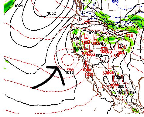
Here is a look at the model depiction of the returning marine layer Thursday when the ridge weakens, the surface high weakens and onshore flow returns.
Posted by Dave Hovde-KSBY on Tuesday, April 23, 2019
Inland high Thursday drop into the mid-80s. Not much change in temps or conditions thru Saturday.
Super nice at 9am in Montana de Oro this morning. Perfect for a bike ride.
Posted by Vincent Shay on Tuesday, April 23, 2019
Sunday and Monday an upper low pushes at the Central Coast. This will increase clouds and winds and push temps down. Drizzle and light showers are also possible as the low moves through.