
A trough of low pressure has developed and slid into the area as a ridge of high pressure has started a slide to the east.
This has allowed the marine clouds to return. This also promotes more onshore breeze in the afternoons which should help moderate highs over the next few days.
Posted by Jennifer Lee Breeden on Wednesday, April 24, 2019
Highs at the beaches retreat back into the 60s with coastal valleys in the 70s and the interior highs falling back into the mid to upper-80s (just a few degrees cooler than the 90 degree temps of yesterday and today). This will hold into the weekend.
Models are still calling for a mid-level low pressure system to cut off the main jet stream flow and wobble at the California coastline Sunday PM-Monday.
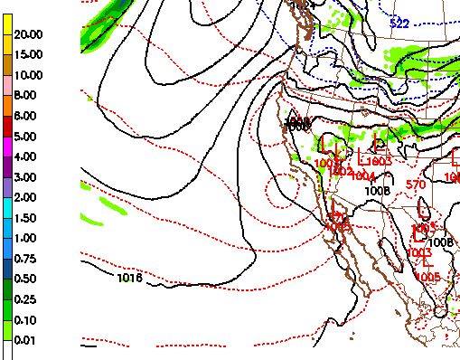
There is a chance we’ll get some light drizzle or showers but nothing really significant. The biggest impact will likely be a temporary cooldown before temps rebound Wednesday and Thursday next week with more high pressure and clear skies.
