


Hello, Central Coast! Happy Sunday.
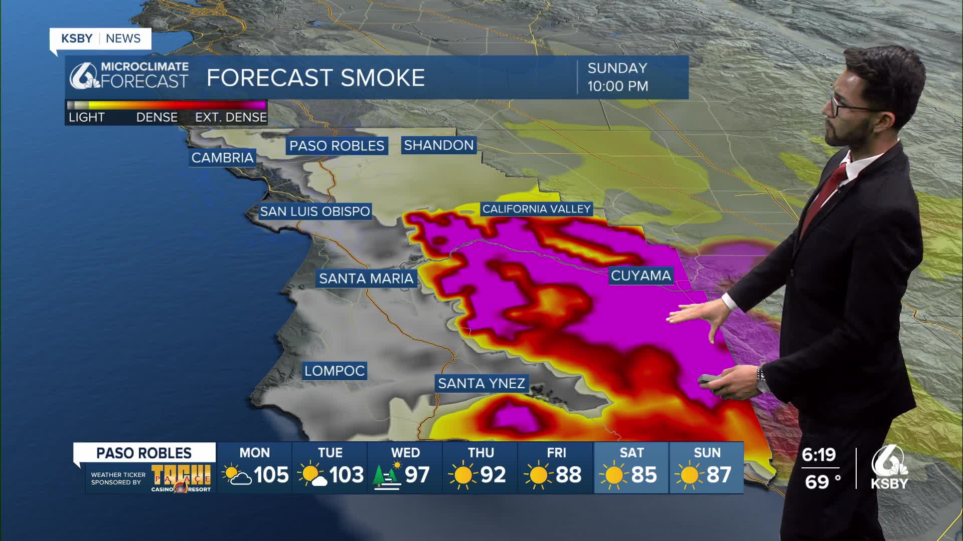
Our Sunday morning began with low clouds over our beach and coastal valley communities, in addition to smoky skies from the Gifford Fire.

As of Sunday afternoon, the Gifford Fire has burned over 117,000 acres, according to CAL FIRE. For the latest updates on the Gifford Fire, click here.
Here are a couple of links on Air Quality Information for San Luis Obispo and Santa Barbara counties:
Air Quality Information San Luis Obispo County
Air Quality Information Santa Barbara County
Residents in San Luis Obispo County can check whether their property is included in evacuations by visiting this link.
For information on evacuation orders and warnings in Santa Barbara County, click here.
Highway 166 also remains closed between Highway 101 and New Cuyama with no estimated time for reopening.
Other road closures include:
- Huasna Townsite South at Huasna and Huasna East
- Hi Mountain Road at Lopez Drive
- Huasna Road restricted to residents only
- Pozo Road at River Road
- Pozo Road at Santa Margarita Lake Road
Detailed forecast:
The hot weather pattern that many coastal and interior valleys have been experiencing will continue into Tuesday as high pressure aloft lingers over California.

Daytime highs on Monday will be above normal for areas mainly away from the coast, but the marine layer and moderate onshore flow will keep coastal areas cooler.
A Heat Advisory has been issued for the interior mountains of Santa Barbara County until 9 p.m. Monday, August 11, 2025, due in large part to the warm overnight low temperatures that have been in the 70s, in addition to daytime temps as much as 10 degrees above normal.

As for winds, a moderate Sundowner wind event is expected Monday evening across the southwestern portion of Santa Barbara County with gusts around 50 mph around the Gaviota and Refugio area.

Monday is expected to be the warmest day before high pressure begins to weaken on Tuesday and increasing onshore flow slowly brings cooler air inland through the rest of the week.
As the high weakens, the marine layer will deepen and eventually spread into more of the coastal valleys this week.


Have a great week, Central Coast!
-Eddie
