Good morning Central Coast!
The rain system that brought significant rain to our region has moved east, leaving sunny skies here on the Central Coast and warmer weather as we head into the back half of the week.
To kick off the day there is some dense fog pushing through the region, it is very much locally isolated so visibility should not be greatly impacted through the daytime hours.

Sunday through Tuesday morning brought some significant rain to many communities, bringing significant rain to where the cold front set up and kept rain falling for well over a day. In those location significant rain was able to make a substantial difference to our rain deficits for our rain year (October through September). Here is a look at some of the highest rain totals in the region.

Many more rain totals can be found at this link.
Even though Santa Maria did very well, other places like Santa Barbara and Paso Robles didn't see much change and SLO got less than an inch and the shortage there is still significant.
Moving on from the rain. Morning low clouds and fog are possible at the coast and the interior otherwise more afternoon sunshine is on the way Wednesday. That sunshine will stick around and be abundant over the next few days and into the weekend.
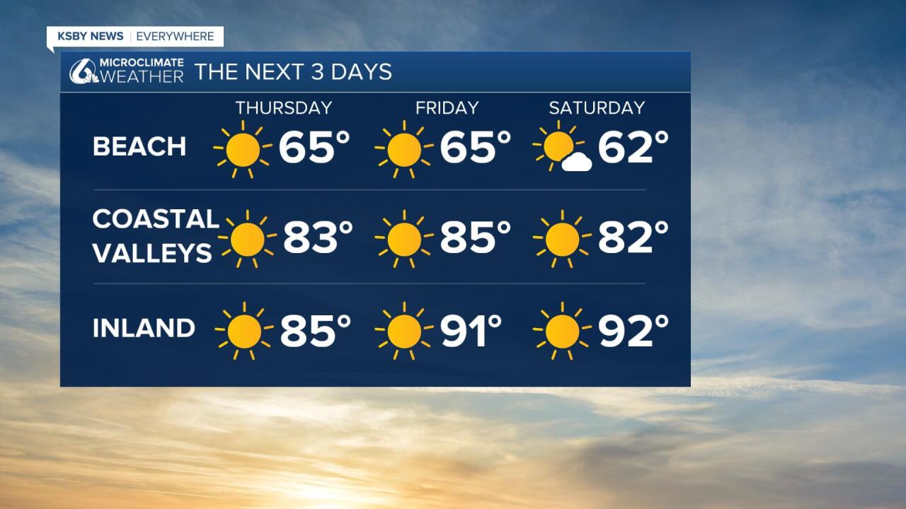
As far as temperatures go Wednesday is still a bit of below normal day. 60s at beaches with mostly 70s elsewhere Wednesday but warming continues Thursday thru the weekend. Ultimately, mid-90s return inland while coastal valleys top in the upper 70s and low 80s over the weekend with beaches also experiencing some minor warming.

Warming will continue into the end of the week and through the weekend with the interior valleys reaching a stretch of warming into the 90s expected as a large ridge of high pressure sets up and will help keep the region clear from clouds.

Have a great day Central Coast!


