

Happy Friday Central Coast!
The long holiday weekend is here but the warm temperatures we usually associate the long weekend with won't be the case this year.
We have a cool pattern that is going to linger through the weekend. That's a drastic change from earlier this week when we saw triple digits in the majority of our regions.
Temps today will stay much lower than we have seen recently, all thanks to that marine influence, cloud cover, and critically a low-pressure system spinning to our north helping to keep the high pressure that made the first half of the week so hot.
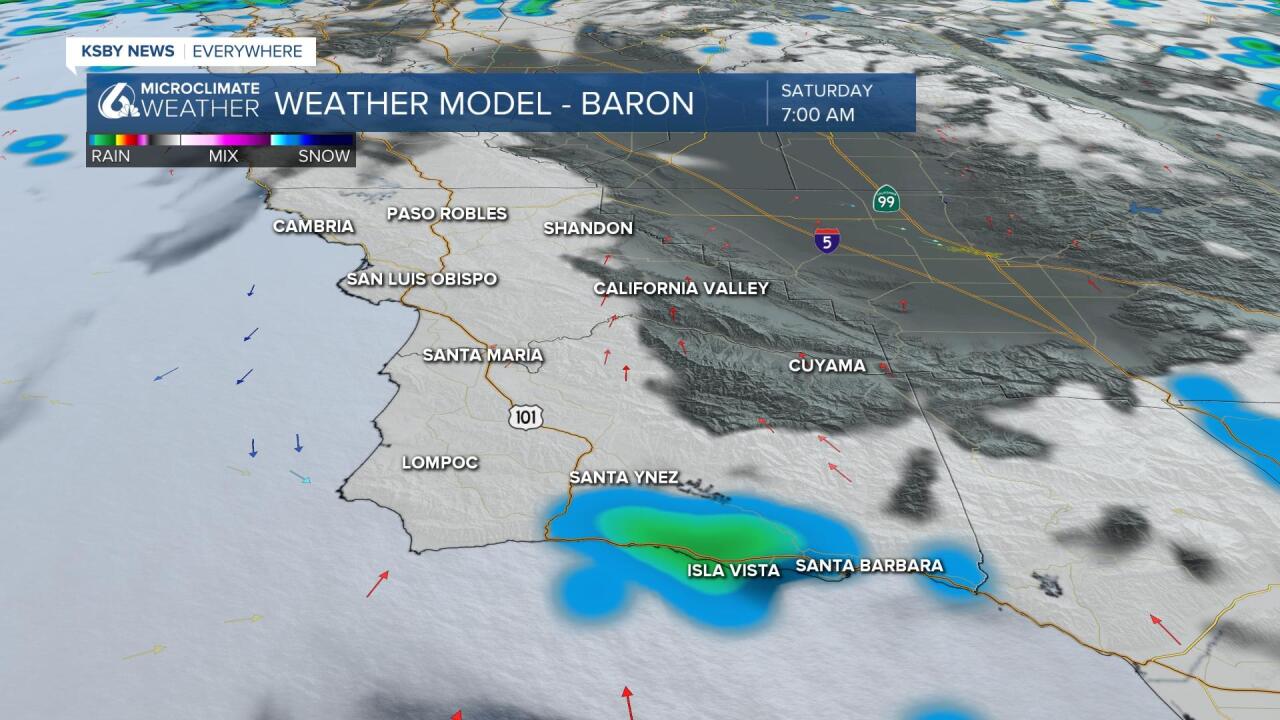
Another big story we are following is the chance of showers on Saturday morning. The south coast region could see some moisture as early as tonight.
The first rain chance is embedded in the dense fog tomorrow morning for the coastal valleys and western beaches. As the air surges onshore some of that mist or drizzle could result in measurable amounts of precipitation.
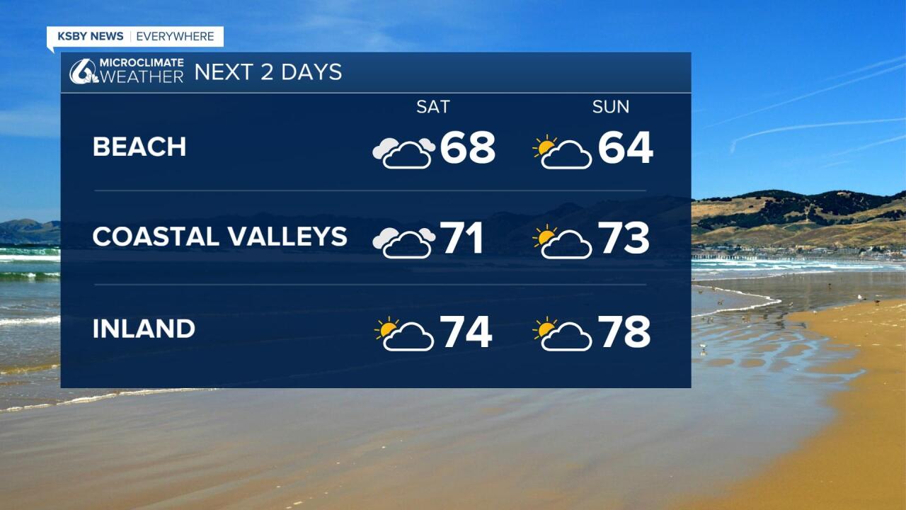
Beach temperatures will be in the upper 50s and low 60s for the next several days with coastal valleys in the 70s and the interior valleys in the 70s and low 80s.
A warm-up is on the way that will push temps back to average and could arrive as early as next Monday.
Have a great long weekend!
