

Wednesday was a beautiful day for the Central Coast with daytime highs stretching into the 60s with some scattered 70s but all of that comes to a change on Thursday.
While rainfall is not expected during the daytime hours on Thursday more clouds and onshore winds pushing temperatures down. Most of the region will see daytime highs sag into the lower 60s on Thursday.
The first of a series of cold fronts arrives late Thursday night into Friday morning for some scattered, and the wind will start to crank up at 15 to 25 mph with higher gusts.
The cool and windy weather continues through Saturday as a cold front moves through the area.
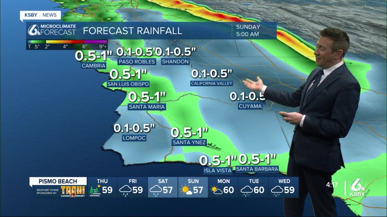
Rainfall through Friday looks to be less than .50” with some inland areas getting less than .10”
Through Saturday the rainfall accumulation could be .50-1”.
Snow levels initially are rather high, but Saturday night they drop down to about 3500 ft. There isn’t much of the system left at that time but winter weather advisories could be needed. It is something to keep an eye on.
So, we are not talking about flooding rain here. Unlike the storms of early February, the weekend activity is not supplied by a warm atmospheric river.
Sunday and Monday look dry.
High temperatures Friday through the weekend will be in the mid 50s to about 60 degrees. Freezing low temps are possible Sunday night into Monday in the interior valleys.
Along with the cool, showery, and windy weather Friday through Saturday, waves will also build to about 10-15ft and a surf advisory has been issued from 4a Friday through 4a Monday for the west-facing beaches of the Central Coast.
Models are now more bullish on a follow-up system Tuesday into Wednesday. This will keep temps down.
