
It was quite the gloomy day on the Central Coast Sunday, with most everywhere seeing rainfall throughout the day.
The Santa Barbara County South Coast received the most rain so far, with places like the Refugio Pass accumulating 2.44" of rain.


These rainfall amounts near the Cave Fire burn scar area were enough to trigger a debris flow Sunday, but as of 6 p.m., CalTrans says there is nothing to report so far and they will continue to monitor the area.
Click here for more rain totals.
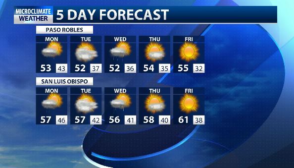
Shower activity will continue Monday for many areas, with a slight chance of thunderstorms containing hail.

Our winds were of major concern Sunday, with several areas receiving gusts over 30 mph but winds are looking to be calmer as we head into Monday.
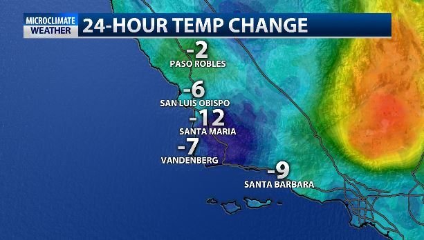
Temperatures will be cooler than the last few days as well, however Sunday's temperatures already saw an over 10 degree drop from Saturday.
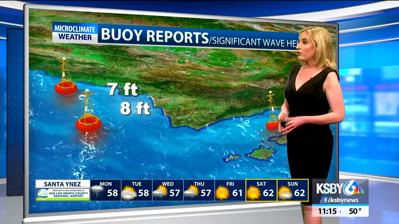
We'll get a brief break from the rain Tuesday before a cold storm brings rain and lower snow levels to the area Wednesday and Thursday.
Try to stay dry!