


Good Morning Central Coast!
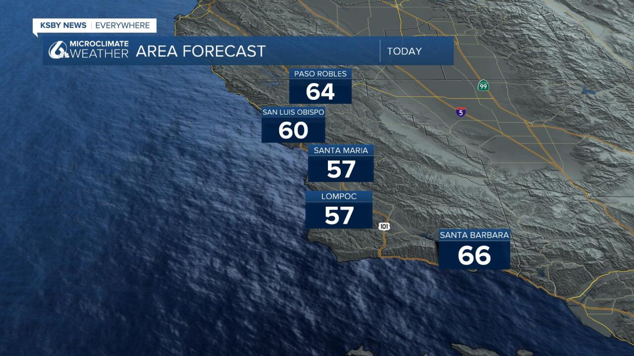
To kick off our Tuesday Morning there are mild (although foggy in some spots) conditions. No major concerns for the early portion of the day when a weak ridge of high pressure continues to stick around. This will keep highs near to what we have seen the last couple of days.
A large pool of cold air is descending into The West riding a cold front into the region. Behind this front there is very cold air that will keep us chilly and with rain chances well into the end of the week. Our highs will drop from the 60s and low 70s of Monday into the 60s on Tuesday and highs Wednesday and Thursday looks to only hit the upper 40s and lower 50s.
Winds are a the main impact as we head into the afternoon. There is a high wind warning in place for portions of the Santa Barbara County South Coast. This is in effect though 6am Wednesday Morning,. There are also high wind advisories in place for the rest of the Central Coast through the same time period.
Sustained winds 30-45mph winds with gusts to 65mph are possible. Even when these advisories drop there are still near advisory-level winds.

With cold daytime highs and overnight lows, that means the snow levels will be low Tuesday night into Wednesday morning. Some models are indicating snow levels down to 1100ft this could put a dusting of light snow in areas like SLO county's hills and mountains and certainly the Santa Barbara county mountains.
Now, it is pretty dry air arriving so the low-level snows likely would be rather spotty maybe covering 30% of the potential area. The interior hills have the best opportunity in my opinion.
The snow levels actually rise Wednesday back to about 2000ft but some interior areas could see it linger in the 1200-1500ft range.
Scattered precipitation is likely on Wednesday, on and off showers and quite breezy.
More moisture enters the trough on Thursday and Friday and snow levels likely rise to roughly 3000 ft. So the Santa Barbara County mountains and Ventura County mountains would have a better chance than SLO for that timeframe. Folks traveling the Grapevine will want to get updated forecasts during this timeframe with higher potential at those higher altitudes. Granted it is a low confidence snow forecast, but I went up to a 1-6" 1000ft and up. There reason for the low confidence is because this is just so rare here, but the pieces are there (cold air, and an atmosphere that is not too wet but wet enough). I increased the rain outlook a little to .25-2.5", with most of that falling Thursday and Friday.
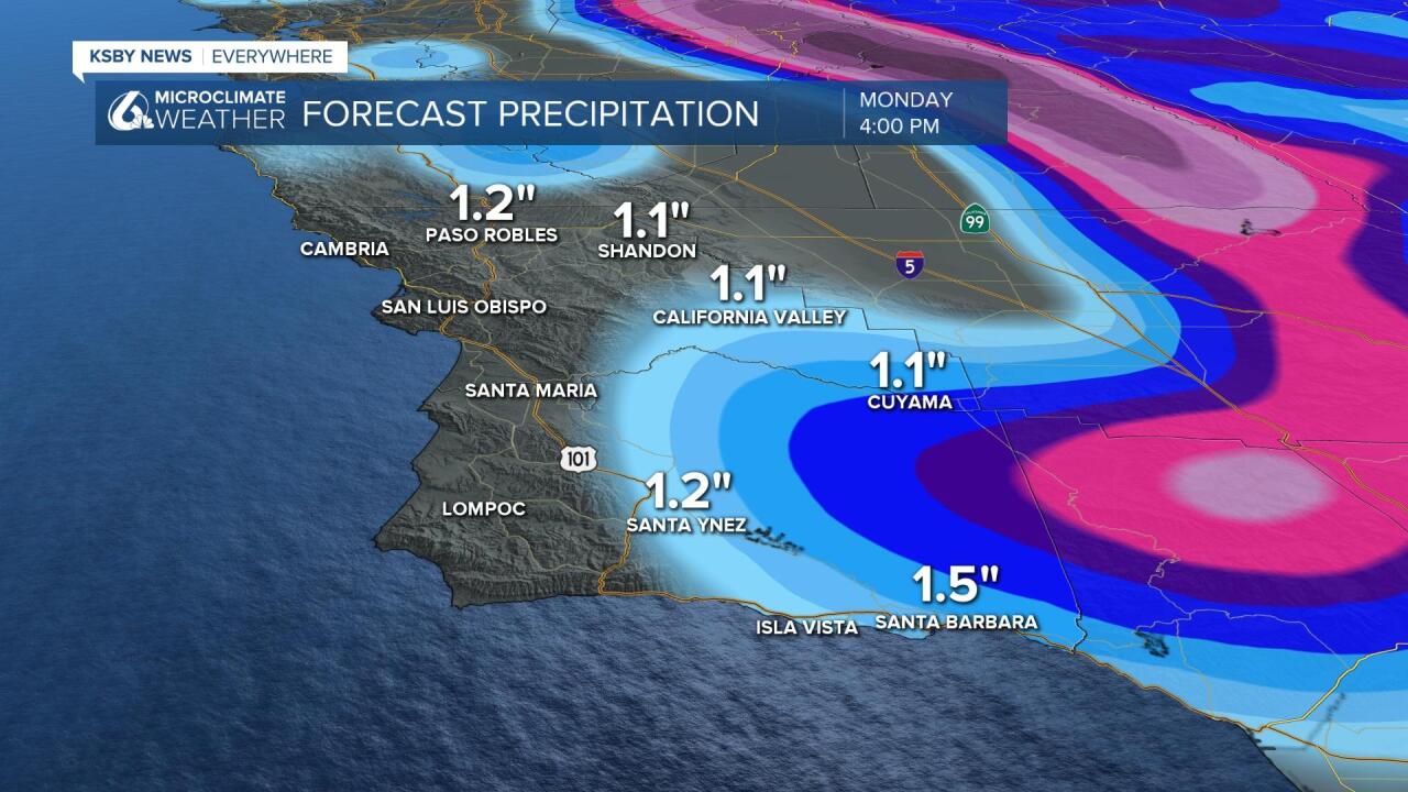
Thursday and Friday will see better rain potential and .15-1.5" looks possible. It'll continue to be breezy and cold.
Waves are another issue with 12-18 ft. breakers Tuesday thru Thursday for the west-facing Central Coast with the Southcoast 4-7ft thru the period.
Models disagree about the weekend. I think the first round of rain should end Saturday with a brief break before more showers Monday-Tuesday.
There also looks to be more activity around March 4th and perhaps even another system around the 6th-8th of March.
If you think that's a lot, the long-range models like cold air for most of the month.


Have a great day Central Coast!
