


——— 12:45 PM Update from Meteorologist Vivian Rennie———
The latest models are in and here is what we are looking at for the late week AR. Keep in mind that this is still a little ways out and may change but here is what the models are coming to at this point.
Thursday night the AR will reach the Central Coast and begin several hours of heavy rain. This will extend well into the morning Friday before backing off slightly. Scattered showers behind the front will continue into the middle of Saturday.
This storm has significant rain potential, meaning that there is a lot of water within this system that will likely bring 2-5" inches more rain. This is only looking at current guidance although this AR has significantly more rain embedded in it and will likely change as it gets closer.
Please stay weather aware.
——— Original Article———
Good Morning Central Coast!
To kick off your Tuesday it is cold, most of the region (except beaches) will have widespread frost this morning. There is also some dense fog that may limit visibilities.

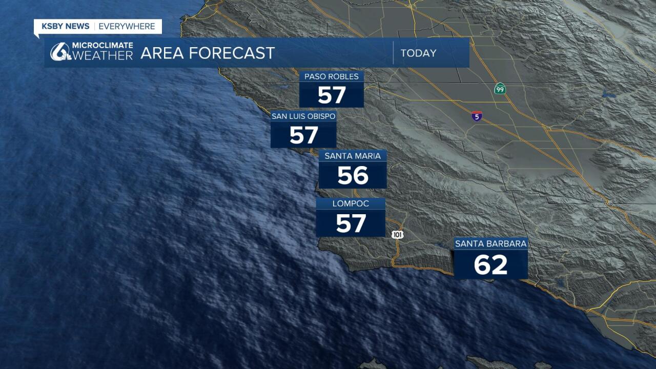
Overall, a quiet weather pattern through Thursday afternoon with very slowly warming temperatures but continued chilly nights. Highs are expected to stay well below normal for this time of the year. Mid 50s expected through most of the region, some 60s possible along the south coast.
Similar to this morning we could see some marine layer develop Tuesday night into Wednesday with low clouds expected to develop and spread well into the valleys. Other than that and the cooler than normal temperatures not a whole lot is going on until Thursday. That is when a large system will barrel into the region and bring the potential for inches of rain, flooding, snow and strong winds.
This system will begin to barrel into the region Thursday night and bring heavy rain through all of the overnight into the day Friday. Some scattered showers will be possible Saturday as well as the main system clears out.
There is a lot of uncertainty in models right now, in terms of accumulation and intensity. The only place where most of the models agree is in timing.
Precipitation totals at this point I take more as potential. There is a lot of rain "potential" within this atmospheric river. This is the GFS models run as of Tuesday morning.

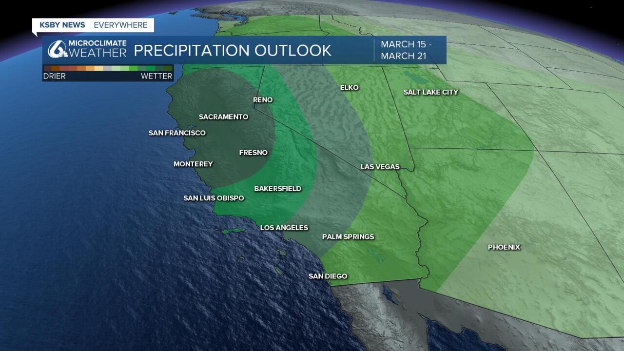
One thing that all the models agree on is that the northernmost portion of the Central Coast will see the most with amounts tailing off to the south.
Those showers will tapper off Saturday morning but don't get too comfortable because the Climate Prediction Center shows rain chances for the month of March, above average.
Something to note for this latest system is that snow elevations will be very high. So even for most of our mountain communities the moisture that falls, will be rain.
This poses some dangerous flooding issues for snow on the ground which will be melting and contributing to the storm runoff that will already be a challenge.
Stay weather aware with this system.
Have a great day Central Coast!
