


Good Morning Central Coast!
To kick off the morning there is a little fog working its way through the region that may limit morning commute visibility. That will clear quickly to abundant sunshine today.

In stark contrast to the rough national weather preceding the holiday weekend, the Central Coast has been about as quiet as it gets in winter. That being said we still have a couple of factors to think about. Firstly there is a Beach Hazard Statement in place across all of our coasts through Noon Saturday. This is due to a king tide reaching the coast today. High tides up to 7ft are expected across the Central Coast this morning. They will crest between 8:30 and 9:00 am across our beaches.
This combined with added wave energy and an increased risk of rip currents bay lead to some minor tidal overflow this morning as well as around the same time Christmas eve.
On the opposite side of these high tides, low tide today will be significantly lower, aka perfect tide pool exploring weather!

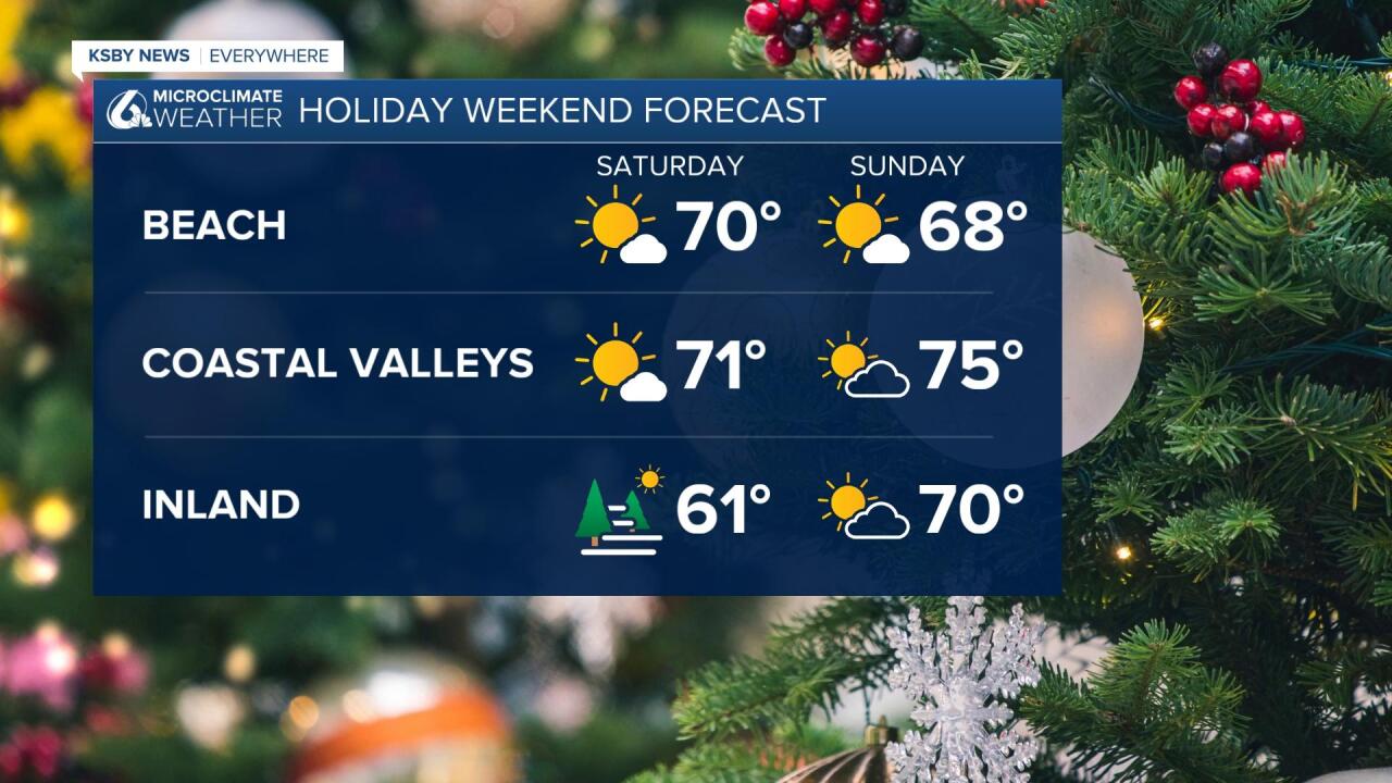
Temperatures today will be warm once again with highs in the 60s and low 70s, but mid-70s are possible over the Christmas weekend.

For the holiday weekend highs will be warm across the region abundant sunshine is expected through Monday Morning. At that point cloud cover will return and show the start of a big change in our pattern.
Temperatures will stay on the warm side until we begin to see our more active pattern. Computer models are still working on detail of timing and intensity. The one thing they do agree on is that we will see some systems.
There will likely be a series of storms: one on Tuesday and at least two more as we head into 2023.
The first system will bring rain, heavy at times to the region Tuesday night into Wednesday. The timing after Tuesday gets a bit tricky with some models disagreeing on timing but most models like several rain events. In essence, the first system looks wet with some additional splash-and-dash systems into early 2023.
The last few model runs are adding more rain to this set of systems. Rain totals from now through the early days of 2023 indicate as much as 3 inches in some spots. I think that they are still a bit bullish and will be closer to the .75-1.5" estimates that were discussed yesterday. There is still some time to refine this forecast to finish the year and begin 2023.
Have a great day Central Coast!
