


Good morning, Central Coast!
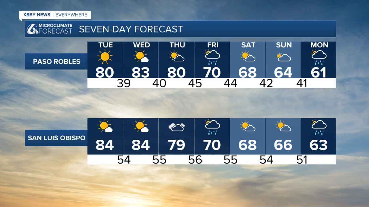
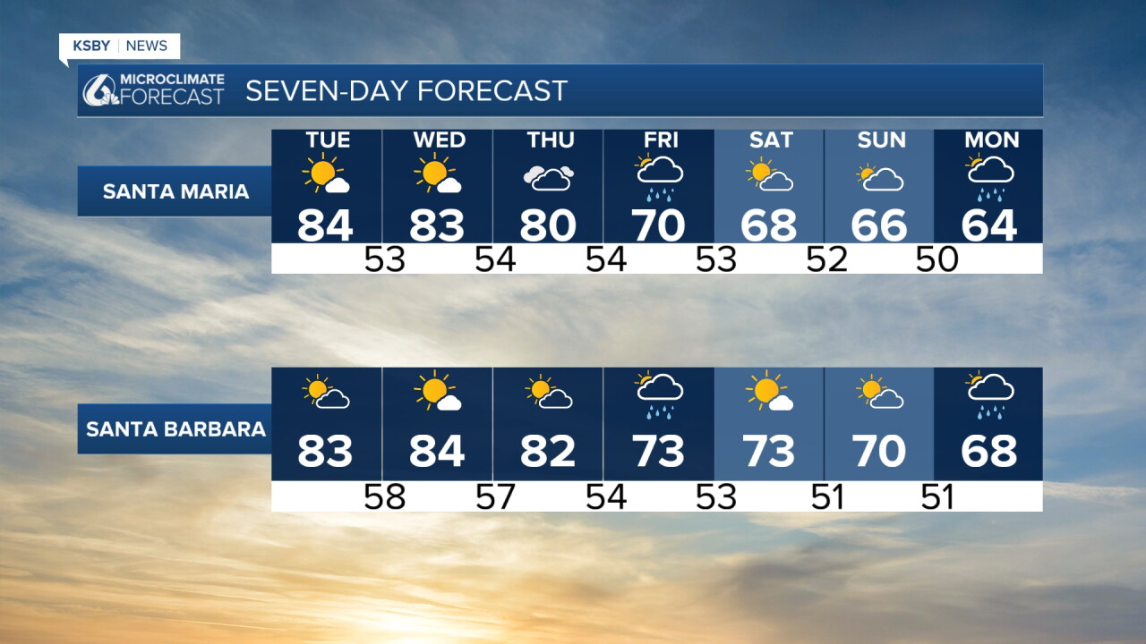
It feels like summer in November, with high temperatures soaring into the 80s on Monday!
High pressure offshore is keeping the skies clear and the winds offshore.
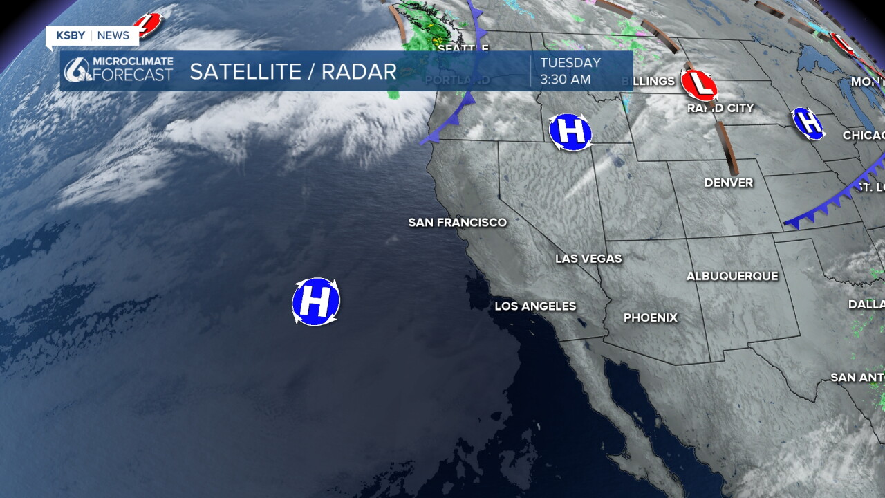
Today we have more of those wonderful, warm temperatures. Here is what that looks like for our communities.
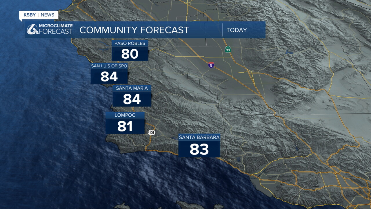
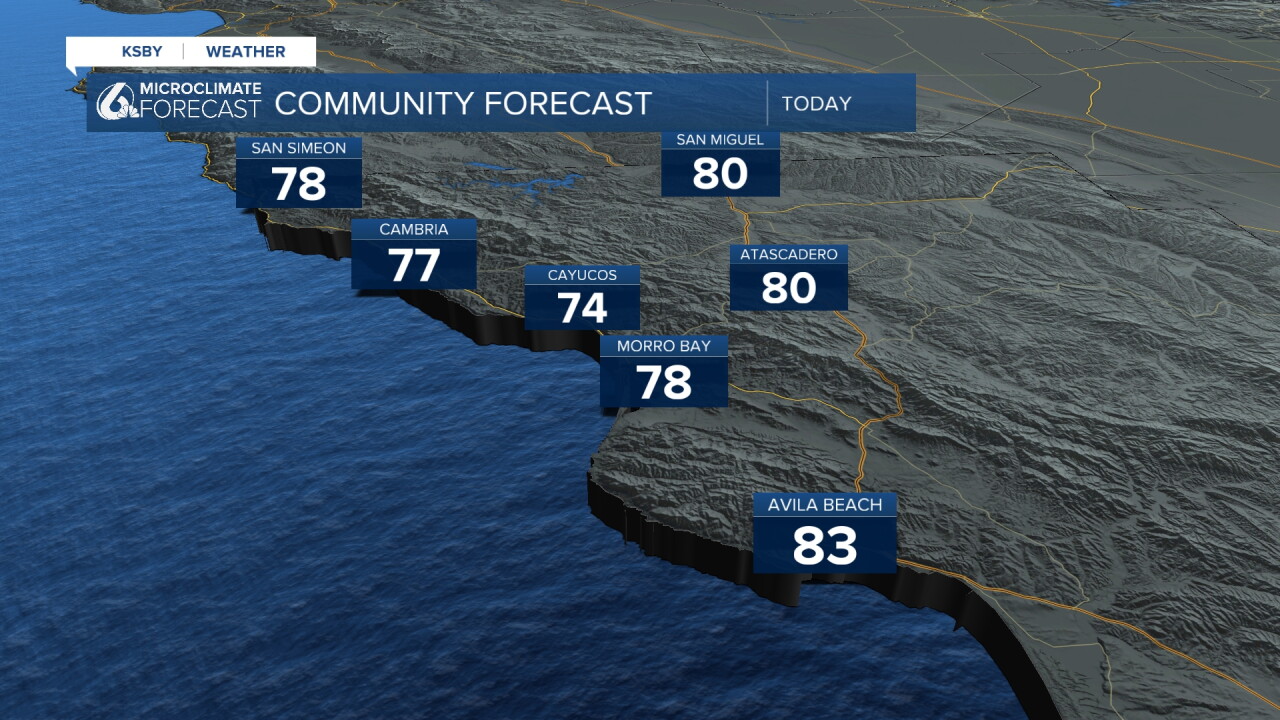
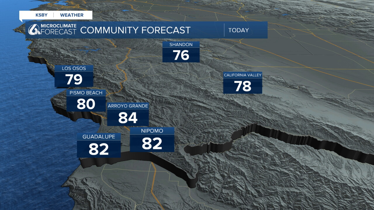
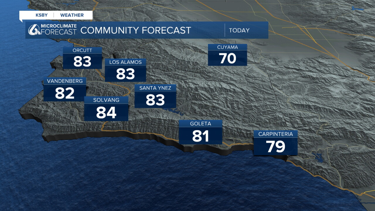
A lot of the warming is due to offshore winds compressing and heating up as they move to lower elevations.
That warmer weather is in place for the next few days, then significant warming is on the way.
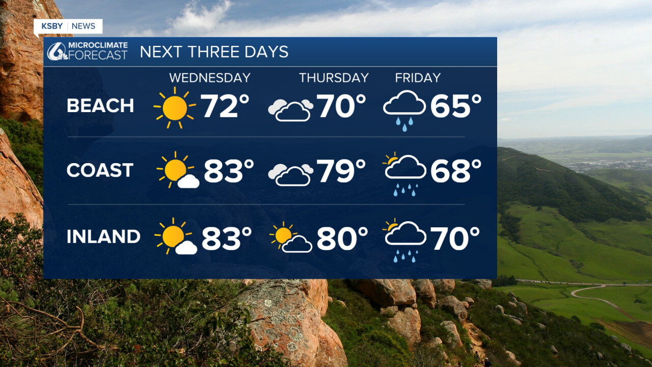
Let's talk about those rain chances!
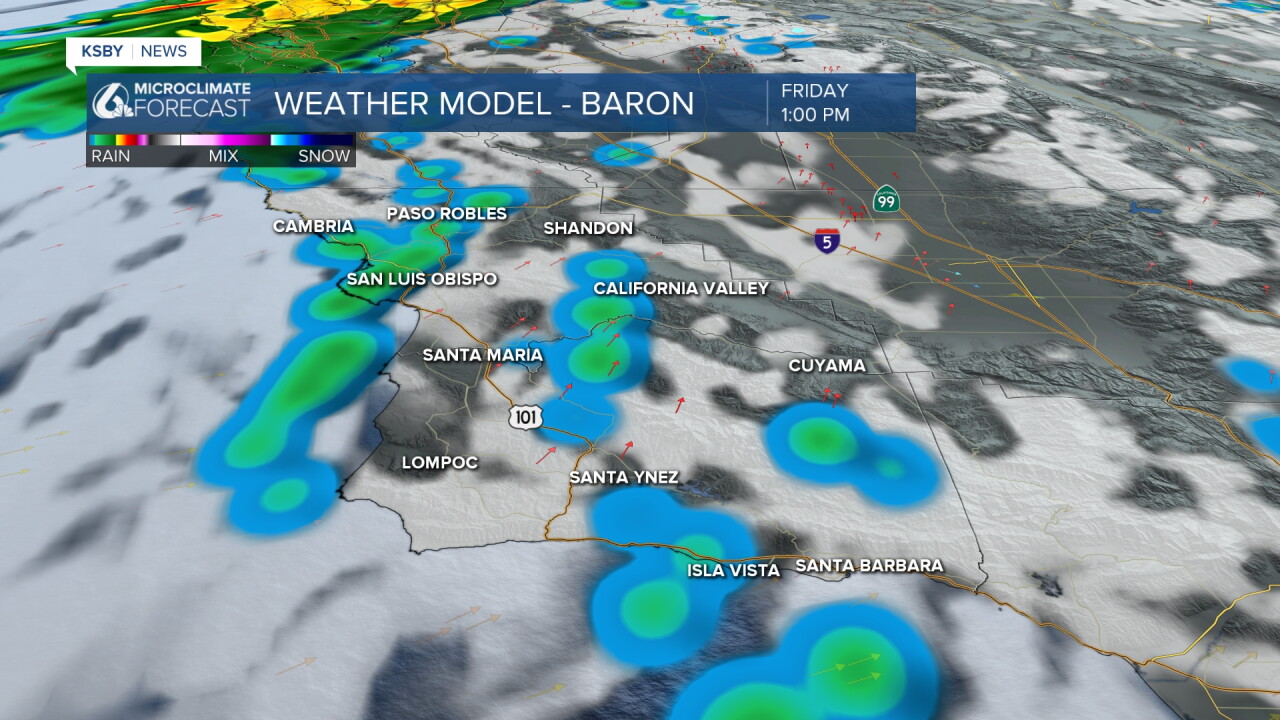
Friday morning rain chances start to move in. Starting light and with abundant clouds.
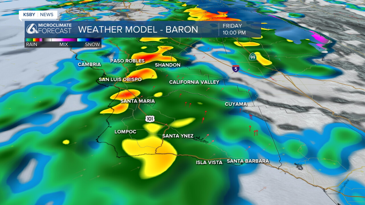
Into Friday evening, a band of heavier rain is set to move through. This may bring some pockets of heavier rain accumulating into over half an inch.
The rain chances will take a break Saturday morning and into Sunday before another cold front pushes in. That means more rain Monday into Tuesday of next week.
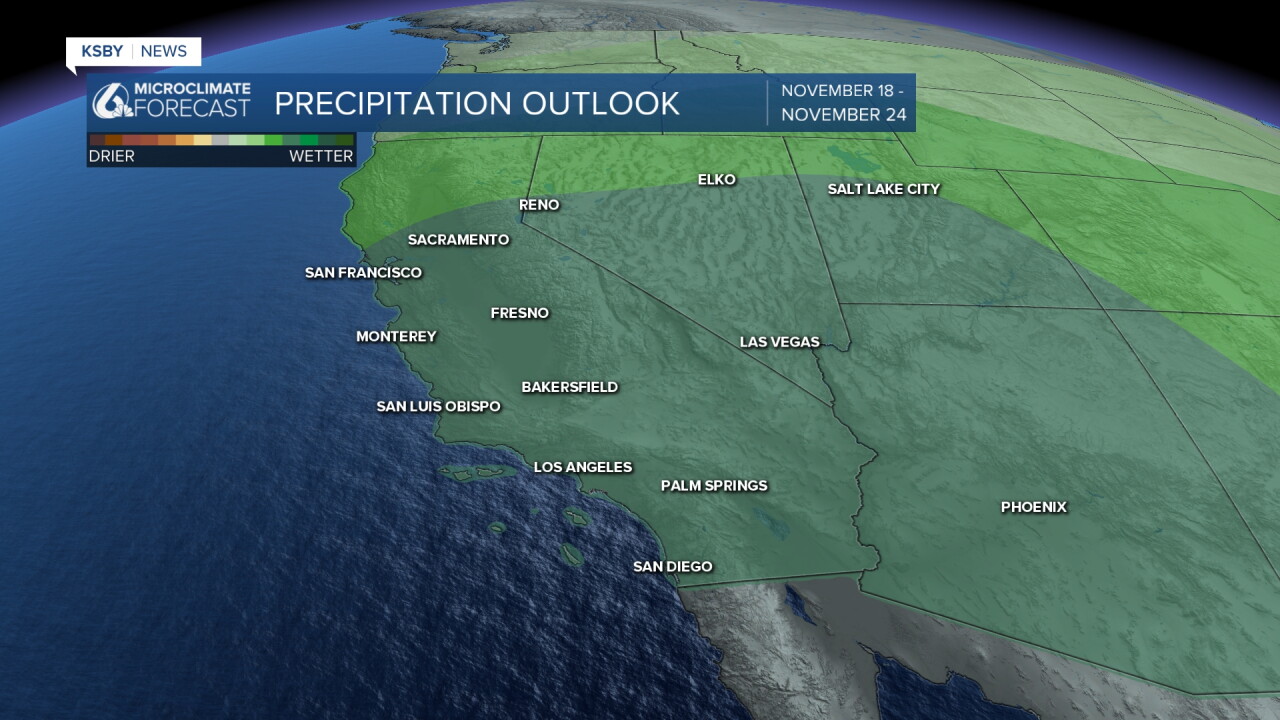
Even into next week, we will stay on the active side, with several more rain chances for the West Coast into the second half of November. It is still a little too early to look into the Thanksgiving forecast, but if current projections hold, we may see some more active weather.
Have a great day, Central Coast!
-Vivian
