

Good Friday evening, Central Coast!
After a brutal stretch of record-breaking heat, some welcome relief is finally on the way for the Central Coast! Today marks the last day of truly record-setting temperatures from this current heat wave, but don't get too comfortable just yet. A stronger ocean breeze will bring things down a few degrees this weekend, which is enough to end the streak of heat advisories and warnings. That said, temperatures will still be running 10–15°F above normal, so it's still going to feel plenty warm out there. Saturday looks to be the coolest day of the bunch, so if you're planning any outdoor fun, that's your window!
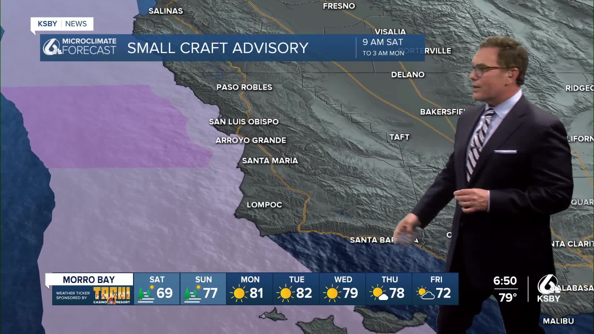
Along with the cooling, keep an eye out for areas of dense coastal fog developing during the nights and mornings this weekend. As the onshore flow picks up and the high pressure weakens a bit, conditions will be just right for a shallow marine layer to roll in. Give yourself some extra time on those foggy morning commutes, especially along the coast and Highway 101 corridor!
Unfortunately, the break won't last long. A warming trend gets underway again Sunday and carries into next week, with a second heat wave expected to build as high pressure rebuilds just off the Southern California coast. Heat advisories could be issued for inland areas and valleys as early as Monday.
The peak of next week's heat looks to arrive Wednesday and Thursday, with highs likely reaching near 90 in the valleys and some 80s near the coast. The good news is that next week's heat wave should come in about 3–5°F cooler than what we just experienced, so it won't quite be as extreme — but it will still be hot enough to take seriously.
On the rain front, don't expect any relief through March 30th; it's staying dry. There are some early hints of light rain possible around early April, but most models are suggesting less than a quarter inch for most areas. Stay tuned as we get closer! In the meantime, stay cool, stay safe, and enjoy that brief Saturday cool-down, Central Coast!
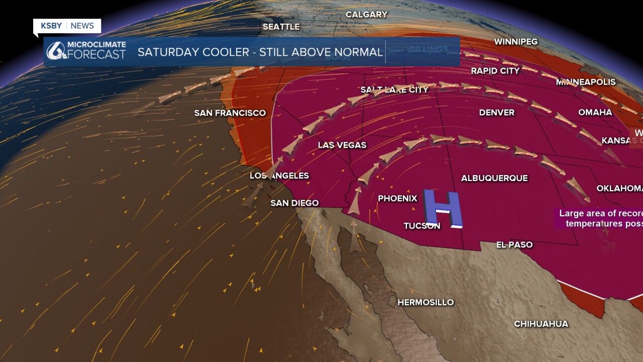
Below: High pressure is centered along the AZ and NM borders. Enjoy the cooler Saturday!

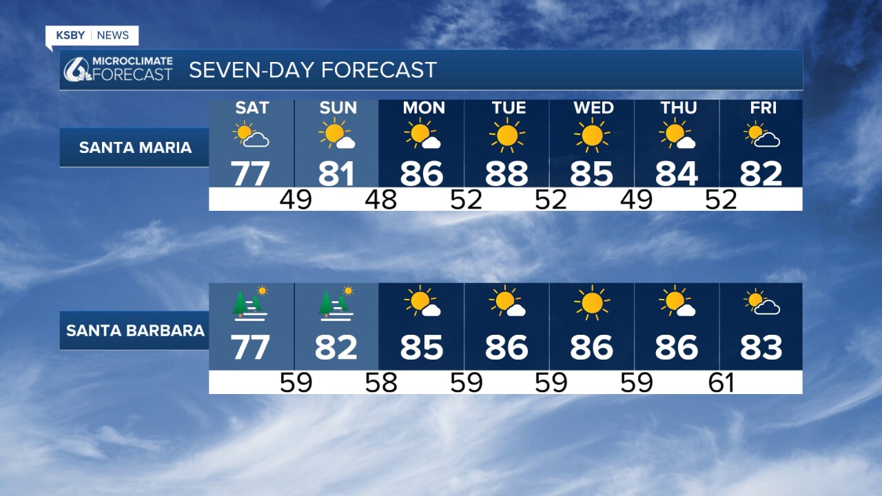
Below are the lows and highs for Saturday.


Enjoy the cooler weekend, Central Coast!
-Jim
