



Good morning, Central Coast, and happy Friday, Central Coast!
We have (almost) made it to the holiday weekend, and the weather will spoil us with picture-perfect conditions through the weekend.
Friday morning is starting off with some mid-level cloud cover and a little bit of very light drizzle across our coastal valleys and beaches. This drizzle will not accumulate to much, but may prompt you to use your windshield wipers once or twice on the morning commute.
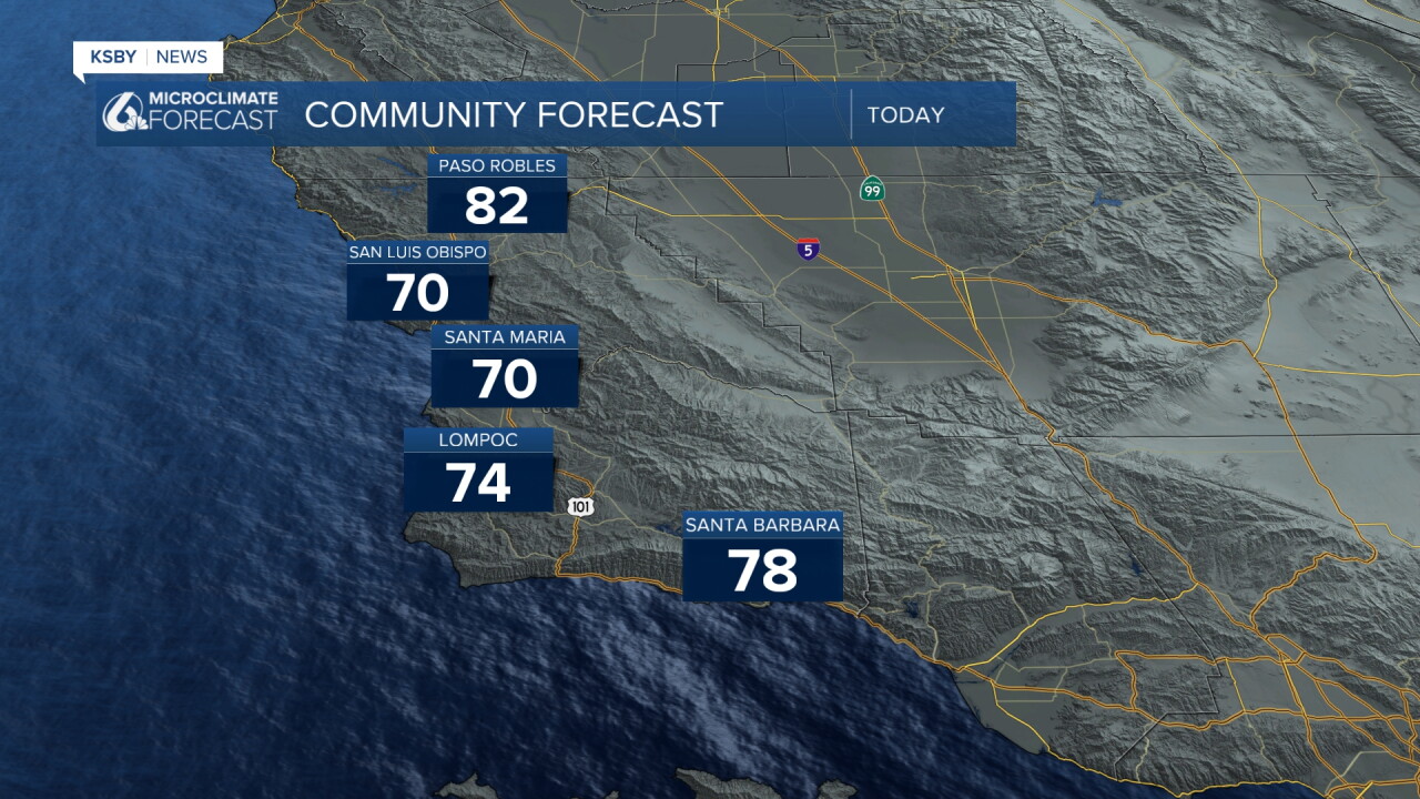
By mid-morning, the clouds will clear out, and temps will warm up. They are still below normal for this time of the year, but despite that, the temps are very comfortable. Here is a look at what we can expect.
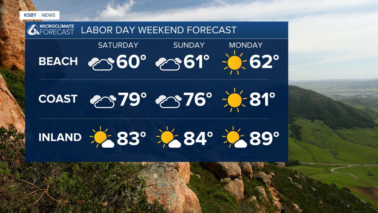
Into the weekend, temps will stay very consistent and mild. By Monday (Labor Day), the core of the trough of low pressure that has kept us on the cooler side will push east and start a warming trend.
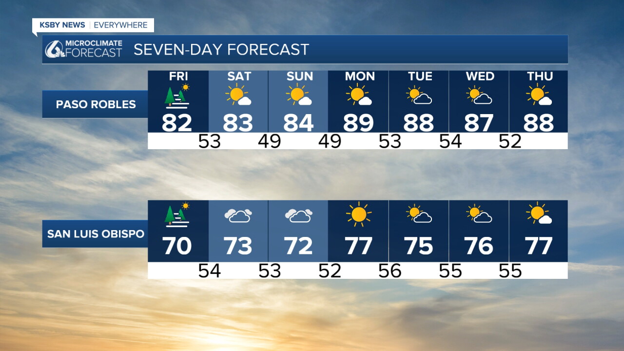
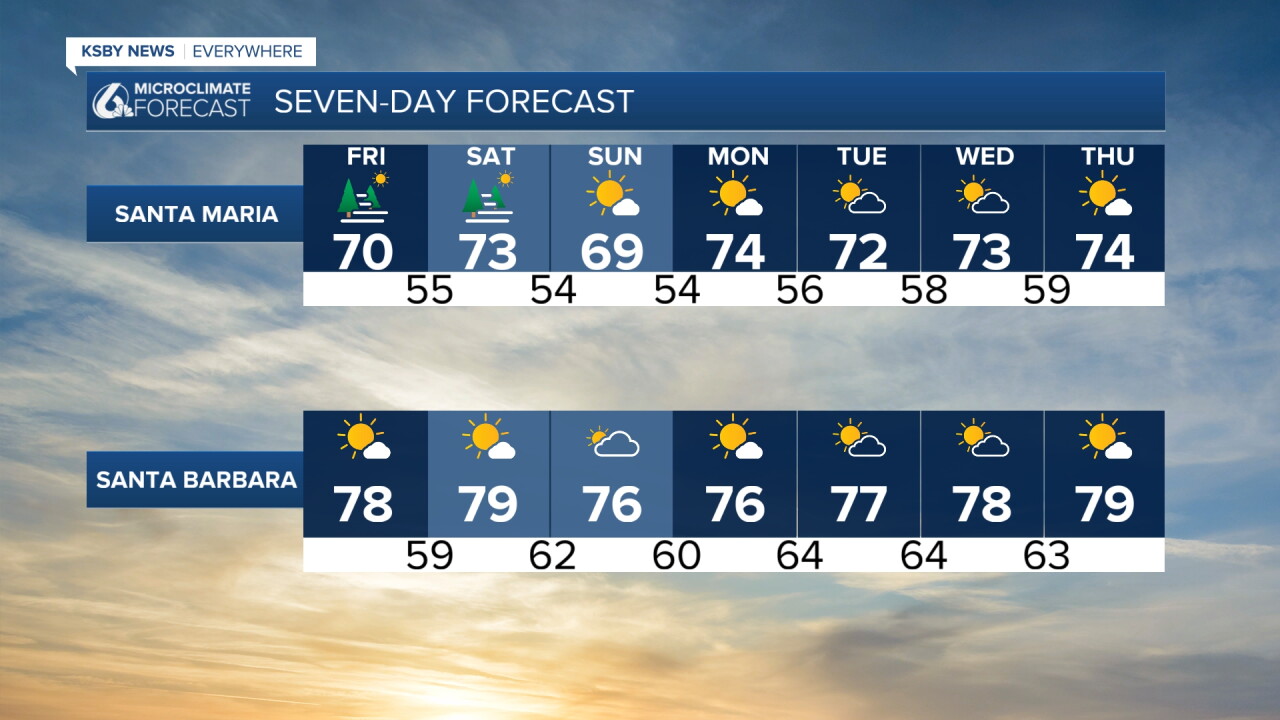
That warming will stick around with afternoon sunshine through next week. Here is what that all looks like on our 7 day forecast!
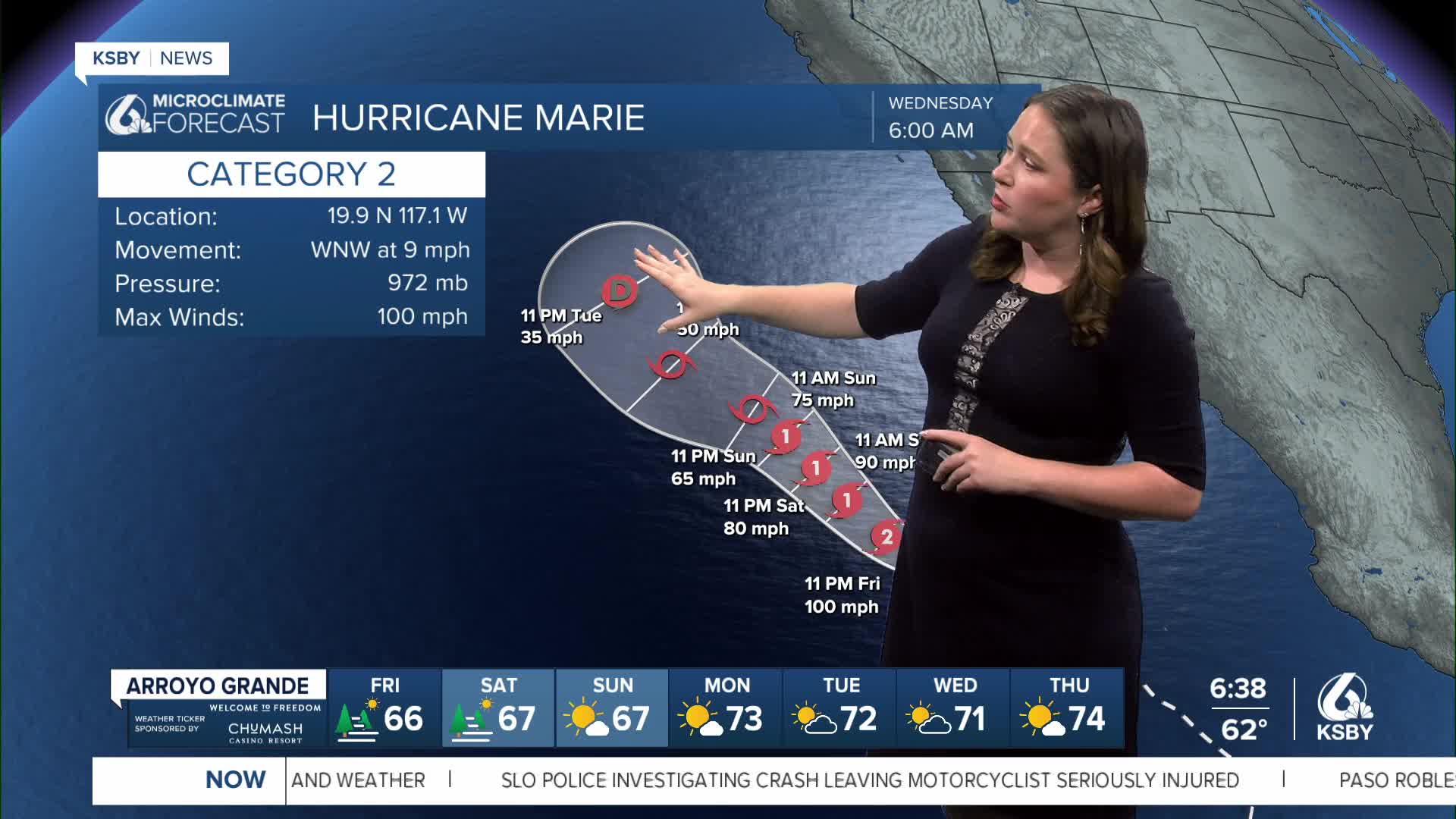
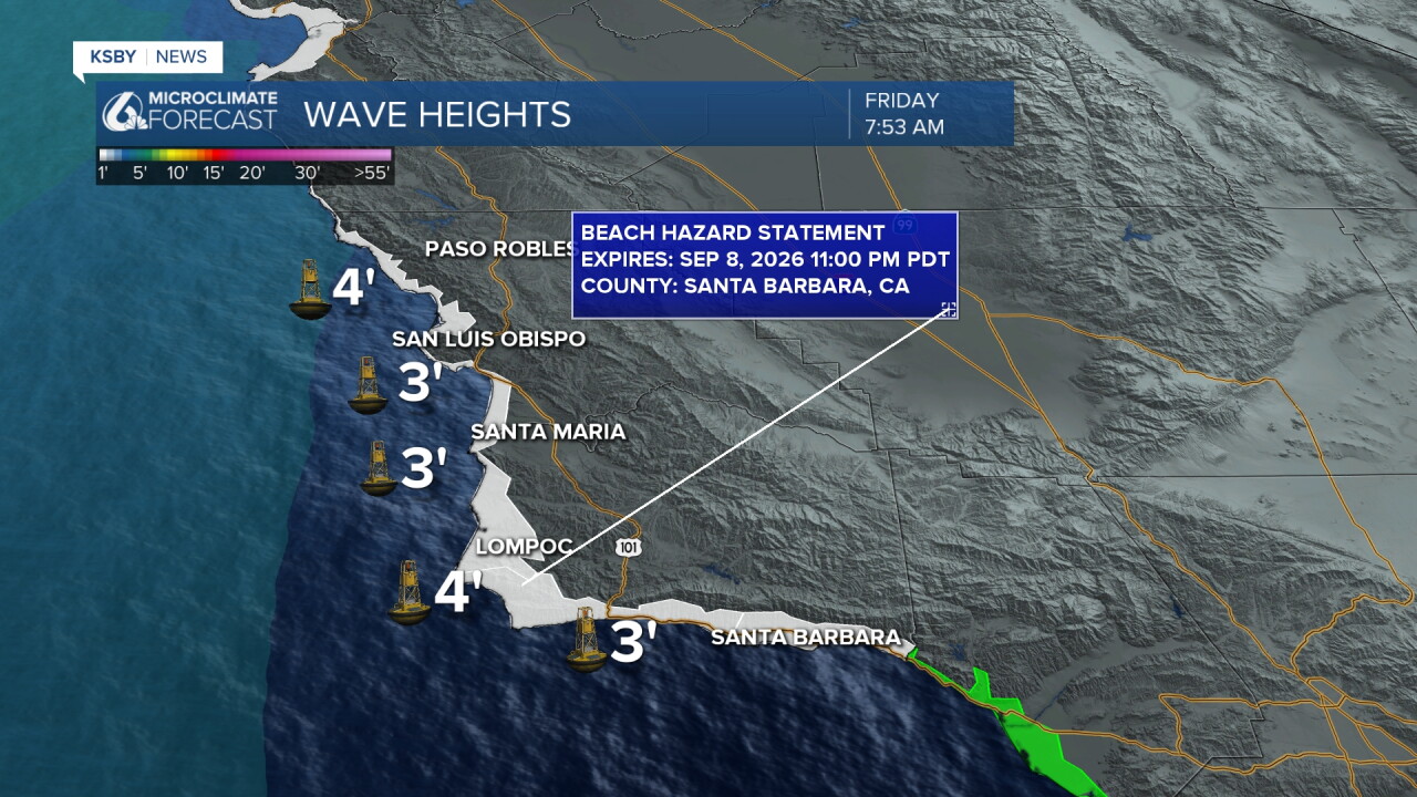
There are three named hurricanes in the Pacific right now. These (mostly Hurricane Marie) will increase our waves over the weekend and bring a significant risk of dangerous rip currents. Here is a look at the surf conditions Friday morning and the Beach Hazard Statement in place for all of our beaches through Tuesday of next week.
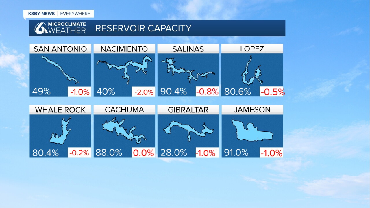
One quick extra note before I go. Here are the lake levels across the region. The week-over-week change is the number in red in the corner.
Have a wonderful day and a great weekend ahead, Central Coast!
-Vivian
