
Happy Labor Day, Central Coast!
It was a beautiful, albeit hot, weekend across our communities.
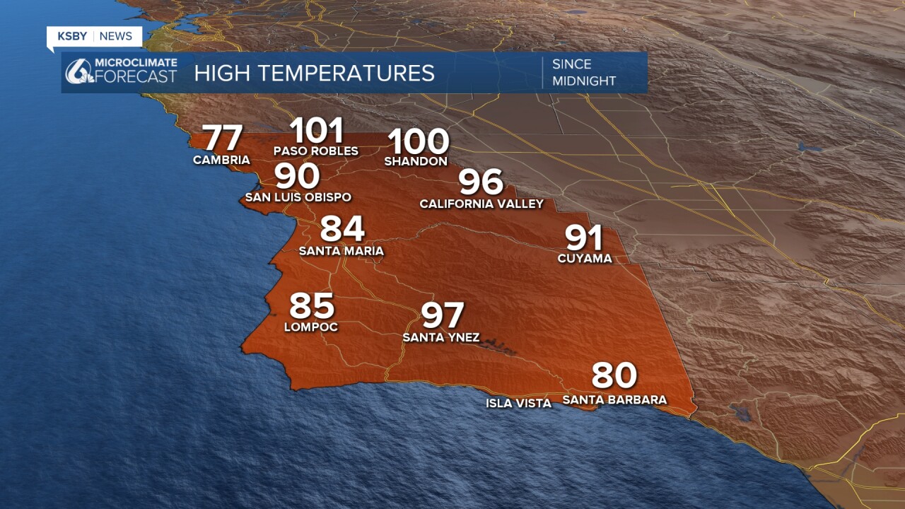
Monday brought triple-digit heat to the interiors and even 80 for some western beaches. Here is a look at the observed high temps Monday afternoon.
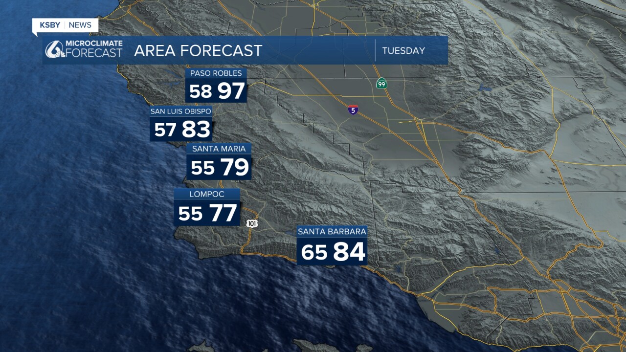
Tuesday will bring more heat to the region, with another round of temps into the upper 90s for interiors. 80s for coastal valleys and 70s for beaches are again in store for the region.
That heat has prompted another round of heat advisories for the interior valleys. That advisory will stay in effect through 6 p.m. Tuesday night.
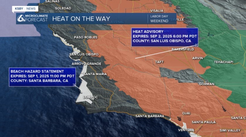
Additionally, there is a beach hazard statement in place for all western beaches through late tonight. This is for waves up to 7 ft and rip current risk.
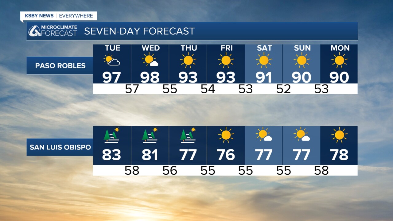
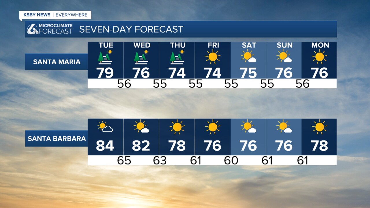
The heat continues through Wednesday, but then the high pressure will push east and a much cooler pattern will develop. Temps will be around normal for this time of the year to close the week and into the weekend. Here is what that looks like on the 7-day forecast.
Have a great evening and shortened week ahead!
-Vivian
