

Today we began a transition between the near record highs of the weekend, to the cooler (and soggy) pattern we are headed to.
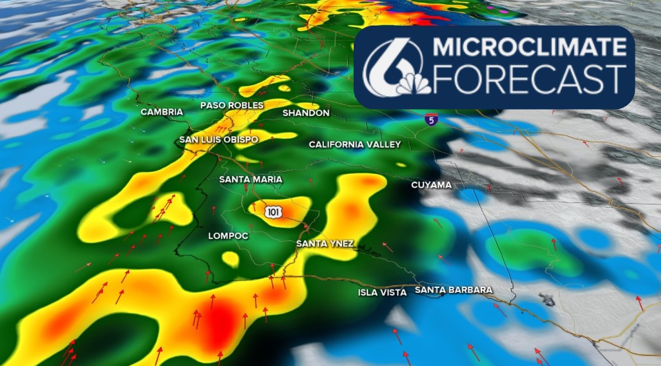
Starting off with the headlines, cooler temps started today with heavy rain on the way. This storm looks to be large and impact communities with strong winds and potential flooding for local poor drainage spots.

Tonight, more cloud cover and fog are expected. Take it slow where visibility may fall tonight and into tomorrow morning. Tomorrow morning will also bring in our first chance for rain. This band will be very light in the pre-dawn hours and unlikely to accumulate much. All it will do is prep our atmosphere for the larger cold front that will impact us with a whole lot more rain.
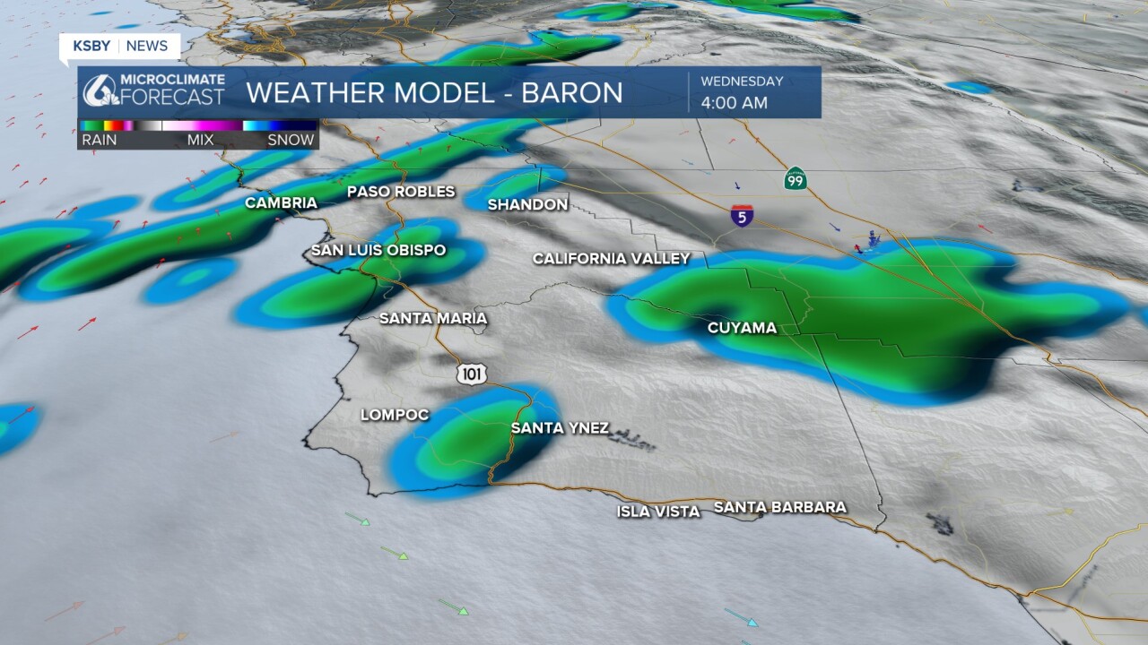
The temps on Wednesday will be nearly identical for most spots. Expect upper 60s to low 70s across the board!

Wednesday night into early Thursday morning, the cold front will finally reach us. First bringing a band of heavy rain to our north coast beaches and slowly extending south through the mid-morning. As the front pushes through, strong winds are expected. Here is what I expect the radar to look like at 10 a.m. Thursday.
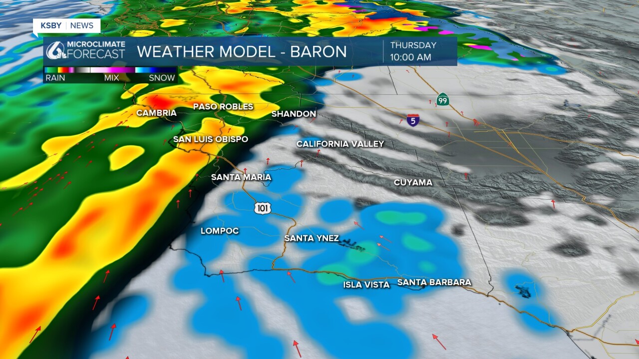
As the day progresses, the front will push south, and by early afternoon, most of the region will be facing strong winds and localized heavy rain. As the main cold front passes through, there is a chance for several isolated thunderstorms.

Thursday evening, the cold front will move into Southern California and give us a brief break from the rain. The second phase of the storm will begin Friday afternoon as the core low pressure from the first band stalls to our southeast. With the storm stalling out so close to us we will get some wrap-around moisture pushing back into the region Friday afternoon. Unlike the first band, these will move from the east to the west and bring less impactful but still very noticeable rain on Friday afternoon into the evening.

Early Saturday morning, one final area of rain will push through (mainly for our south coast). This will be consistent, but on the whole, lighter rain to the region.

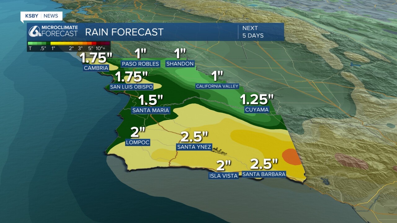
Because there are so many bands of rain totals are quite impactful. Most of the rain is expected on Thursday, but the wrap-around moisture will add up too.
Interior valleys look to have the least, but still are expected to pick up around an inch of rain. Coastal valleys and beaches will be between 1.5" and 1.75" with the ridges and peaks looking closer to 2". The south coast and Los Padres National Forest will see the most, with some spots up to 2.5" of rain between Wednesday morning and Saturday afternoon.
Because this is such a long-scale system, we look to stay below flooding criteria for most spots, but localized small creek and poor drainage area issues could arise. I am keeping a close eye on the recent burn scars as the heavy rain moves in.
At this point, no alerts have been issued, but I am sure that will change soon. I expect wind advisories and local flooding alerts to be in place ahead of the storm.
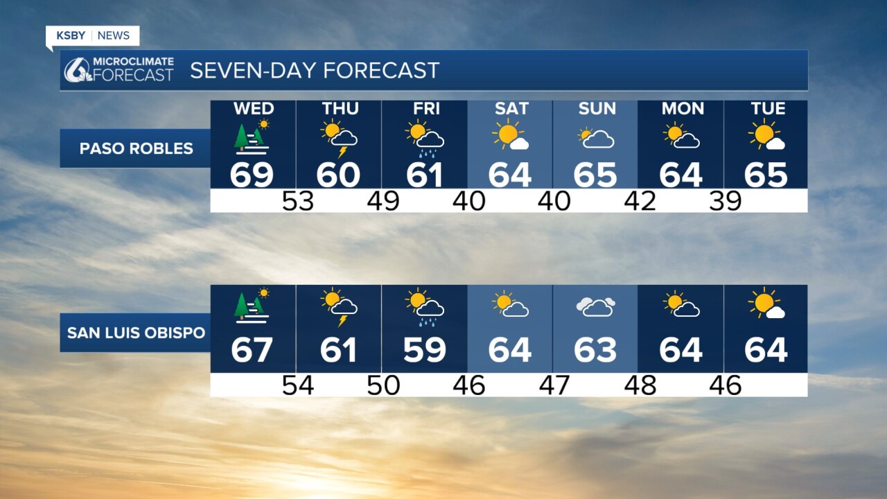
I know that was a lot of information. Here is what it all looks like distilled into a 7-day forecast.

Have a great evening and the rest of the week. I will continue to update you all on the incoming storm, on air, online, and on social media through the week.
-Vivian
