

Happy Monday, Central Coast!
We had a cloudy start to the day and these conditions stayed with us for most of the day. Some areas cleared up this afternoon, but the marine layer was quick to return for the evening.
These cloudy conditions are hanging on for the rest of the week for most areas, save for the Paso Robles area. Keep these cloudy skies in mind if you're heading out for the Fourth of July.

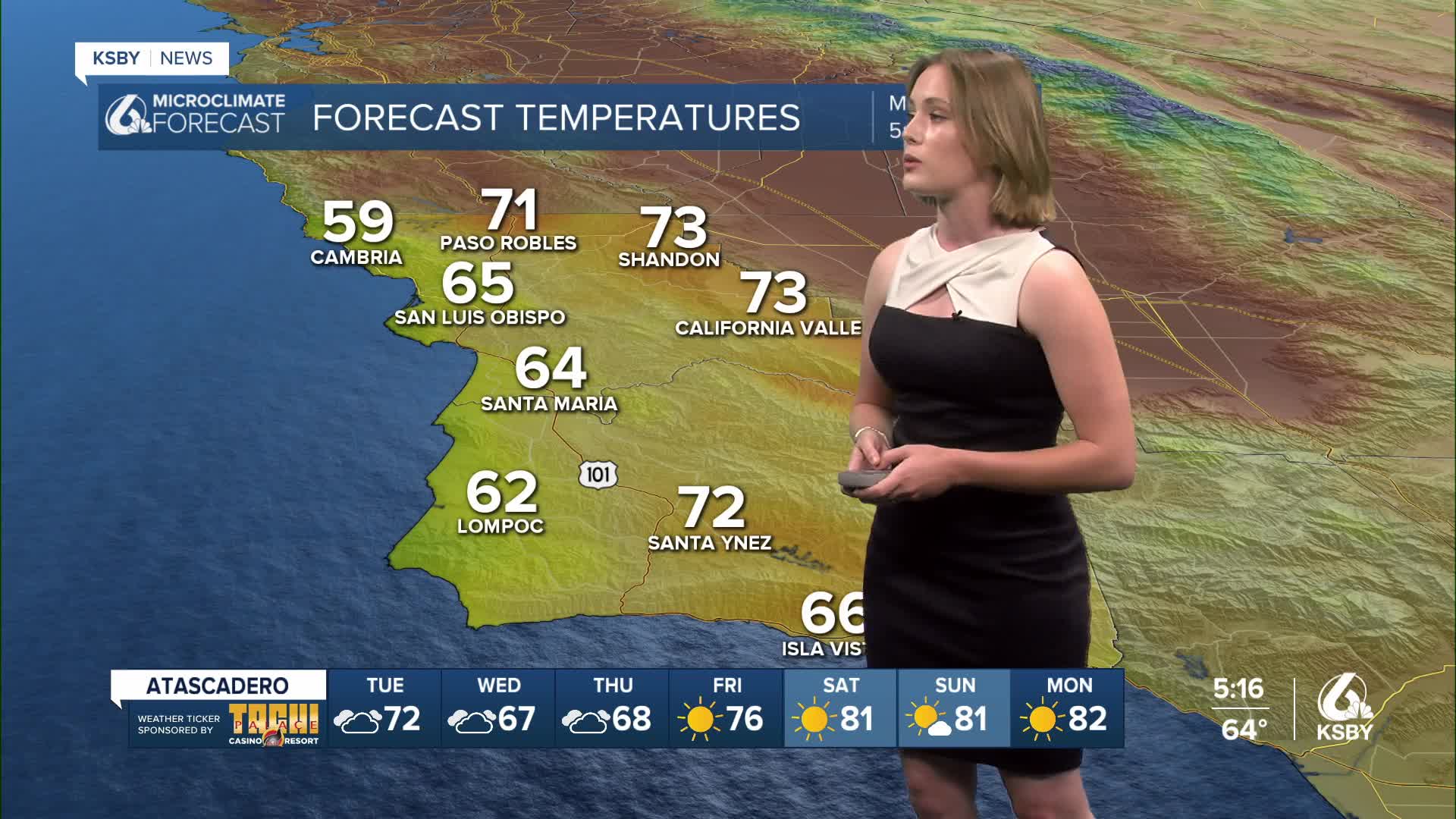
While it's been gloomy, there are still pretty warm conditions across the Central Coast. High temperatures ranged from the high 60s to mid 70s today, which is a trend that will continue throughout the week as we slowly warm up for the weekend.

Like I mentioned, the June Gloom has settled in across the Central Coast and it's going to last into the first week of July. Visibility may be a little low for fireworks as we start our Independence Day celebrations, so we'll keep monitoring those clouds as we get closer to this weekend.
The clouds are sticking around, but a steady warm-up is heading our way, too! We'll have consistent temperatures in the Santa Maria and Santa Barbara areas until the weekend, where there will be a slight jump for the fourth.
San Luis Obispo will have a steady increase in temperatures while hanging onto the cloud coverage well into next week. Expect mid 70s by the time the weekend rolls around.
The skies will clear in the Paso Robles area by the time Friday rolls around, just in time for 90 degree temperatures.


I'll be filling in for Meteorologist Jim Castillo for the beginning of this week. See you tomorrow, Central Coast!
~ Makayla
