


Good morning, Central Coast!
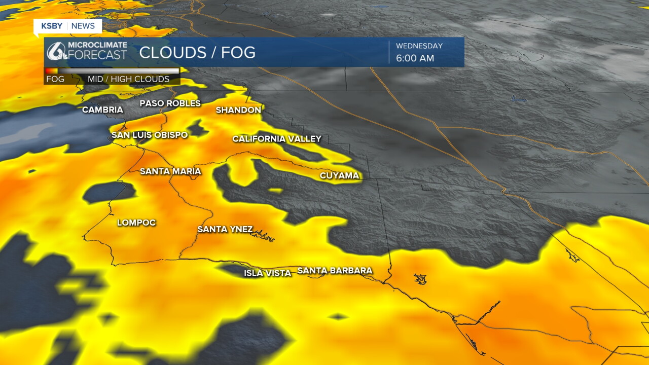
As we kick off the morning cloud cover and cool temps headline the forecast. There is even a little bit of latent marine layer drizzle in the foothills. That will not amount to anything substantial but is still of note.
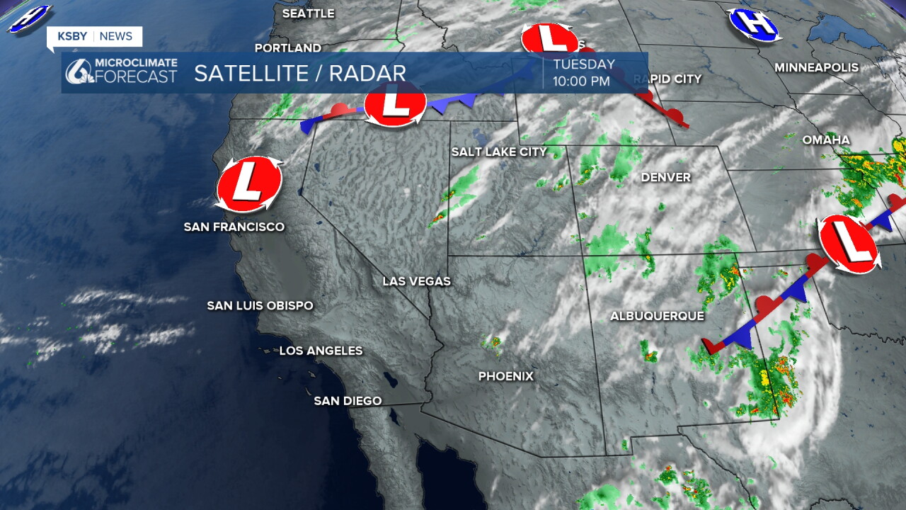
The clouds and cooler temps are thanks to onshore winds from a low pressure sitting in northern California.
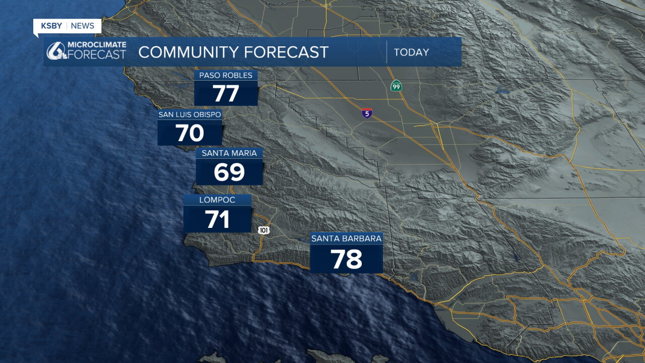
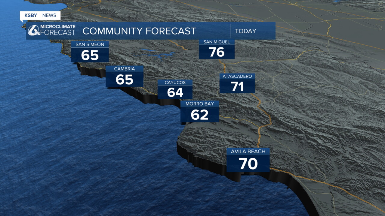
Today will be the coolest and cloudiest day of the forecast with some peeks of sunshine this afternoon but cloudy skies and cool temps until that point. Here is a look at those temps.
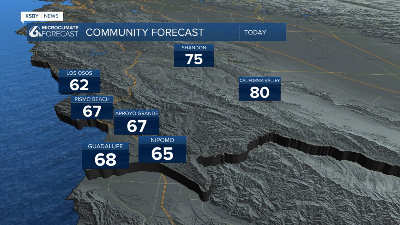
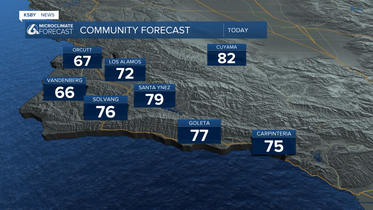
Starting Thursday temps will warm up substantially. This is mainly thanks to the low pressure pushing farther east out of the region into the weekend. Some offshore winds will kick back in and warm us back up towards normal for this time of the year by Saturday.
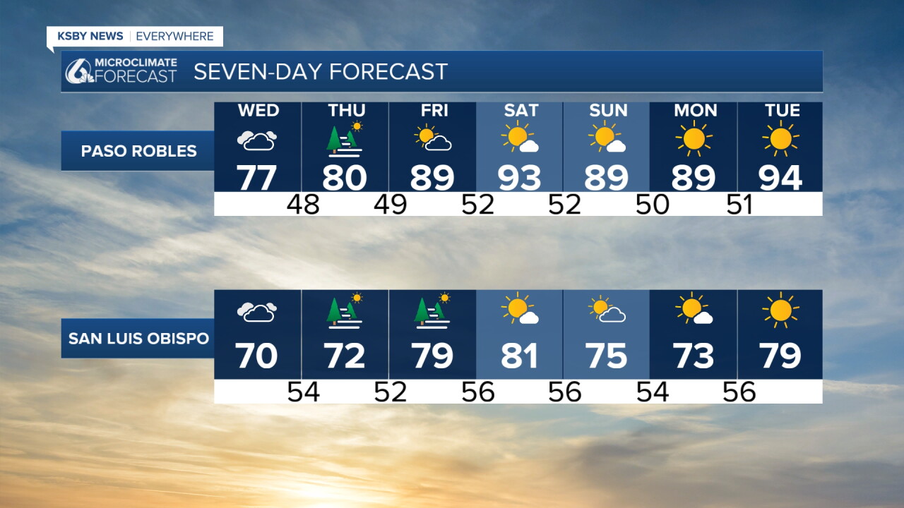
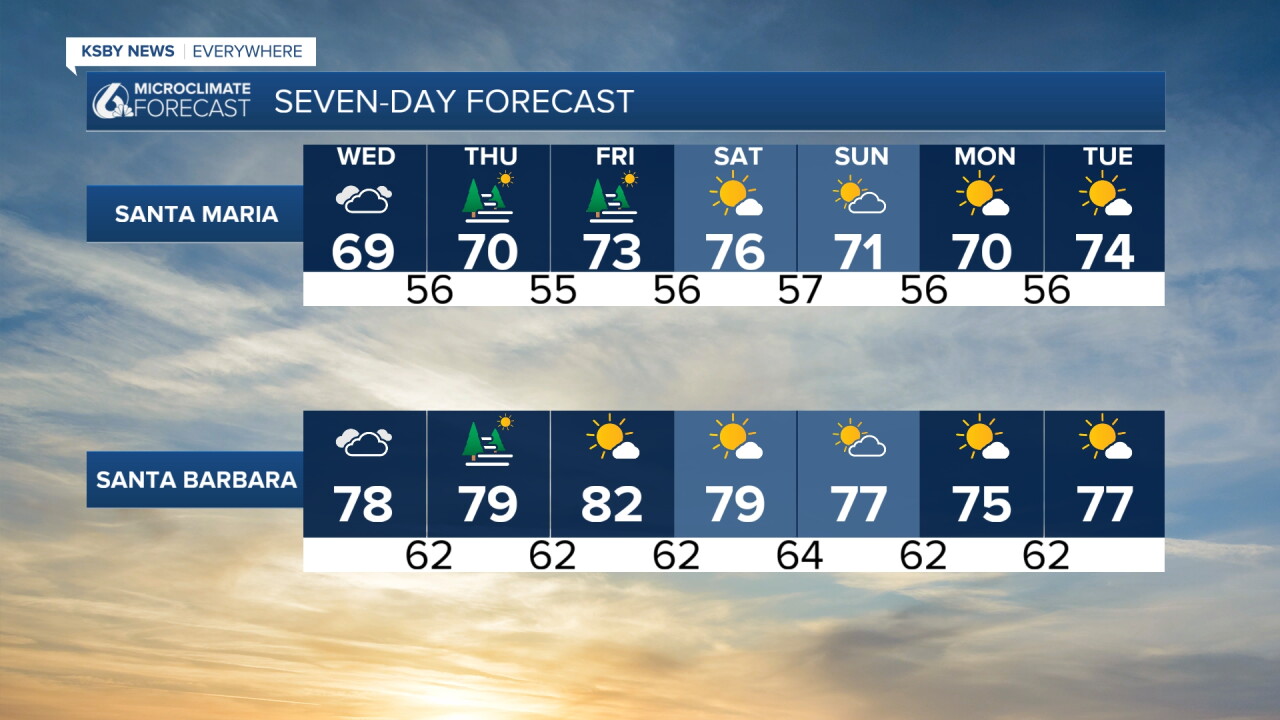
For the rest of the the extended forecast high temps will even out to near normal with some morning cloud and afternoon sunshine.
Here is a look at the 7 day forecast!
Have a wonderful day, Central Coast!
-Vivian
