
Good morning, Central Coast!
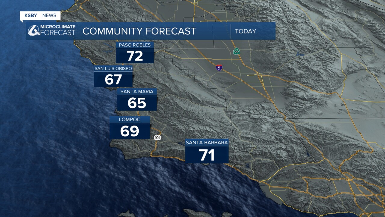
The last few days have been chilly across the region as cloud cover sticks around. Here are a look at the high temps we reached on Monday.

For some context, the "normal" high temperature for Paso Robles on June 29th is 92 degrees. That is nearly 20 degrees below normal for this time of the year.
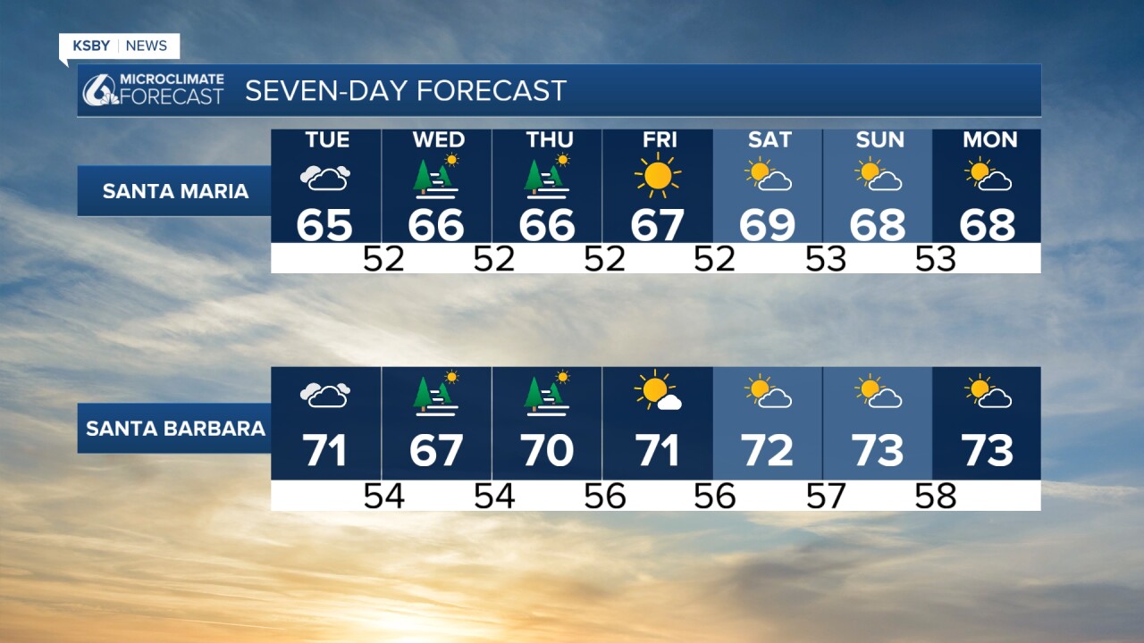
Today will be very similar, with highs in the 70s for interiors and 60s for coastal valleys and beaches. Also similar to yesterday, the skies will clear slowly; sunshine is expected by the late afternoon by the beaches, a bit earlier inland.
We continue the "copy and paste" forecast through Thursday when the trough of low pressure will move east and will be replaced by high pressure. Sunshine and warmer temps will be the story, starting on Friday and continuing for the 4th of July!
Looking to the cloud cover, at least right now it looks like clouds and fog will stay mild through the fireworks, so that is some good news!

I will keep a close eye on the forecast going forward into the 250th!
Have a wonderful day, Central Coast!
-Vivian
