

Happy Thursday, Central Coast!
Today was a beautiful one, sunny skies, mild weather, and limited smoke from the Gifford Fire.
Before I dive into the forecast, here is the latest info on the Gifford Fire. According to the 6:34 p.m. update the blaze stands at 132,650 acres and is 51% contained.
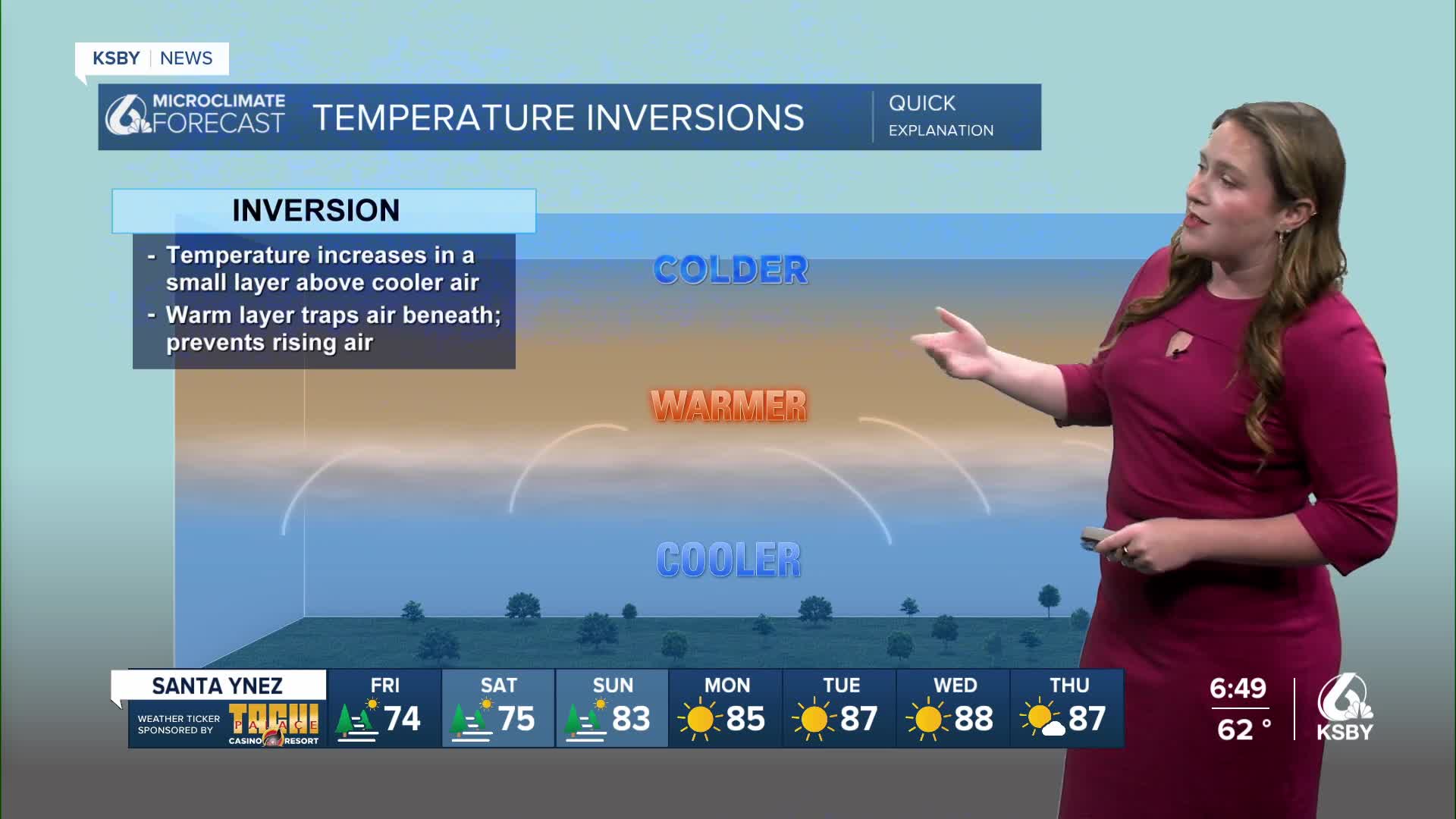
There is a temperature inversion in the mid levels of the atmosphere that is blocking the smoke plume from reaching up into the skies. Despite how it looks, the blaze is still very much active.

Winds are still an active concern. This evening gusts for all communities will stay around the 20 mph threshold. The south coast has another sundowner wind event on the way. Gusts up to 50 mph are once again possible along the Gaviota coastline. Because of this a wind advisory is in place through 5 a.m. Friday morning.

Friday will bring mild weather once again with most spots starting off the day with cloud cover. Highs will be a degree or two below normal for this time of the year.

Here is a look at the 7-day forecast. Cooler weather is on tap for the weekend, while onshore winds bring marine layer fog for most communities each morning and evening. Next week, though, that pattern will reverse itself. Warmer weather and abundant sunshine will be back by late next week.


Into the further extended forecast that warm up will continue into the last week of August with more high temps on the way.

Have a wonderful evening, Central Coast!
-Vivian
