



Good morning, Central Coast!
As we kick off a new week temperatures are on the cool side thanks to a lingering low pressure overhead. That low brought clouds this weekend and this morning and will kick off the day on a cooler note here on the Central Coast! Some interior valleys (California Valley) were in the 30s this morning.
Temps will start to warm and we will see clearing skies throughout the morning. Temps will be close to the highs we have seen the past few days. Here is what you can expect.
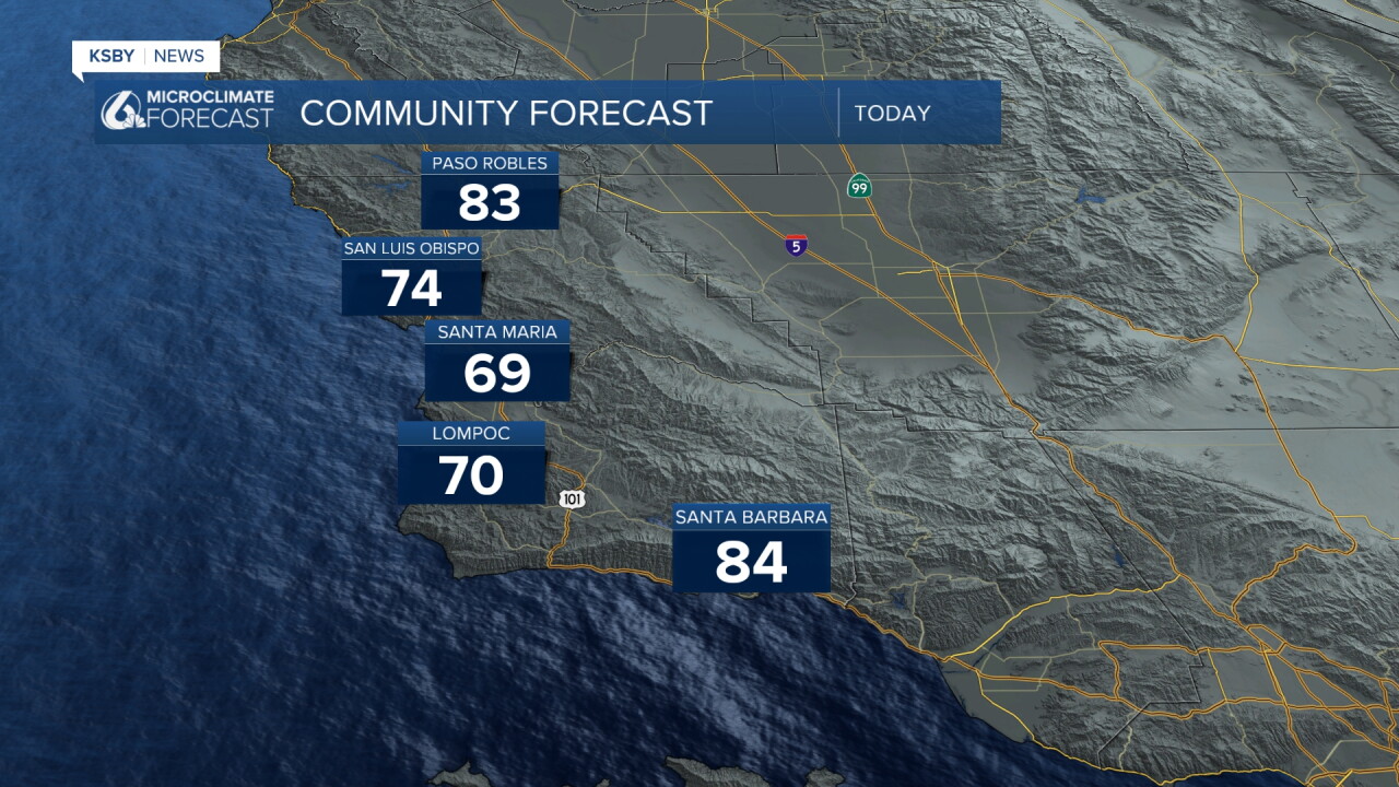
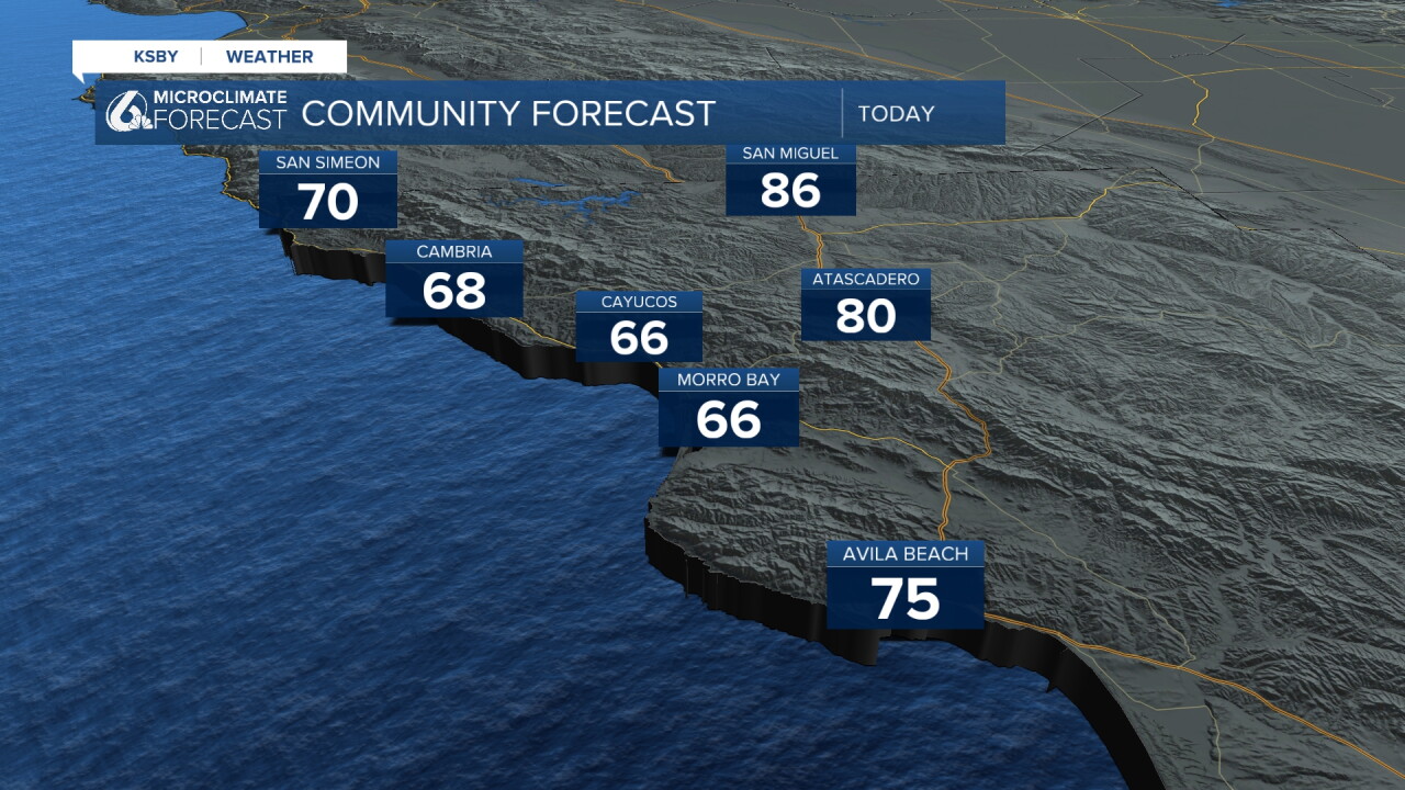
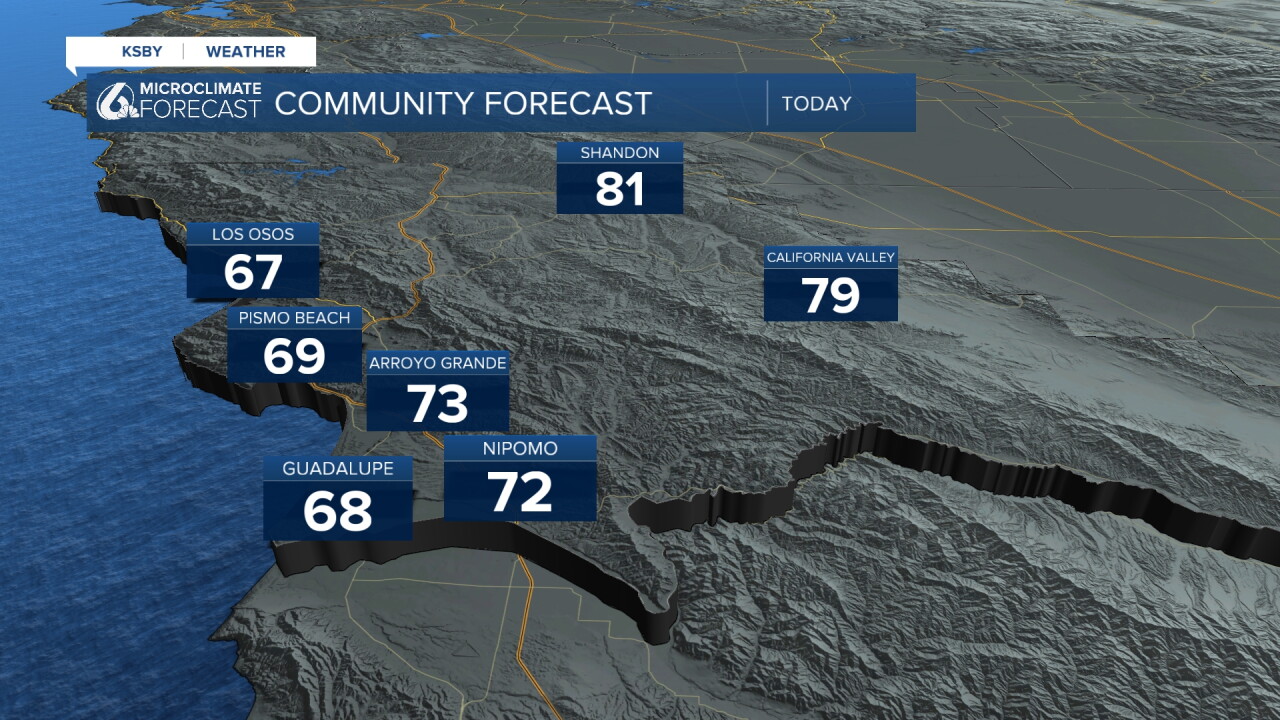
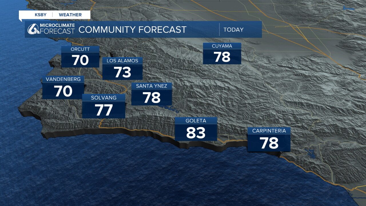
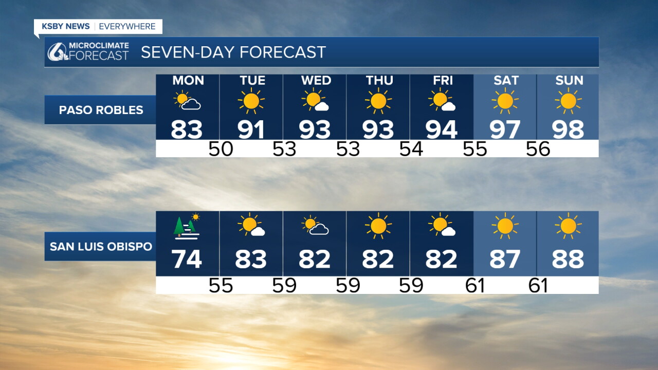
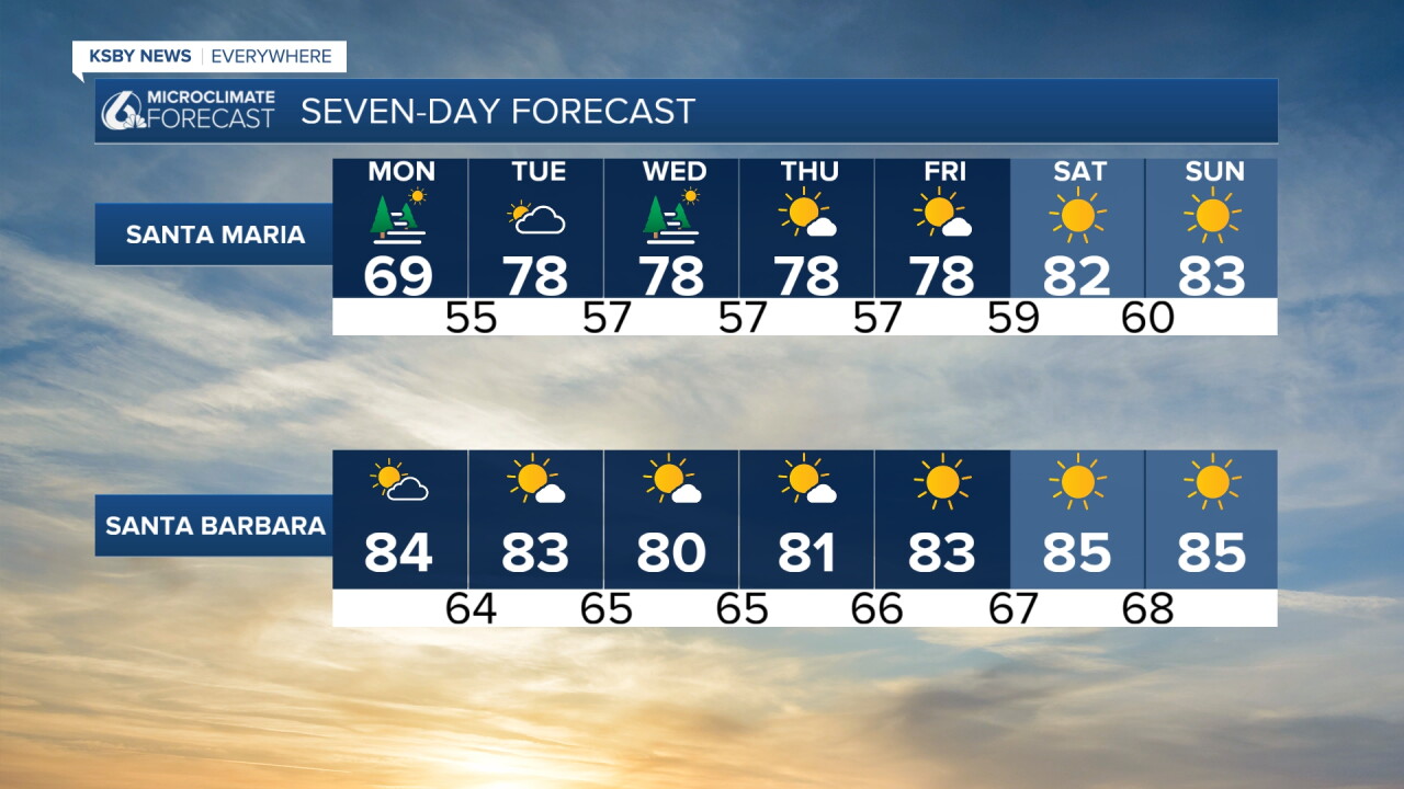
Over the next few days a high pressure system will move in and bring in temps that are close to normal for this time of the year. for the rest of the week with increasing sunshine. By the weekend though the high pressure will increase offshore winds significantly and start a MUCH warmer pattern. We will be back in the upper 90s for Saturday and Sunday in the Paso Robles area
Here is what that looks like on the 7 day forecast.
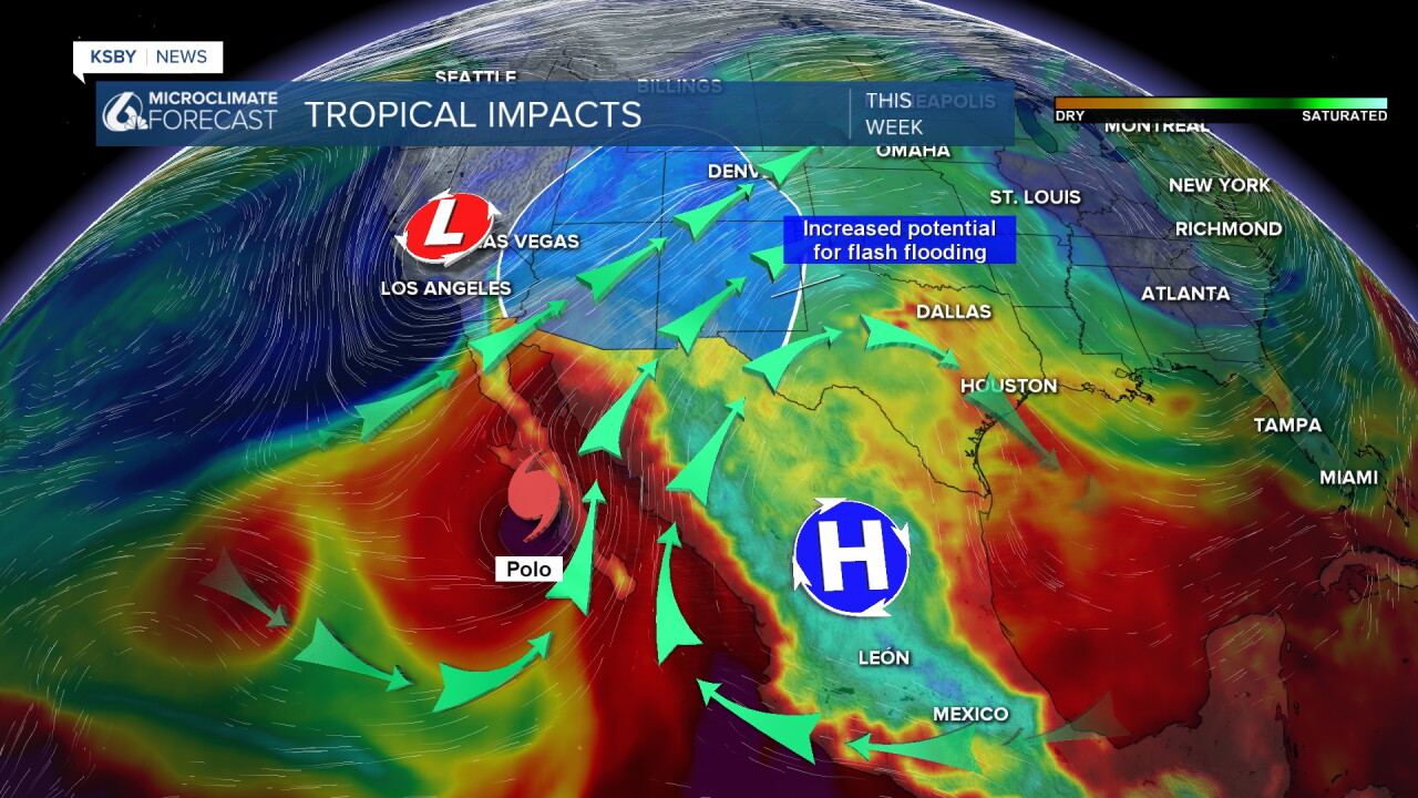
The big headline for the West Coast weather is Hurricane Polo as it heads towards its first (of two) landfalls. That will bring flooding and strong winds to northern Mexico while a plume of associated moisture will bring flash flooding risk to the four corners.
For us the low pressure keeping the storm away from us will stay dry and we will have little atmospheric impact.
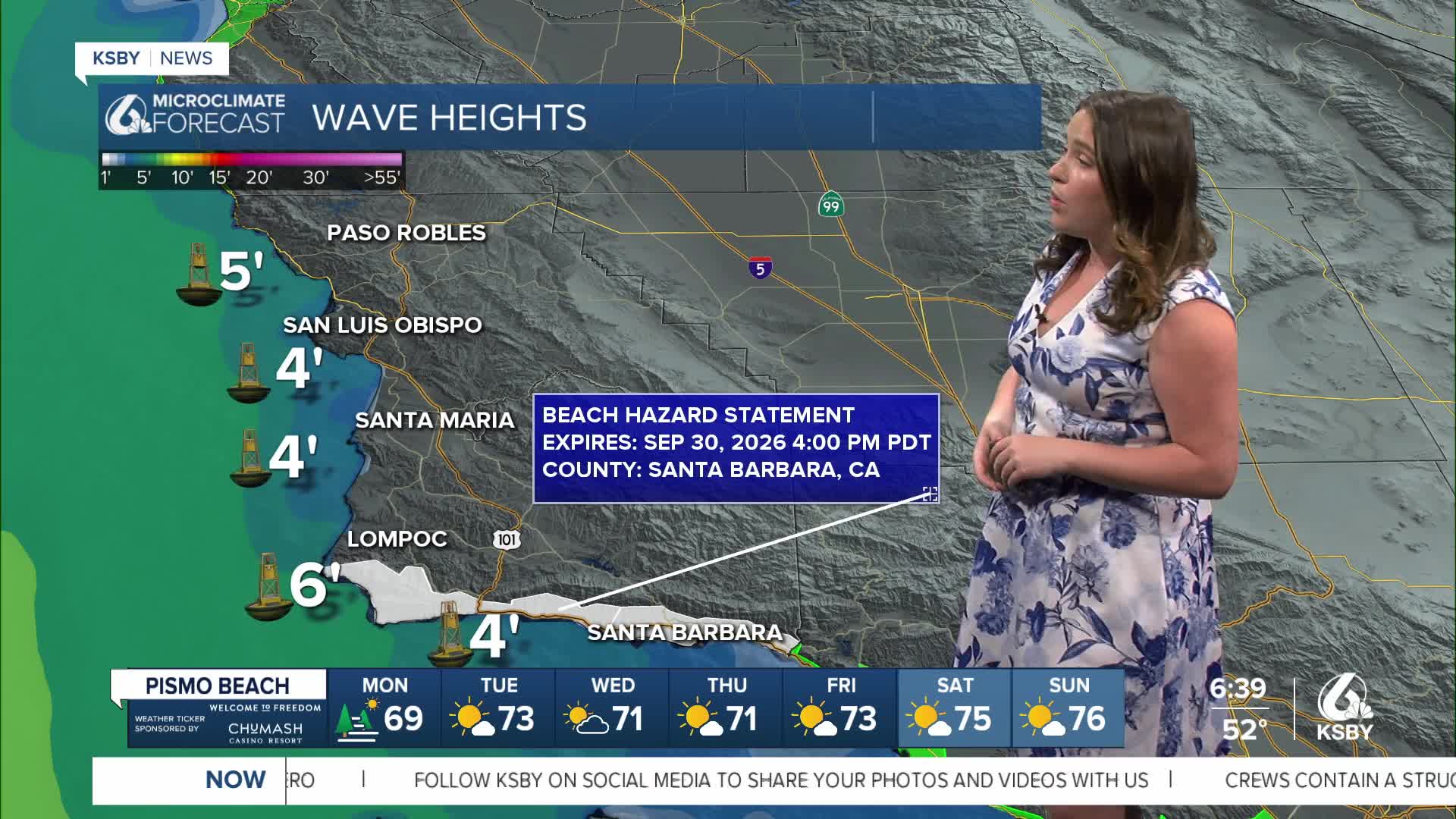
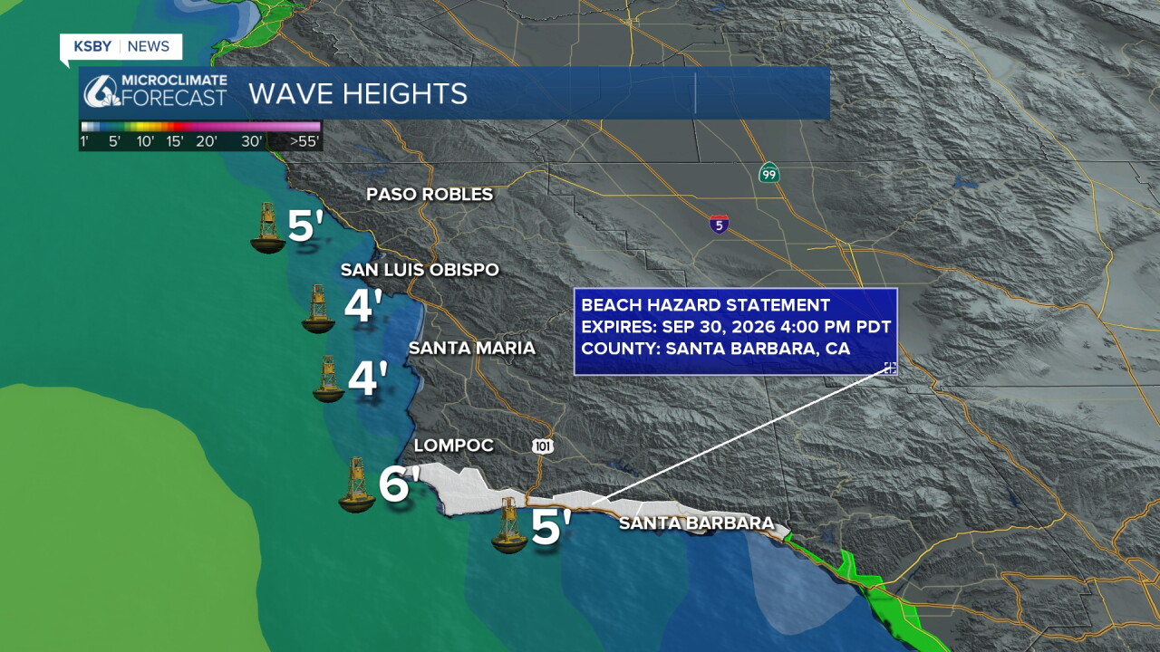
More of the impact will be felt in our oceans and at beaches with higher waves and the risk for some rip currents for our South Coast. There is a beach hazard statement in place through Wednesday due to that risk.
Have a wonderful day, Central Coast!
-Vivian
