


Good morning, Central Coast!
Starting off the day with the cloud cover and fog. It has a bit less of an extent than over the past few days, but you may still face some fog as you head out the door.
Here is a look at temperatures for Thursday across the region.
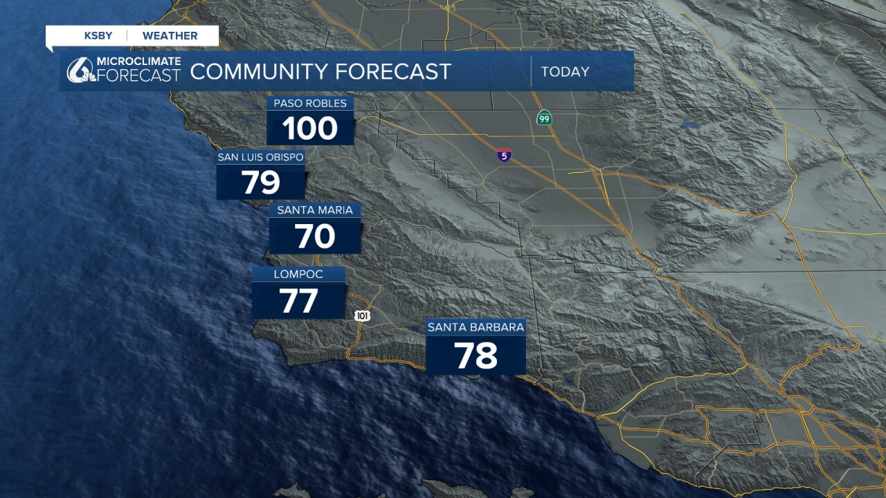
The big concern remains our interior communities. Heat warnings continue for the Cuyama Valley and northern mountains where temperatures will stay hot. The warning as well as the advisories have been extended and are now in place through Sunday night at 8 p.m.

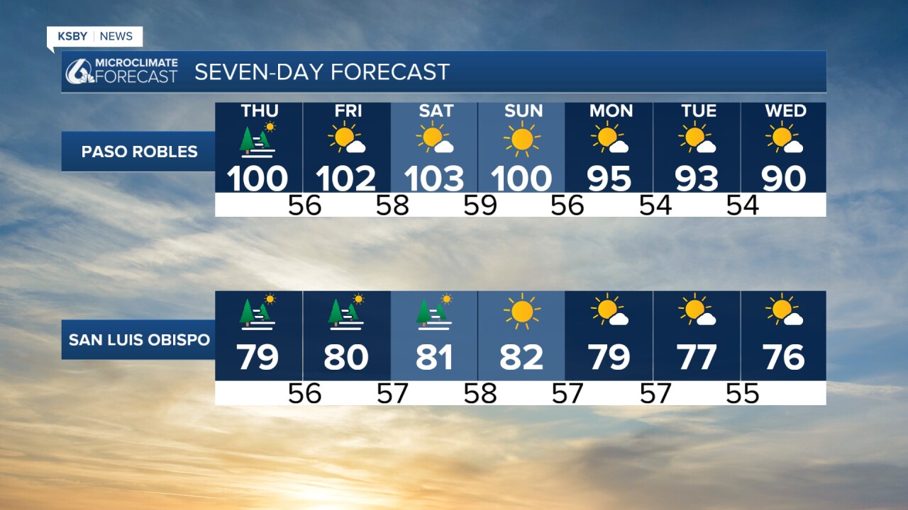
Looking ahead to the weekend, Friday brings a monsoon moisture surge that will make the heat feel even more intense. While temperatures may only rise a degree or two, that sticky humidity will keep overnight lows uncomfortably warm in places like Paso Robles, Buellton, and Solvang.
The good news comes Sunday and Monday when the upper-level pattern finally weakens. We're looking at 1-2 degrees of cooling Sunday, followed by another 2-4 degrees of relief on Monday as stronger onshore flow kicks in. By late next week the temps will fall below normal for this time of the year.
Here is what all of that looks like on the 7 day forecast!

Stay cool and stay safe, Central Coast!
-Vivian
