

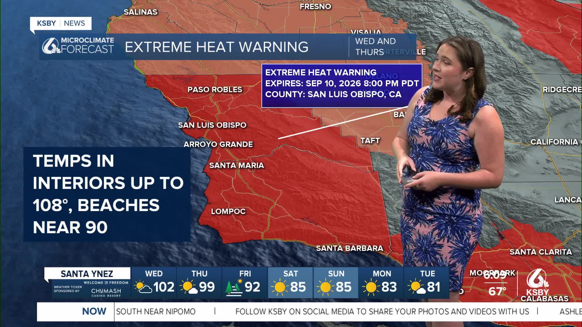


Good morning, Central Coast!
We're waking up to a very concerning weather setup this Wednesday morning. Dense marine layer coverage is notably absent from our usual spots along the coast, and that's setting the stage for what will be one of the most dangerous heat events we've seen in quite some time.
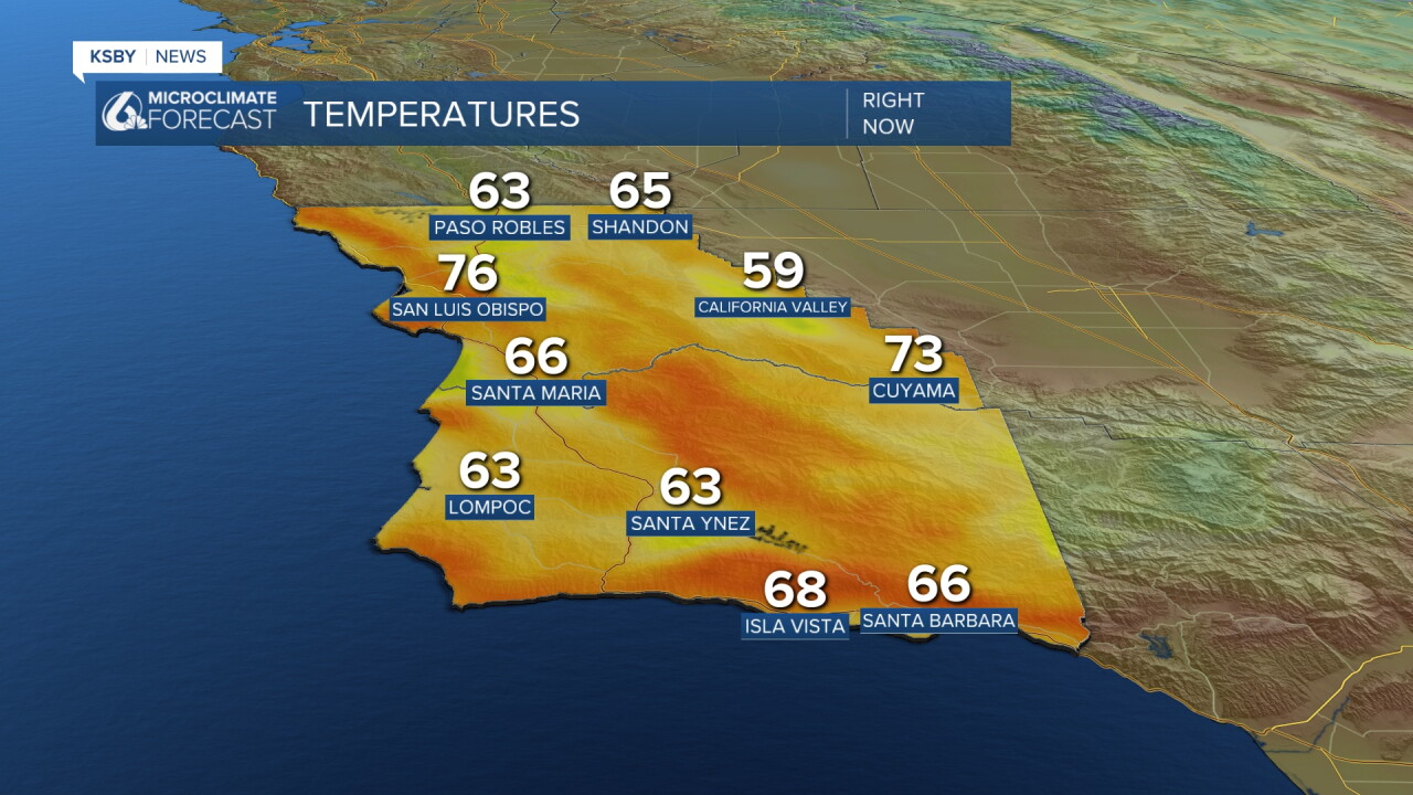
The lack of our typical marine layer protection means temperatures are already climbing rapidly across San Luis Obispo and Santa Barbara counties. Here is a look at the temps as of 7 a.m. Wednesday morning.
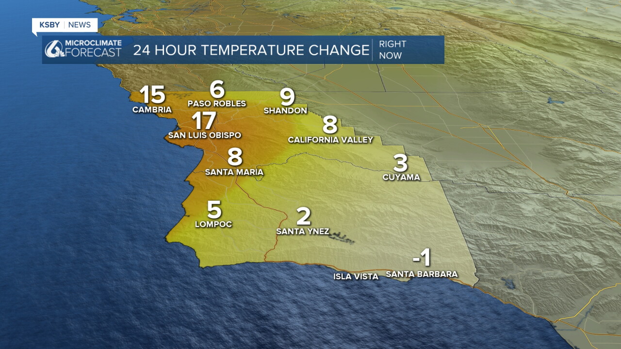
Offshore winds from both the north and east are pushing any cooling influence away from the coast, leaving our communities exposed to the building heat. Here is a look at the temperature change between 7 a.m. Tuesday and 7 a.m. Wednesday morning.
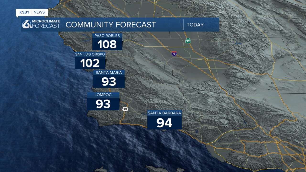
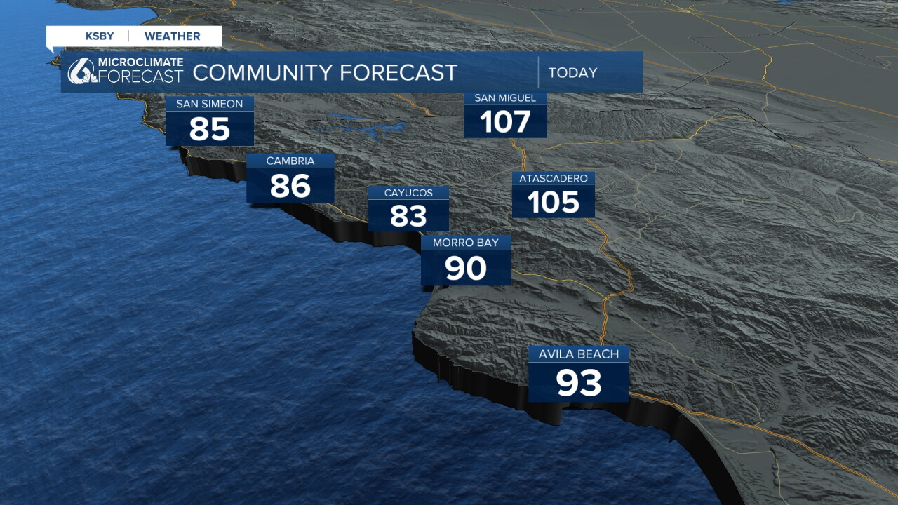
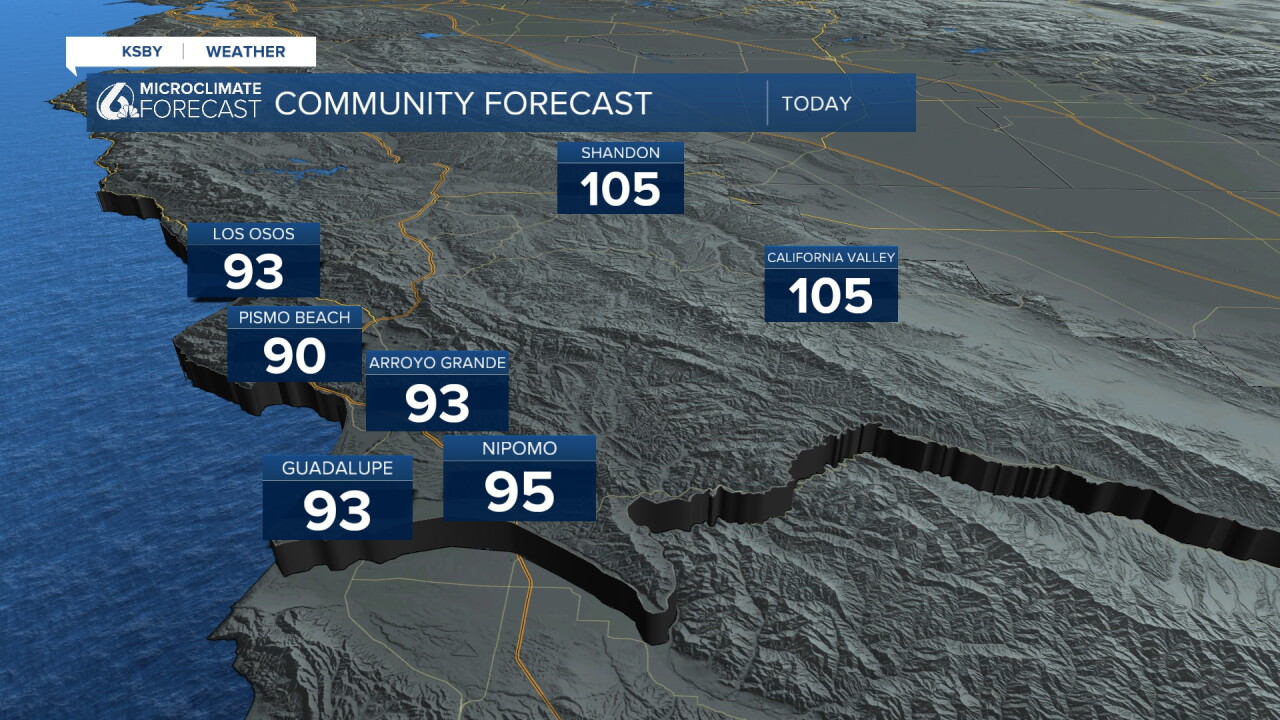
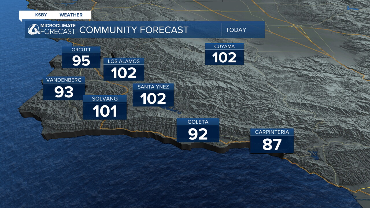
We will continue that heat up through the day. Here is a look at our high temps for today across our communities.
The real concern is overnight recovery - warm, humid nights will make it difficult for our bodies to cool down, especially for those without air conditioning.
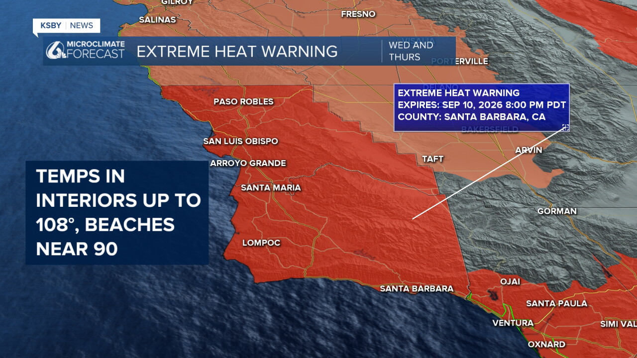
Due to these temperatures Extreme Heat Warning is in place for all of our communities through 8 p.m. Thursday. This is a substantial increase in concern from the heat advisory we have been under for the past few days. Limit outdoor activities during afternoon hours, seek air-conditioned spaces, and take frequent breaks if you must be outside. Check on elderly neighbors and keep pets indoors.
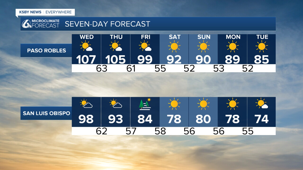
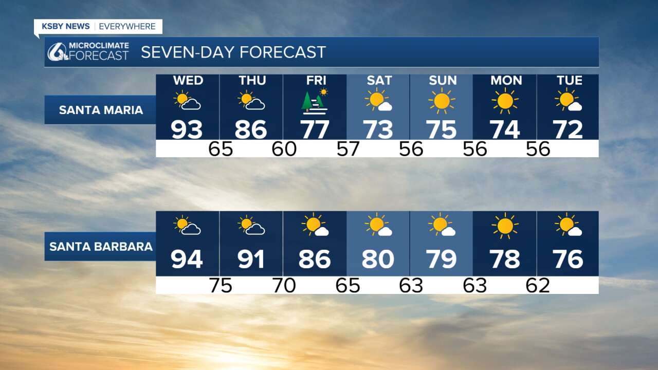
Looking ahead into Friday and the weekend relief is coming!
Friday brings the first round of cooling as high pressure weakens and onshore flow returns. By Saturday, we'll see much more comfortable conditions with temperatures dropping 6-8 degrees and significantly lower humidity levels.
The 7-day forecast shows a return to more seasonal temperatures this weekend, with our marine layer making a comeback along the coast.
Have a wonderful day, Central Coast! Stay cool and weather aware!
-Vivian
