



Good morning, Central Coast!
As we kick off our Tuesday morning, it is another day where your zip code makes all the difference across the Central Coast. While our coastal communities and beach communities will enjoy seasonable August weather, our inland valleys are bracing for continued dangerous heat through the weekend.
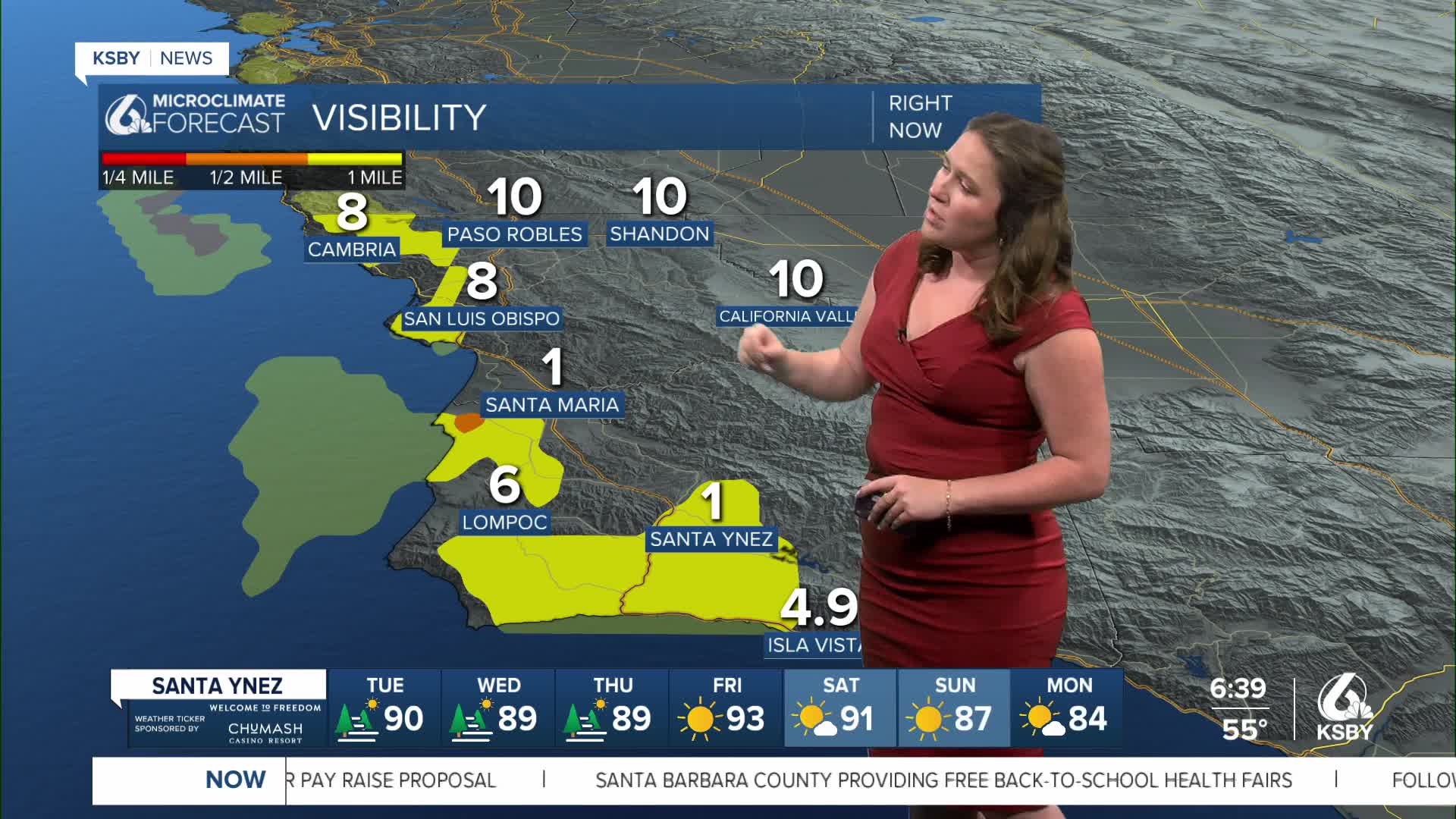
Morning fog will be the main story to kick off the day, with some spots of dense fog complicating the morning commute. That being said, it will clear out fast. By the time a launch takes place from Vandenberg (around 9:30 a.m.), visibility should be good from coastal valleys and interiors, while beaches will still be battling cloud cover and fog.
This afternoon, temps will still increase into the 80s for many coastal valleys, 70s by the beach, while interior valleys will see temps soar to the triple digits. Here is a look at those high temps for Tuesday.

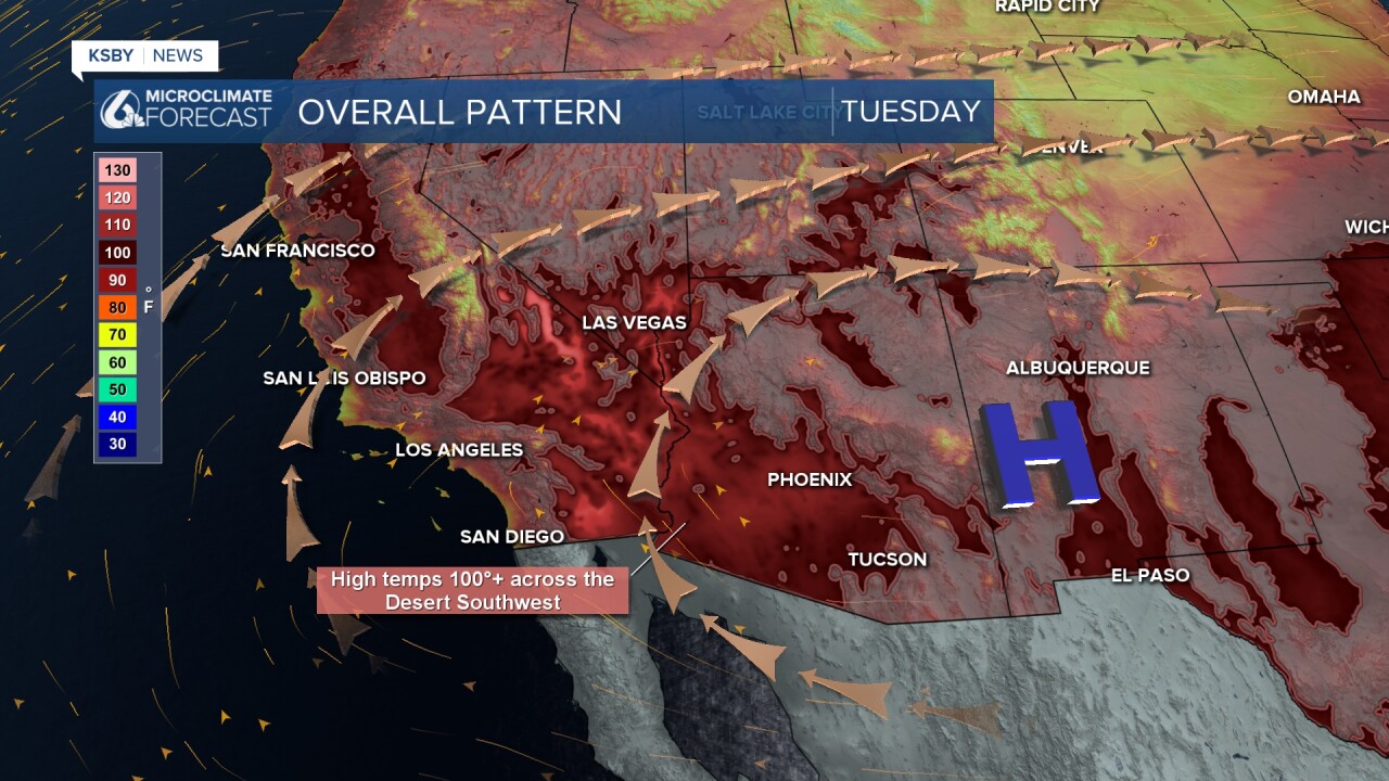
Interior valley heat is a concern through the forecast, with dangerously hot temps expected. There is a high heat warning in effect for the Cuyama Valley through Saturday, plus a high heat advisory for much of the interior valleys also through Saturday.
Most of this week will be identical to today, but into late week and the weekend, humidity will start to move in from the east of us and bring uncomfortably warm temps into the weekend.
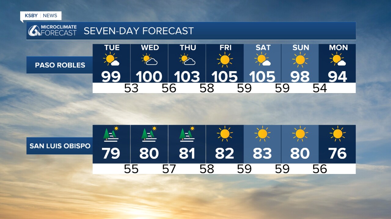
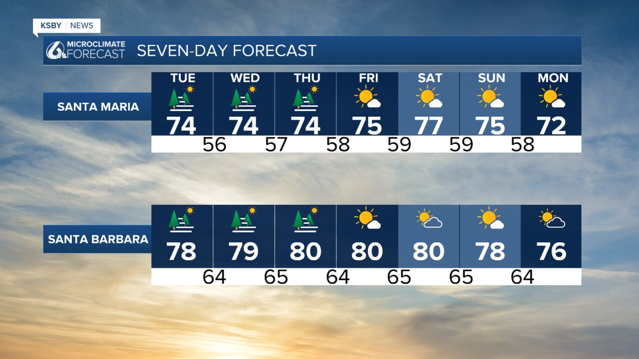
Next week temps will cool, and humidity will drop.
Stay cool, Central Coast!
-Vivian
